TopoQuest Logo
Do you find TopoQuest useful?
Help keep TopoQuest running and adding new maps/features by donating!
Bitcoin:  19c7KJd3qBynnjoSw5npx9KScwjBe4ifkT
Litecoin:  LXs6TkuXGGXo1vDsWCkWVdjQX94eUKd6ui
Home View Maps Find Maps Find Places Resources & Links


Manvel, North Dakota Topographic Map

USGS Map Title: Manvel, ND
USGS Map MRC: 48097A2
DRG (GeoTIFF) Download: o48097a2.tif


Neighboring USGS Topographic Map Quads:


  Ardoch, ND  
48097B3
 

  Oslo, MN  
48097B2
 

  Oslo NE, MN  
48097B1
 

  Mekinock, ND  
48097A3
 

  Manvel, ND  
48097A2
 

  Oslo SE, MN  
48097A1
 

  Emerado, ND  
47097H3
 

  Kelly, ND  
47097H2
 

  Grand Forks, ND  
47097H1


Map MRC Location:

N49°
W98°
N49°
W97°
H8 H7 H6 H5 H4 H3 H2 H1
G8 G7 G6 G5 G4 G3 G2 G1
F8 F7 F6 F5 F4 F3 F2 F1
E8 E7 E6 E5 E4 E3 E2 E1
D8 D7 D6 D5 D4 D3 D2 D1
C8 C7 C6 C5 C4 C3 C2 C1
B8 B7 B6 B5 B4 B3 B2 B1
A8 A7 A6 A5 A4 A3 A2 A1
N48°
W98°
N48°
W97°

Manvel, ND USGS 1:24K Topographic Map Preview:
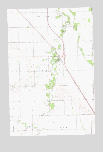
Manvel, ND USGS Topographic Map
Click on map above to begin viewing in our Map Viewer.

This topographic map contains these locations and features:
Feature Name Type Latitude Longitude GNIS ID View Map
City of ManvelCivilN48.0726°W97.1779°1036148View Map
County Ditch Number 11CanalN48.0194°W97.1540°1028480View Map
County Ditch Number 32CanalN48.0919°W97.2226°1028497View Map
Ferry Township Rural Fire Protection DistrictBuildingN48.0770°W97.1728°2637748View Map
Ferry Township Rural Fire Protection District AmbulanceBuildingN48.0736°W97.1770°2658767View Map
Heyde AirportAirportN48.0709°W97.1872°2650656View Map
Kelly SloughStreamN48.0083°W97.2254°1029723View Map
ManvelPopulated PlaceN48.0778°W97.1765°1030090View Map
Manvel City HallBuildingN48.0751°W97.1771°2745027View Map
Manvel Community CenterBuildingN48.0752°W97.1764°2746042View Map
Manvel Elementary SchoolSchoolN48.0724°W97.1760°2748034View Map
Manvel Post OfficePost OfficeN48.0756°W97.1770°2742497View Map
Ray Ronan ParkParkN48.0697°W97.1792°1030850View Map
Saint Timothy CemeteryCemeteryN48.0876°W97.1859°1031308View Map
Salt Water CouleeStreamN48.0086°W97.2117°1031331View Map
Township of FerryCivilN48.0609°W97.1712°1036616View Map
Turtle River (historical)LocaleN48.1064°W97.1517°1034424View Map

Note: Coordinates in the location and feature list above are referenced to NAD83 datum.


Copyright (C) 2008-2025 Ryan Niemi / Sunset Dynamics ... All Rights Reserved