TopoQuest Logo
Do you find TopoQuest useful?
Help keep TopoQuest running and adding new maps/features by donating!
Bitcoin:  19c7KJd3qBynnjoSw5npx9KScwjBe4ifkT
Litecoin:  LXs6TkuXGGXo1vDsWCkWVdjQX94eUKd6ui
Home View Maps Find Maps Find Places Resources & Links


Many Farms, Arizona Topographic Map

USGS Map Title: Many Farms, AZ
USGS Map MRC: 36109C5
DRG (GeoTIFF) Download: o36109c5.tif


Neighboring USGS Topographic Map Quads:


  Windy Valley, AZ  
36109D6
 

  Many Farms NE, AZ  
36109D5
 

  Fire Dance Mesa, AZ  
36109D4
 

  Many Farms SW, AZ  
36109C6
 

  Many Farms, AZ  
36109C5
 

  Tall Tree Mesa, AZ  
36109C4
 

  Ventana Mesa, AZ  
36109B6
 

  Chinle, AZ  
36109B5
 

  Del Muerto, AZ  
36109B4


Map MRC Location:

N37°
W110°
N37°
W109°
H8 H7 H6 H5 H4 H3 H2 H1
G8 G7 G6 G5 G4 G3 G2 G1
F8 F7 F6 F5 F4 F3 F2 F1
E8 E7 E6 E5 E4 E3 E2 E1
D8 D7 D6 D5 D4 D3 D2 D1
C8 C7 C6 C5 C4 C3 C2 C1
B8 B7 B6 B5 B4 B3 B2 B1
A8 A7 A6 A5 A4 A3 A2 A1
N36°
W110°
N36°
W109°

Many Farms, AZ USGS 1:24K Topographic Map Preview:
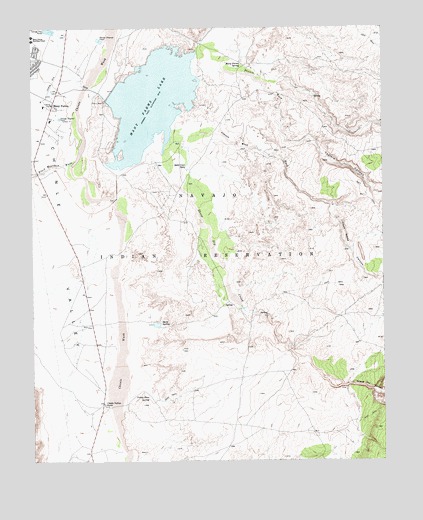
Many Farms, AZ USGS Topographic Map
Click on map above to begin viewing in our Map Viewer.

This topographic map contains these locations and features:
Feature Name Type Latitude Longitude GNIS ID View Map
Black Mountain WashValleyN36.3364°W109.6104°1567View Map
Chinle Valley StoreLocaleN36.2667°W109.6007°2865View Map
Hard SpringSpringN36.2899°W109.5798°5559View Map
Jimson Weed CanyonValleyN36.3194°W109.5173°6422View Map
Jimson Weed WashValleyN36.3467°W109.5737°6423View Map
Many FarmsPopulated PlaceN36.3528°W109.6179°7659View Map
Many Farms ChapterCivilN36.3517°W109.5452°2419009View Map
Many Farms Child Development CenterSchoolN36.3542°W109.6221°21690View Map
Many Farms DamDamN36.3633°W109.6090°21691View Map
Many Farms LakeReservoirN36.3535°W109.5827°7661View Map
Many Farms Lake CampgroundLocaleN36.3417°W109.6101°21694View Map
Many Farms Public SchoolSchoolN36.3483°W109.6183°21695View Map
Many Farms SpringSpringN36.3649°W109.5509°7662View Map
Many Farms Trading PostLocaleN36.3531°W109.6184°21696View Map
Sand Cone SpringsSpringN36.3345°W109.5710°10869View Map
Sheep Dip CanyonValleyN36.2858°W109.5379°11177View Map
Sheep Dip CreekStreamN36.3436°W109.5759°11178View Map
Tezinie CanyonValleyN36.3392°W109.5223°12274View Map
Tezinie WashValleyN36.3622°W109.5576°12275View Map
Valley Store SpringSpringN36.2691°W109.5848°13173View Map

Note: Coordinates in the location and feature list above are referenced to NAD83 datum.


Copyright (C) 2008-2024 Ryan Niemi / Sunset Dynamics ... All Rights Reserved