TopoQuest Logo
Do you find TopoQuest useful?
Help keep TopoQuest running and adding new maps/features by donating!
Bitcoin:  19c7KJd3qBynnjoSw5npx9KScwjBe4ifkT
Litecoin:  LXs6TkuXGGXo1vDsWCkWVdjQX94eUKd6ui
Home View Maps Find Maps Find Places Resources & Links


Maysville, Colorado Topographic Map

USGS Map Title: Maysville, CO
USGS Map MRC: 38106E2
DRG (GeoTIFF) Download: o38106e2.tif


Neighboring USGS Topographic Map Quads:


  Saint Elmo, CO  
38106F3
 

  Mount Antero, CO  
38106F2
 

  Nathrop, CO  
38106F1
 

  Garfield, CO  
38106E3
 

  Maysville, CO  
38106E2
 

  Salida West, CO  
38106E1
 

  Pahlone Peak, CO  
38106D3
 

  Mount Ouray, CO  
38106D2
 

  Poncha Pass, CO  
38106D1


Map MRC Location:

N39°
W107°
N39°
W106°
H8 H7 H6 H5 H4 H3 H2 H1
G8 G7 G6 G5 G4 G3 G2 G1
F8 F7 F6 F5 F4 F3 F2 F1
E8 E7 E6 E5 E4 E3 E2 E1
D8 D7 D6 D5 D4 D3 D2 D1
C8 C7 C6 C5 C4 C3 C2 C1
B8 B7 B6 B5 B4 B3 B2 B1
A8 A7 A6 A5 A4 A3 A2 A1
N38°
W107°
N38°
W106°

Maysville, CO USGS 1:24K Topographic Map Preview:
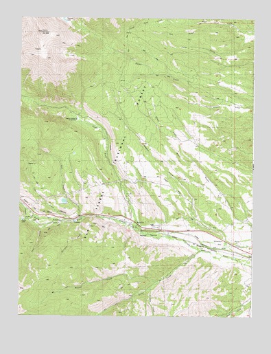
Maysville, CO USGS Topographic Map
Click on map above to begin viewing in our Map Viewer.

This topographic map contains these locations and features:
Feature Name Type Latitude Longitude GNIS ID View Map
Angel of Shavano CampgroundLocaleN38.5828°W106.2206°196807View Map
Blank CabinLocaleN38.5983°W106.1978°189447View Map
Cameron DitchCanalN38.5292°W106.1345°189441View Map
Cedar GulchValleyN38.6154°W106.1299°189492View Map
Chaffee County Fire Protection District Station 5BuildingN38.5389°W106.1901°2667291View Map
Colorado Fire CampBuildingN38.5515°W106.1906°2667292View Map
Como CreekStreamN38.5403°W106.2297°189418View Map
Copper King MineMineN38.5281°W106.1814°1745840View Map
Cree CreekStreamN38.5403°W106.2234°189358View Map
Fooses CreekStreamN38.5411°W106.2406°189363View Map
Fooses DamDamN38.5403°W106.2481°189416View Map
Fooses LakeLakeN38.5402°W106.2483°196821View Map
Green CreekStreamN38.5278°W106.1534°189424View Map
Independence MineMineN38.5747°W106.1859°1745846View Map
Lost CreekStreamN38.5414°W106.2167°189414View Map
MaysvillePopulated PlaceN38.5386°W106.1903°203904View Map
Maysville Census Designated PlaceCensusN38.5305°W106.2156°2583265View Map
McClure CreekStreamN38.5417°W106.2159°189415View Map
Mill GulchValleyN38.6228°W106.1408°189493View Map
Mount ShavanoSummitN38.6189°W106.2395°189451View Map
North Fork DitchCanalN38.5386°W106.1500°189443View Map
North Fork South Arkansas RiverStreamN38.5347°W106.1836°189356View Map
Pass CreekStreamN38.5069°W106.1256°189420View Map
Placer CreekStreamN38.5419°W106.1356°189448View Map
Redman CreekStreamN38.5122°W106.1797°189419View Map
Salida DivisionCivilN38.5888°W106.1393°1935560View Map
Shavano LakeLakeN38.6241°W106.2268°196808View Map
South Sand CreekStreamN38.6233°W106.1589°189491View Map
Springfield MineMineN38.5003°W106.1672°1735717View Map
Weldon GulchValleyN38.5325°W106.1404°189445View Map
Willow CreekStreamN38.5142°W106.1756°189417View Map

Note: Coordinates in the location and feature list above are referenced to NAD83 datum.


Copyright (C) 2008-2024 Ryan Niemi / Sunset Dynamics ... All Rights Reserved