TopoQuest Logo
Do you find TopoQuest useful?
Help keep TopoQuest running and adding new maps/features by donating!
Bitcoin:  19c7KJd3qBynnjoSw5npx9KScwjBe4ifkT
Litecoin:  LXs6TkuXGGXo1vDsWCkWVdjQX94eUKd6ui
Home View Maps Find Maps Find Places Resources & Links


Mud Lake NW, Nevada Topographic Map

USGS Map Title: Mud Lake NW, NV
USGS Map MRC: 37117H2
DRG (GeoTIFF) Download: o37117h2.tif


Neighboring USGS Topographic Map Quads:


  Mount Butte, NV  
38117A3
 

  Tonopah, NV  
38117A2
 

  East of Tonopah, NV  
38117A1
 

  Klondike, NV  
37117H3
 

  Mud Lake NW, NV  
37117H2
 

  Mud Lake North, NV  
37117H1
 

  Alkali, NV  
37117G3
 

  McMahon Ridge, NV  
37117G2
 

  Mud Lake South, NV  
37117G1


Map MRC Location:

N38°
W118°
N38°
W117°
H8 H7 H6 H5 H4 H3 H2 H1
G8 G7 G6 G5 G4 G3 G2 G1
F8 F7 F6 F5 F4 F3 F2 F1
E8 E7 E6 E5 E4 E3 E2 E1
D8 D7 D6 D5 D4 D3 D2 D1
C8 C7 C6 C5 C4 C3 C2 C1
B8 B7 B6 B5 B4 B3 B2 B1
A8 A7 A6 A5 A4 A3 A2 A1
N37°
W118°
N37°
W117°

Mud Lake NW, NV USGS 1:24K Topographic Map Preview:
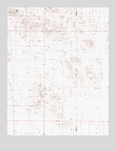
Mud Lake NW, NV USGS Topographic Map
Click on map above to begin viewing in our Map Viewer.

This topographic map contains these locations and features:
Feature Name Type Latitude Longitude GNIS ID View Map
Allied Divine MineMineN37.9894°W117.2370°852580View Map
Alto Divide MineMineN37.9894°W117.2370°852585View Map
Apex Divide MineMineN37.9894°W117.2370°852569View Map
Argentine Divide MineMineN37.9894°W117.2370°852567View Map
Brougher Divide MineMineN37.9894°W117.2370°852561View Map
Calumet Divide MineMineN37.9894°W117.2370°852524View Map
Crown Divide MineMineN37.9894°W117.2370°852566View Map
DivideGapN37.9941°W117.2370°853638View Map
Divide City MineMineN37.9894°W117.2370°852593View Map
Divide Consolidated MineMineN37.9894°W117.2370°852564View Map
Divide Extension MineMineN37.9894°W117.2370°852558View Map
Divide Junior MineMineN37.9894°W117.2370°852590View Map
Divide Mining DistrictCivilN37.9894°W117.2370°852511View Map
Doctor Divide MineMineN37.9894°W117.2370°852578View Map
East Divide MineMineN37.9894°W117.2370°852577View Map
Florence Divide MineMineN37.9894°W117.2370°852575View Map
Giant Divide MineMineN37.9894°W117.2370°852579View Map
Gold MountainSummitN37.9955°W117.2442°852512View Map
Gold Mountain (historical)LocaleN37.9955°W117.2365°854791View Map
Gold Reef (historical)Populated PlaceN37.9660°W117.2162°846523View Map
Gold Reef Divide MineMineN37.9894°W117.2370°852584View Map
Gold Reef SpringSpringN37.9874°W117.2348°851642View Map
Gold Seam MineMineN37.9663°W117.2148°840694View Map
Gold Zone MineMineN37.9894°W117.2370°852588View Map
Golden State Divide MineMineN37.9894°W117.2370°852525View Map
Great Dane MineMineN37.9894°W117.2370°852581View Map
Grimes Divide MineMineN37.9894°W117.2370°852591View Map
Harmell Divide MineMineN37.9894°W117.2370°852526View Map
Hasbrouck MineMineN37.9894°W117.2370°853639View Map
Hennessy Divide MineMineN37.9894°W117.2370°852571View Map
High Divide MineMineN37.9894°W117.2370°852576View Map
Horseshoe Divide MineMineN37.9894°W117.2370°852570View Map
Hull Canyon MineMineN37.9894°W117.2370°852586View Map
Independence MineMineN37.9894°W117.2370°852527View Map
Jims Divide MineMineN37.9894°W117.2370°852587View Map
Klondike Mining DistrictCivilN37.9127°W117.2029°854792View Map
Klondyke HillsSummitN37.9985°W117.2106°863883View Map
Knox Divide MineMineN37.9894°W117.2370°852528View Map
Midway Divide MineMineN37.9894°W117.2370°852563View Map
Mohawk Divide MineMineN37.9894°W117.2370°852565View Map
North Divide MineMineN37.9894°W117.2370°852572View Map
Reno Divide MineMineN37.9894°W117.2370°852589View Map
Reorganized Silver King MineMineN37.9894°W117.2370°852529View Map
Revert MineMineN37.9894°W117.2370°852559View Map
Silver Divide MineMineN37.9894°W117.2370°852583View Map
Silver King MineMineN37.9988°W117.2498°856377View Map
Silver King MineMineN37.9022°W117.1884°853618View Map
Silver Mines Corporation MineMineN37.9894°W117.2370°852530View Map
Silver Zone MineMineN37.9127°W117.2065°853617View Map
Smith Turquoise MineMineN37.9041°W117.2176°853636View Map
Smuggler Divide MineMineN37.9894°W117.2370°852574View Map
Southern Klondike (historical)Populated PlaceN37.9144°W117.2109°851680View Map
Southern Klondyke HillsSummitN37.9124°W117.1926°853637View Map
Sutherland Divide MineMineN37.9894°W117.2370°852573View Map
Toggery Divide MineMineN37.9894°W117.2370°852582View Map
Tonopah Divide MineMineN37.9894°W117.2370°852592View Map
Tonopah Dividend MineMineN37.9894°W117.2370°852562View Map
Verdi Divide MineMineN37.9894°W117.2370°852557View Map
Victory MineMineN37.9894°W117.2370°852560View Map
Wilson Divide MineMineN37.9894°W117.2370°852568View Map

Note: Coordinates in the location and feature list above are referenced to NAD83 datum.


Copyright (C) 2008-2024 Ryan Niemi / Sunset Dynamics ... All Rights Reserved