TopoQuest Logo
Do you find TopoQuest useful?
Help keep TopoQuest running and adding new maps/features by donating!
Bitcoin:  19c7KJd3qBynnjoSw5npx9KScwjBe4ifkT
Litecoin:  LXs6TkuXGGXo1vDsWCkWVdjQX94eUKd6ui
Home View Maps Find Maps Find Places Resources & Links


Ninemile Point, Montana Topographic Map

USGS Map Title: Ninemile Point, MT
USGS Map MRC: 45107G5
DRG (GeoTIFF) Download: o45107g5.tif


Neighboring USGS Topographic Map Quads:


  Lemon Ranch, MT  
45107H6
 

  Foster, MT  
45107H5
 

  Dudley Spring, MT  
45107H4
 

  Chimney Creek, MT  
45107G6
 

  Ninemile Point, MT  
45107G5
 

  The Dugout, MT  
45107G4
 

  Walker Hill, MT  
45107F6
 

  Hardin, MT  
45107F5
 

  Little Dry Creek, MT  
45107F4


Map MRC Location:

N46°
W108°
N46°
W107°
H8 H7 H6 H5 H4 H3 H2 H1
G8 G7 G6 G5 G4 G3 G2 G1
F8 F7 F6 F5 F4 F3 F2 F1
E8 E7 E6 E5 E4 E3 E2 E1
D8 D7 D6 D5 D4 D3 D2 D1
C8 C7 C6 C5 C4 C3 C2 C1
B8 B7 B6 B5 B4 B3 B2 B1
A8 A7 A6 A5 A4 A3 A2 A1
N45°
W108°
N45°
W107°

Ninemile Point, MT USGS 1:24K Topographic Map Preview:
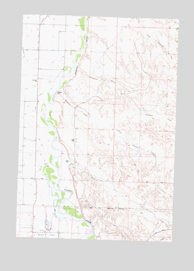
Ninemile Point, MT USGS Topographic Map
Click on map above to begin viewing in our Map Viewer.

This topographic map contains these locations and features:
Feature Name Type Latitude Longitude GNIS ID View Map
01N33E16AD__01 WellWellN45.8350°W107.6145°812592View Map
01N33E27BBBB01 WellWellN45.8114°W107.6112°812288View Map
01N33E27BBBB02 WellWellN45.8114°W107.6112°812289View Map
01N33E28CD__01 WellWellN45.7989°W107.6245°812148View Map
01S33E03DDDD01 WellWellN45.7689°W107.6212°811827View Map
01S33E14ABBB01 WellWellN45.8403°W107.5831°812647View Map
02N33E35CD__01 WellWellN45.8725°W107.5834°812947View Map
Arapooish Fishing Access SiteLocaleN45.7536°W107.5679°1744481View Map
Arapooish PondLakeN45.7545°W107.5678°1716362View Map
Arapooish Recreation ParkParkN45.7547°W107.5673°1716361View Map
Big Horn Low Line CanalCanalN45.8616°W107.6126°768796View Map
Carperville (historical)Populated PlaceN45.8547°W107.6117°1716289View Map
Carperville Post Office (historical)Post OfficeN45.8547°W107.6117°1716288View Map
Chapman CouleeValleyN45.8464°W107.5815°769755View Map
Chimney CreekStreamN45.8458°W107.6248°769835View Map
Demar (historical)LocaleN45.7925°W107.6109°1716278View Map
Dry CreekStreamN45.7936°W107.5937°770786View Map
Fort Custer Golf ClubLocaleN45.7858°W107.6245°799316View Map
Grant Marsh Wildlife Management AreaParkN45.8416°W107.5895°1716309View Map
Grant Marsh Wildlife Management Area Fishing Access SiteLocaleN45.8439°W107.5870°1744260View Map
Hardin DivisionCivilN45.8433°W107.5383°1940638View Map
Hardin KOA CampgroundLocaleN45.7639°W107.6140°1716384View Map
Hive ButteSummitN45.7553°W107.5192°1716304View Map
Holly (historical)LocaleN45.8522°W107.6012°1716518View Map
Little Ninemile CreekStreamN45.8150°W107.5504°773470View Map
Lone Tree CouleeStreamN45.8316°W107.6034°773580View Map
Miller RanchLocaleN45.8050°W107.5812°774247View Map
Nine Mile School (historical)SchoolN45.8380°W107.6129°774640View Map
Ninemile CreekStreamN45.8328°W107.5934°774645View Map
Ninemile PointCapeN45.8303°W107.5967°774647View Map
Ottum RanchLocaleN45.7936°W107.5854°775000View Map
Ottun Number 3 DamDamN45.8233°W107.5290°797190View Map
Whitman CouleeValleyN45.7611°W107.5829°768092View Map

Note: Coordinates in the location and feature list above are referenced to NAD83 datum.


Copyright (C) 2008-2025 Ryan Niemi / Sunset Dynamics ... All Rights Reserved