TopoQuest Logo
Do you find TopoQuest useful?
Help keep TopoQuest running and adding new maps/features by donating!
Bitcoin:  19c7KJd3qBynnjoSw5npx9KScwjBe4ifkT
Litecoin:  LXs6TkuXGGXo1vDsWCkWVdjQX94eUKd6ui
Home View Maps Find Maps Find Places Resources & Links


Nortons, Oregon Topographic Map

USGS Map Title: Nortons, OR
USGS Map MRC: 44123F6
DRG (GeoTIFF) Download: o44123f6.tif


Neighboring USGS Topographic Map Quads:


  Euchre Mountain, OR  
44123G7
 

  Valsetz, OR  
44123G6
 

  Fanno Ridge, OR  
44123G5
 

  Eddyville, OR  
44123F7
 

  Nortons, OR  
44123F6
 

  Summit, OR  
44123F5
 

  Elk City, OR  
44123E7
 

  Harlan, OR  
44123E6
 

  Marys Peak, OR  
44123E5


Map MRC Location:

N45°
W124°
N45°
W123°
H8 H7 H6 H5 H4 H3 H2 H1
G8 G7 G6 G5 G4 G3 G2 G1
F8 F7 F6 F5 F4 F3 F2 F1
E8 E7 E6 E5 E4 E3 E2 E1
D8 D7 D6 D5 D4 D3 D2 D1
C8 C7 C6 C5 C4 C3 C2 C1
B8 B7 B6 B5 B4 B3 B2 B1
A8 A7 A6 A5 A4 A3 A2 A1
N44°
W124°
N44°
W123°

Nortons, OR USGS 1:24K Topographic Map Preview:
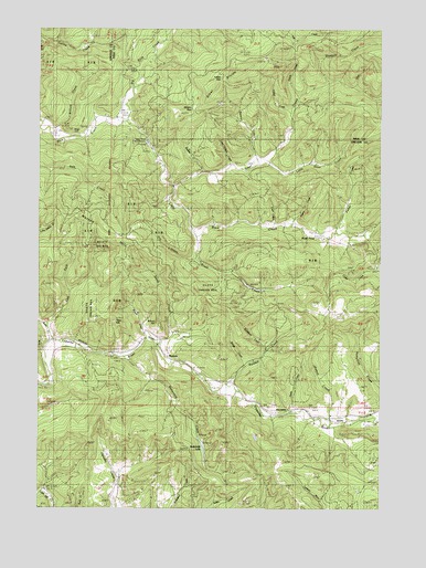
Nortons, OR USGS Topographic Map
Click on map above to begin viewing in our Map Viewer.

This topographic map contains these locations and features:
Feature Name Type Latitude Longitude GNIS ID View Map
Bahais of Lincoln CountyChurchN44.6506°W123.6253°2508158View Map
Beaver CreekStreamN44.7148°W123.6698°1117425View Map
Big Rock CreekStreamN44.7260°W123.7193°1117661View Map
Blogett CreekStreamN44.7360°W123.6457°1135548View Map
Bones CreekStreamN44.6621°W123.6762°1135531View Map
Brush CreekStreamN44.6976°W123.6937°1118151View Map
Bryant CreekStreamN44.6704°W123.7123°1118169View Map
Buckhorn CreekStreamN44.6662°W123.6676°1135532View Map
Buttermilk CreekStreamN44.6643°W123.7182°1118404View Map
Buttermilk LakeLakeN44.6407°W123.6907°1118405View Map
Cedar CreekStreamN44.6876°W123.6259°1118729View Map
Cedar CreekStreamN44.7282°W123.6596°1135539View Map
Coon CreekStreamN44.6985°W123.6687°1135535View Map
Davis CreekStreamN44.6496°W123.6590°1119708View Map
Dry CreekStreamN44.6901°W123.6937°1120119View Map
Dutch CreekStreamN44.7323°W123.6565°1135540View Map
East Fork Bales CreekStreamN44.6729°W123.7484°1120295View Map
Fall CreekStreamN44.7498°W123.6615°1120604View Map
Felton CreekStreamN44.6465°W123.6437°1120661View Map
Fisher CreekStreamN44.6971°W123.6429°1135546View Map
Hays CreekStreamN44.7351°W123.6365°1135538View Map
Indian GapGapN44.7368°W123.6843°1135542View Map
Little Rock CreekStreamN44.7260°W123.7193°1123266View Map
Little Steer CreekStreamN44.7148°W123.6659°1135808View Map
Long Canyon CreekStreamN44.7146°W123.6809°1135537View Map
Millers GapGapN44.7290°W123.6943°1135541View Map
Moser PondReservoirN44.6959°W123.6489°1135533View Map
Norton HillSummitN44.6932°W123.7190°1136581View Map
NortonsPopulated PlaceN44.6637°W123.7021°1136582View Map
Nortons CemeteryCemeteryN44.6618°W123.6940°1135201View Map
Nortons Post Office (historical)Post OfficeN44.6637°W123.7021°1165717View Map
Oregon State Fish HatcheryLocaleN44.7193°W123.7107°1125031View Map
Pigeon CreekStreamN44.6985°W123.6593°1135534View Map
Randall CreekStreamN44.6576°W123.6821°1125802View Map
Redfern (historical)LocaleN44.6487°W123.6457°1166540View Map
Rudder CreekStreamN44.7123°W123.6923°1130883View Map
School HillSummitN44.6735°W123.7076°1135550View Map
Spring CreekStreamN44.7187°W123.7096°1130884View Map
Steer CreekStreamN44.7090°W123.7018°1639333View Map
Steer DivideRidgeN44.7373°W123.6804°1135543View Map
Stony CreekStreamN44.6690°W123.7062°1127634View Map
Tater HillSummitN44.6740°W123.7240°1135551View Map
Wigle CemeteryCemeteryN44.7232°W123.7390°1135194View Map
William CreekStreamN44.7240°W123.7476°1135536View Map
Young CreekStreamN44.6473°W123.6268°1152752View Map

Note: Coordinates in the location and feature list above are referenced to NAD83 datum.


Copyright (C) 2008-2024 Ryan Niemi / Sunset Dynamics ... All Rights Reserved