TopoQuest Logo
Do you find TopoQuest useful?
Help keep TopoQuest running and adding new maps/features by donating!
Bitcoin:  19c7KJd3qBynnjoSw5npx9KScwjBe4ifkT
Litecoin:  LXs6TkuXGGXo1vDsWCkWVdjQX94eUKd6ui
Home View Maps Find Maps Find Places Resources & Links


Paradise, Montana Topographic Map

USGS Map Title: Paradise, MT
USGS Map MRC: 47114D7
DRG (GeoTIFF) Download: o47114d7.tif


Neighboring USGS Topographic Map Quads:


  Weeksville, MT  
47114E8
 

  Baldy Lake, MT  
47114E7
 

  Hot Springs, MT  
47114E6
 

  Plains, MT  
47114D8
 

  Paradise, MT  
47114D7
 

  Sunrise Spring, MT  
47114D6
 

  Keystone Peak, MT  
47114C8
 

  Quinns Hot Springs, MT  
47114C7
 

  Knowles, MT  
47114C6


Map MRC Location:

N48°
W115°
N48°
W114°
H8 H7 H6 H5 H4 H3 H2 H1
G8 G7 G6 G5 G4 G3 G2 G1
F8 F7 F6 F5 F4 F3 F2 F1
E8 E7 E6 E5 E4 E3 E2 E1
D8 D7 D6 D5 D4 D3 D2 D1
C8 C7 C6 C5 C4 C3 C2 C1
B8 B7 B6 B5 B4 B3 B2 B1
A8 A7 A6 A5 A4 A3 A2 A1
N47°
W115°
N47°
W114°

Paradise, MT USGS 1:24K Topographic Map Preview:
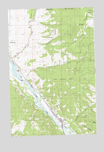
Paradise, MT USGS Topographic Map
Click on map above to begin viewing in our Map Viewer.

This topographic map contains these locations and features:
Feature Name Type Latitude Longitude GNIS ID View Map
19N26W01CAB_01 WellWellN47.4327°W114.8560°822882View Map
20N26W14ACCB01 WellWellN47.4933°W114.8712°823376View Map
20N26W24DDC_01 WellWellN47.4705°W114.8449°823226View Map
20N26W25ACCC01 SpringSpringN47.4624°W114.8512°823144View Map
Boyer CreekStreamN47.4513°W114.8749°780338View Map
Deemer CreekStreamN47.4677°W114.8443°782189View Map
Deemer PeakSummitN47.4835°W114.7693°782190View Map
Greenwood CreekStreamN47.4880°W114.8399°1780916View Map
Henry CreekStreamN47.4280°W114.8515°784781View Map
Henry PeakSummitN47.4299°W114.7671°784784View Map
Hugo CanyonValleyN47.4016°W114.7590°801745View Map
Hugo CreekStreamN47.4027°W114.7590°801746View Map
McLaughlin CreekStreamN47.3822°W114.7990°787096View Map
McMillans Trading Post (historical)LocaleN47.3755°W114.7926°1781016View Map
Minnehan (historical)LocaleN47.3805°W114.7899°1781014View Map
ParadiseLocaleN47.3894°W114.8021°1781006View Map
ParadisePopulated PlaceN47.3894°W114.8021°788621View Map
Paradise CemeteryCemeteryN47.3863°W114.7949°1780929View Map
Paradise Census Designated PlaceCensusN47.3857°W114.7989°2409024View Map
Paradise Elementary SchoolSchoolN47.3874°W114.7960°1780850View Map
Paradise GulchValleyN47.4008°W114.8121°788622View Map
Paradise Post OfficePost OfficeN47.3859°W114.7987°1781005View Map
Smiley SloughLakeN47.4379°W114.8633°807043View Map

Note: Coordinates in the location and feature list above are referenced to NAD83 datum.


Copyright (C) 2008-2025 Ryan Niemi / Sunset Dynamics ... All Rights Reserved