TopoQuest Logo
Do you find TopoQuest useful?
Help keep TopoQuest running and adding new maps/features by donating!
Bitcoin:  19c7KJd3qBynnjoSw5npx9KScwjBe4ifkT
Litecoin:  LXs6TkuXGGXo1vDsWCkWVdjQX94eUKd6ui
Home View Maps Find Maps Find Places Resources & Links


Parker, South Dakota Topographic Map

USGS Map Title: Parker, SD
USGS Map MRC: 43097D2
DRG (GeoTIFF) Download: o43097d2.tif


Neighboring USGS Topographic Map Quads:


  Canistota, SD  
43097E3
 

  East Vermillion Lake, SD  
43097E2
 

  Grass Lake, SD  
43097E1
 

  Marion, SD  
43097D3
 

  Parker, SD  
43097D2
 

  Parker NE, SD  
43097D1
 

  Freeman SE, SD  
43097C3
 

  Parker SW, SD  
43097C2
 

  Hurley, SD  
43097C1


Map MRC Location:

N44°
W98°
N44°
W97°
H8 H7 H6 H5 H4 H3 H2 H1
G8 G7 G6 G5 G4 G3 G2 G1
F8 F7 F6 F5 F4 F3 F2 F1
E8 E7 E6 E5 E4 E3 E2 E1
D8 D7 D6 D5 D4 D3 D2 D1
C8 C7 C6 C5 C4 C3 C2 C1
B8 B7 B6 B5 B4 B3 B2 B1
A8 A7 A6 A5 A4 A3 A2 A1
N43°
W98°
N43°
W97°

Parker, SD USGS 1:24K Topographic Map Preview:
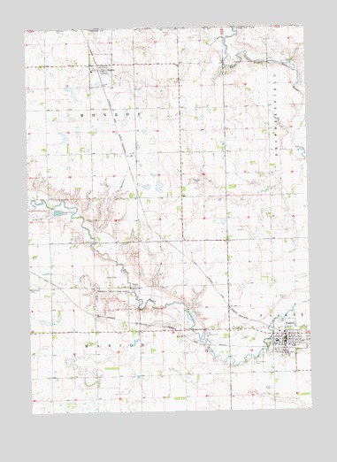
Parker, SD USGS Topographic Map
Click on map above to begin viewing in our Map Viewer.

This topographic map contains these locations and features:
Feature Name Type Latitude Longitude GNIS ID View Map
City of ParkerCivilN43.3978°W97.1335°1267527View Map
MonroePopulated PlaceN43.4864°W97.2151°1265671View Map
Monroe Volunteer Fire DepartmentBuildingN43.4862°W97.2178°2580761View Map
Par-Mar Valley Country ClubLocaleN43.4019°W97.1812°1256949View Map
ParkerPopulated PlaceN43.3975°W97.1364°1265677View Map
Parker Ambulance ServiceBuildingN43.3961°W97.1370°2658928View Map
Parker City OfficeBuildingN43.3970°W97.1369°2725239View Map
Parker Elementary SchoolSchoolN43.3974°W97.1405°2729351View Map
Parker High SchoolSchoolN43.3974°W97.1405°2729352View Map
Parker Middle SchoolSchoolN43.3974°W97.1405°2729353View Map
Parker Police DepartmentBuildingN43.3934°W97.1368°2755502View Map
Parker Post OfficePost OfficeN43.3963°W97.1371°2711088View Map
Parker Public LibraryBuildingN43.3970°W97.1369°2723647View Map
Parker Volunteer Fire DepartmentBuildingN43.3962°W97.1373°2580773View Map
Rose Hill CemeteryCemeteryN43.4116°W97.1403°1257465View Map
Saint Christina CemeteryCemeteryN43.3904°W97.1509°1257585View Map
Thunder Valley Drag StripLocaleN43.4147°W97.2128°1261148View Map
Town of MonroeCivilN43.4865°W97.2167°1267482View Map
Township of MarionCivilN43.3859°W97.2199°1268044View Map
Township of Marion (historical)CivilN43.4230°W97.2309°1268034View Map
Township of MonroeCivilN43.4647°W97.2212°1268043View Map
Turner County CourthouseBuildingN43.3934°W97.1366°2722905View Map
Turner County Sheriff's OfficeBuildingN43.3934°W97.1368°2755599View Map
Turner County Waterfowl Production AreaParkN43.4553°W97.1963°2765538View Map

Note: Coordinates in the location and feature list above are referenced to NAD83 datum.


Copyright (C) 2008-2025 Ryan Niemi / Sunset Dynamics ... All Rights Reserved