TopoQuest Logo
Do you find TopoQuest useful?
Help keep TopoQuest running and adding new maps/features by donating!
Bitcoin:  19c7KJd3qBynnjoSw5npx9KScwjBe4ifkT
Litecoin:  LXs6TkuXGGXo1vDsWCkWVdjQX94eUKd6ui
Home View Maps Find Maps Find Places Resources & Links


Pelkie, Michigan Topographic Map

USGS Map Title: Pelkie, MI
USGS Map MRC: 46088G6
DRG (GeoTIFF) Download: o46088g6.tif


Neighboring USGS Topographic Map Quads:


  Pine Lake, MI  
46088H6
 

  Otter Lake, MI  
46088H5


  Pelkie, MI  
46088G6
 

  Bear Town, MI  
46088G5


  Prickett Lake, MI  
46088F6
 

  Baraga Plains, MI  
46088F5


Map MRC Location:

N47°
W89°
N47°
W88°
H8 H7 H6 H5 H4 H3 H2 H1
G8 G7 G6 G5 G4 G3 G2 G1
F8 F7 F6 F5 F4 F3 F2 F1
E8 E7 E6 E5 E4 E3 E2 E1
D8 D7 D6 D5 D4 D3 D2 D1
C8 C7 C6 C5 C4 C3 C2 C1
B8 B7 B6 B5 B4 B3 B2 B1
A8 A7 A6 A5 A4 A3 A2 A1
N46°
W89°
N46°
W88°

Pelkie, MI USGS 1:24K Topographic Map Preview:
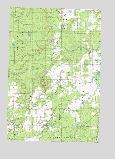
Pelkie, MI USGS Topographic Map
Click on map above to begin viewing in our Map Viewer.

This topographic map contains these locations and features:
Feature Name Type Latitude Longitude GNIS ID View Map
Alston Apostolic Lutheran ChurchChurchN46.7619°W88.7044°2123796View Map
Alston CemeteryCemeteryN46.7556°W88.7408°1619017View Map
Ebers CreekStreamN46.8649°W88.6762°1619823View Map
EloPopulated PlaceN46.8733°W88.6371°1619850View Map
Elo Post Office (historical)Post OfficeN46.8733°W88.6369°2124136View Map
Farce CreekStreamN46.7630°W88.6946°1619887View Map
HazelPopulated PlaceN46.7899°W88.7179°1622564View Map
Laird Township Volunteer Fire DepartmentBuildingN46.7646°W88.7383°2626977View Map
Limestone MountainSummitN46.8063°W88.7021°1620517View Map
Mill CreekStreamN46.7713°W88.7296°1622762View Map
Mission United Lutheran ChurchChurchN46.8089°W88.6364°2129346View Map
North Branch Bear CreekStreamN46.8733°W88.6857°1621023View Map
North Branch Otter RiverStreamN46.8377°W88.6799°1621030View Map
PelkiePopulated PlaceN46.8133°W88.6365°1621187View Map
Pelkie CemeteryCemeteryN46.7799°W88.6301°1621188View Map
Pelkie Grade School (historical)SchoolN46.8133°W88.6364°2129334View Map
Pelkie Post OfficePost OfficeN46.8124°W88.6366°2129347View Map
Pelkie Station (historical)LocaleN46.8131°W88.6361°2129344View Map
Pelkie Volunteer Fire DepartmentBuildingN46.8138°W88.6357°2626816View Map
Pine CreekStreamN46.7947°W88.6340°1621189View Map
Silver RiverStreamN46.8005°W88.6257°1621618View Map
West Branch Otter RiverStreamN46.8377°W88.6796°1622105View Map
West Branch Sturgeon RiverStreamN46.8110°W88.6326°1622109View Map

Note: Coordinates in the location and feature list above are referenced to NAD83 datum.


Copyright (C) 2008-2025 Ryan Niemi / Sunset Dynamics ... All Rights Reserved