TopoQuest Logo
Do you find TopoQuest useful?
Help keep TopoQuest running and adding new maps/features by donating!
Bitcoin:  19c7KJd3qBynnjoSw5npx9KScwjBe4ifkT
Litecoin:  LXs6TkuXGGXo1vDsWCkWVdjQX94eUKd6ui
Home View Maps Find Maps Find Places Resources & Links


Pine Hill, Montana Topographic Map

USGS Map Title: Pine Hill, MT
USGS Map MRC: 45113G3
DRG (GeoTIFF) Download: o45113g3.tif


Neighboring USGS Topographic Map Quads:


  Warren Peak, MT  
45113H4
 

  Long Peak, MT  
45113H3
 

  Lower Seymour Lake, MT  
45113H2
 

  Pintler Lake, MT  
45113G4
 

  Pine Hill, MT  
45113G3
 

  Foolhen Mountain, MT  
45113G2
 

  Mud Lake, MT  
45113F4
 

  Proposal Rock, MT  
45113F3
 

  Shaw Mountain, MT  
45113F2


Map MRC Location:

N46°
W114°
N46°
W113°
H8 H7 H6 H5 H4 H3 H2 H1
G8 G7 G6 G5 G4 G3 G2 G1
F8 F7 F6 F5 F4 F3 F2 F1
E8 E7 E6 E5 E4 E3 E2 E1
D8 D7 D6 D5 D4 D3 D2 D1
C8 C7 C6 C5 C4 C3 C2 C1
B8 B7 B6 B5 B4 B3 B2 B1
A8 A7 A6 A5 A4 A3 A2 A1
N45°
W114°
N45°
W113°

Pine Hill, MT USGS 1:24K Topographic Map Preview:
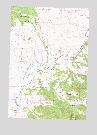
Pine Hill, MT USGS Topographic Map
Click on map above to begin viewing in our Map Viewer.

This topographic map contains these locations and features:
Feature Name Type Latitude Longitude GNIS ID View Map
01N14W15DDDD01 WellWellN45.8294°W113.3156°812543View Map
Ampo DitchCanalN45.8663°W113.3495°779013View Map
Ampo Toomey DitchCanalN45.8308°W113.3181°779014View Map
Bacon RanchLocaleN45.8505°W113.2542°779230View Map
Chalk BluffCliffN45.8274°W113.2945°781145View Map
Christiansen CreekStreamN45.8086°W113.3300°791376View Map
Christianson RanchLocaleN45.8038°W113.3262°781253View Map
Goris GulchValleyN45.7702°W113.3503°784129View Map
Mudd CreekStreamN45.8099°W113.3231°787821View Map
Nichols DitchCanalN45.8588°W113.3481°787989View Map
Nichols RanchLocaleN45.8299°W113.3178°787990View Map
Papoose CreekStreamN45.7658°W113.2701°788615View Map
Pine HillSummitN45.8391°W113.3459°788896View Map
Pintler CreekStreamN45.7583°W113.3631°788922View Map
Salefsky CreekStreamN45.7727°W113.3620°789961View Map
Sawlog CreekStreamN45.8383°W113.2503°790043View Map
Seefield DitchCanalN45.8299°W113.3209°790193View Map
Shaw CreekStreamN45.7599°W113.2656°790294View Map
Smith RanchLocaleN45.7658°W113.3598°794590View Map
Squaw Creek (historical)LocaleN45.8027°W113.3259°1797267View Map
Stewart CreekStreamN45.8508°W113.2523°791508View Map
Toomey CreekStreamN45.8169°W113.2864°792276View Map
Toomey LakeLakeN45.8181°W113.3057°792277View Map
Toomey SpringSpringN45.8221°W113.3009°792278View Map
Wallace Christiansen RanchLocaleN45.7752°W113.3570°794589View Map
York GulchValleyN45.8052°W113.3542°793618View Map

Note: Coordinates in the location and feature list above are referenced to NAD83 datum.


Copyright (C) 2008-2025 Ryan Niemi / Sunset Dynamics ... All Rights Reserved