TopoQuest Logo
Do you find TopoQuest useful?
Help keep TopoQuest running and adding new maps/features by donating!
Bitcoin:  19c7KJd3qBynnjoSw5npx9KScwjBe4ifkT
Litecoin:  LXs6TkuXGGXo1vDsWCkWVdjQX94eUKd6ui
Home View Maps Find Maps Find Places Resources & Links


Pleasant Dale, Nebraska Topographic Map

USGS Map Title: Pleasant Dale, NE
USGS Map MRC: 40096G8
DRG (GeoTIFF) Download: o40096g8.tif


Neighboring USGS Topographic Map Quads:


  Seward, NE  
40097H1
 

  Garland, NE  
40096H8
 

  Raymond, NE  
40096H7
 

  Milford, NE  
40097G1
 

  Pleasant Dale, NE  
40096G8
 

  Emerald, NE  
40096G7
 

  Dorchester, NE  
40097F1
 

  Crete North, NE  
40096F8
 

  Denton, NE  
40096F7


Map MRC Location:

N41°
W97°
N41°
W96°
H8 H7 H6 H5 H4 H3 H2 H1
G8 G7 G6 G5 G4 G3 G2 G1
F8 F7 F6 F5 F4 F3 F2 F1
E8 E7 E6 E5 E4 E3 E2 E1
D8 D7 D6 D5 D4 D3 D2 D1
C8 C7 C6 C5 C4 C3 C2 C1
B8 B7 B6 B5 B4 B3 B2 B1
A8 A7 A6 A5 A4 A3 A2 A1
N40°
W97°
N40°
W96°

Pleasant Dale, NE USGS 1:24K Topographic Map Preview:
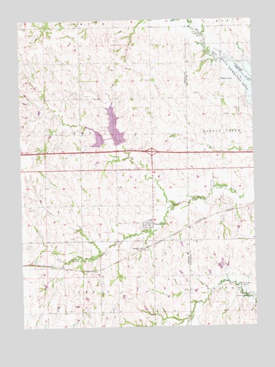
Pleasant Dale, NE USGS Topographic Map
Click on map above to begin viewing in our Map Viewer.

This topographic map contains these locations and features:
Feature Name Type Latitude Longitude GNIS ID View Map
Area Three CampgroundLocaleN40.8569°W96.8934°1898588View Map
Bethlehem Lutheran ChurchChurchN40.7917°W96.9336°1881884View Map
Burd SchoolSchoolN40.8058°W96.8920°827779View Map
Culver CreekStreamN40.7811°W96.9578°828515View Map
Election Precinct ICivilN40.8286°W96.9680°1929210View Map
Interchange 388CrossingN40.8214°W96.9295°1881971View Map
Lake View CampgroundLocaleN40.8597°W96.8817°1898589View Map
Maple Grove SchoolSchoolN40.8508°W96.8914°831041View Map
Middle Creek Public SchoolSchoolN40.7989°W96.8803°1899147View Map
Pleasant DalePopulated PlaceN40.7919°W96.9322°835414View Map
Pleasant DaleLocaleN40.7819°W96.9350°1881881View Map
Pleasant Dale CemeteryCemeteryN40.8145°W96.9478°832162View Map
Pleasant Dale Elementary SchoolSchoolN40.7911°W96.9320°1881886View Map
Pleasant Dale Post OfficePost OfficeN40.7911°W96.9354°1881882View Map
Pleasant Dale Volunteer Fire DepartmentBuildingN40.7918°W96.9355°1881883View Map
Township ICivilN40.8250°W96.9336°1881770View Map
Twin LakesReservoirN40.8309°W96.9494°834242View Map
Twin LakesReservoirN40.8261°W96.9581°1768785View Map
Twin Lakes Camp-N-ShopLocaleN40.8222°W96.9392°1881885View Map
Twin Lakes Dam-Site 13 DamDamN40.8250°W96.9570°1768784View Map
Twin Lakes State Wildlife Management AreaParkN40.8333°W96.9503°1881800View Map
Village of Pleasant DaleCivilN40.7912°W96.9330°2399690View Map
Zion ChurchChurchN40.8361°W96.8906°834953View Map

Note: Coordinates in the location and feature list above are referenced to NAD83 datum.


Copyright (C) 2008-2024 Ryan Niemi / Sunset Dynamics ... All Rights Reserved