TopoQuest Logo
Do you find TopoQuest useful?
Help keep TopoQuest running and adding new maps/features by donating!
Bitcoin:  19c7KJd3qBynnjoSw5npx9KScwjBe4ifkT
Litecoin:  LXs6TkuXGGXo1vDsWCkWVdjQX94eUKd6ui
Home View Maps Find Maps Find Places Resources & Links


Quill Hill, Maine Topographic Map

USGS Map Title: Quill Hill, ME
USGS Map MRC: 45070A5
DRG (GeoTIFF) Download: o45070a5.tif


Neighboring USGS Topographic Map Quads:


  Black Mountain, ME  
45070B6
 

  Tim Mountain, ME  
45070B5
 

  Stratton, ME  
45070B4
 

  Kennebago Lake, ME  
45070A6
 

  Quill Hill, ME  
45070A5
 

  Black Nubble, ME  
45070A4
 

  Rangeley, ME  
44070H6
 

  Saddleback Mountain, ME  
44070H5
 

  Redington, ME  
44070H4


Map MRC Location:

N46°
W71°
N46°
W70°
H8 H7 H6 H5 H4 H3 H2 H1
G8 G7 G6 G5 G4 G3 G2 G1
F8 F7 F6 F5 F4 F3 F2 F1
E8 E7 E6 E5 E4 E3 E2 E1
D8 D7 D6 D5 D4 D3 D2 D1
C8 C7 C6 C5 C4 C3 C2 C1
B8 B7 B6 B5 B4 B3 B2 B1
A8 A7 A6 A5 A4 A3 A2 A1
N45°
W71°
N45°
W70°

Quill Hill, ME USGS 1:24K Topographic Map Preview:
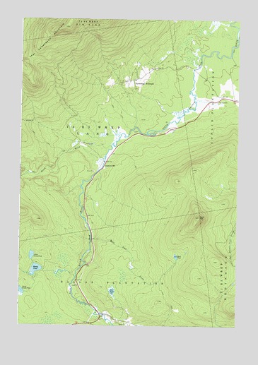
Quill Hill, ME USGS Topographic Map
Click on map above to begin viewing in our Map Viewer.

This topographic map contains these locations and features:
Feature Name Type Latitude Longitude GNIS ID View Map
Baker BrookStreamN45.0684°W70.5770°561461View Map
Dallas School (historical)SchoolN45.0031°W70.5703°1908307View Map
Dead River (historical)Populated PlaceN45.0009°W70.5828°1908308View Map
Dill PondLakeN45.0139°W70.5710°565099View Map
East Kennebago MountainSummitN45.1218°W70.5997°565625View Map
Greely PondLakeN45.0228°W70.6151°567199View Map
Green FarmLocaleN45.0923°W70.5115°567205View Map
Kennebago School (historical)SchoolN45.1012°W70.5595°1908350View Map
Kennebago SettlementPopulated PlaceN45.1003°W70.5623°579448View Map
Lang TownshipCivilN45.0837°W70.5961°2748800View Map
Langtown MillPopulated PlaceN45.0664°W70.5767°579469View Map
Langtown School (historical)SchoolN45.0787°W70.5592°1908356View Map
Little Greely PondLakeN45.0284°W70.6175°569804View Map
Quill HillSummitN45.0444°W70.5216°573938View Map
Quill PondLakeN45.0283°W70.5346°573939View Map
Quill Pond BrookStreamN45.0351°W70.5837°573940View Map
The LandingPopulated PlaceN45.0737°W70.5878°579763View Map
Third Greely PondLakeN45.0141°W70.6236°576953View Map

Note: Coordinates in the location and feature list above are referenced to NAD83 datum.


Copyright (C) 2008-2025 Ryan Niemi / Sunset Dynamics ... All Rights Reserved