TopoQuest Logo
Do you find TopoQuest useful?
Help keep TopoQuest running and adding new maps/features by donating!
Bitcoin:  19c7KJd3qBynnjoSw5npx9KScwjBe4ifkT
Litecoin:  LXs6TkuXGGXo1vDsWCkWVdjQX94eUKd6ui
Home View Maps Find Maps Find Places Resources & Links


Rangely, Colorado Topographic Map

USGS Map Title: Rangely, CO
USGS Map MRC: 40108A7
DRG (GeoTIFF) Download: o40108a7.tif


Neighboring USGS Topographic Map Quads:


  Mellen Hill, CO  
40108B8
 

  Rangely NE, CO  
40108B7
 

  Cactus Reservoir, CO  
40108B6
 

  Banty Point, CO  
40108A8
 

  Rangely, CO  
40108A7
 

  Gillam Draw, CO  
40108A6
 

  Banta Ridge, CO  
39108H8
 

  Water Canyon, CO  
39108H7
 

  Philadelphia Creek, CO  
39108H6


Map MRC Location:

N41°
W109°
N41°
W108°
H8 H7 H6 H5 H4 H3 H2 H1
G8 G7 G6 G5 G4 G3 G2 G1
F8 F7 F6 F5 F4 F3 F2 F1
E8 E7 E6 E5 E4 E3 E2 E1
D8 D7 D6 D5 D4 D3 D2 D1
C8 C7 C6 C5 C4 C3 C2 C1
B8 B7 B6 B5 B4 B3 B2 B1
A8 A7 A6 A5 A4 A3 A2 A1
N40°
W109°
N40°
W108°

Rangely, CO USGS 1:24K Topographic Map Preview:
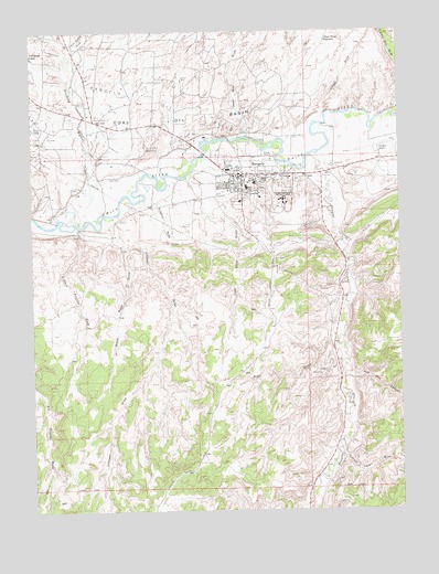
Rangely, CO USGS Topographic Map
Click on map above to begin viewing in our Map Viewer.

This topographic map contains these locations and features:
Feature Name Type Latitude Longitude GNIS ID View Map
Chase DrawValleyN40.1030°W108.7758°171562View Map
Chase Draw ReservoirReservoirN40.1225°W108.7753°171668View Map
Coal Mine DrawValleyN40.0780°W108.8173°171676View Map
Coal Oil BasinBasinN40.1214°W108.8576°171546View Map
Dead Dog DrawValleyN40.0972°W108.8082°171560View Map
Douglas CreekStreamN40.0925°W108.7809°171680View Map
Johnson DrawValleyN40.0807°W108.8420°171677View Map
Levison CampLocaleN40.1125°W108.8243°171667View Map
Little Trujillo WashStreamN40.0741°W108.8601°171679View Map
Nate Spring DrawValleyN40.1215°W108.8630°171561View Map
RangelyPopulated PlaceN40.0875°W108.8048°171670View Map
Rangely AirportAirportN40.0944°W108.7607°204564View Map
Rangely CemeteryCemeteryN40.0903°W108.7677°2750964View Map
Rangely District HospitalHospitalN40.0788°W108.8069°2695601View Map
Rangely Hospital District Ambulance ServiceBuildingN40.0807°W108.8047°2716990View Map
Rangely Oil FieldOilfieldN40.1083°W108.8423°171545View Map
Rangely Police DepartmentBuildingN40.0870°W108.8027°2757305View Map
Rangely Post OfficePost OfficeN40.0873°W108.7989°2750891View Map
Rangely Rural Fire DepartmentBuildingN40.0883°W108.7938°2666905View Map
Red Hill CanyonValleyN40.0341°W108.7703°171674View Map
Rocky Ford DrawValleyN40.0145°W108.7721°171673View Map
Saint Timothy ChurchChurchN40.0872°W108.7876°171669View Map
Sharples CampLocaleN40.1033°W108.8534°171665View Map
Stinking Water CreekStreamN40.0769°W108.8573°170825View Map
Sulphur DrawValleyN40.0839°W108.8321°171672View Map
Town of RangelyCivilN40.0889°W108.7567°2412528View Map
Trail DrawValleyN40.0444°W108.7718°171675View Map
Wasatch CampLocaleN40.0950°W108.8357°171666View Map
Willow CreekStreamN40.0661°W108.8476°201740View Map
Wood Road DrawValleyN40.0764°W108.8479°171678View Map

Note: Coordinates in the location and feature list above are referenced to NAD83 datum.


Copyright (C) 2008-2025 Ryan Niemi / Sunset Dynamics ... All Rights Reserved