TopoQuest Logo
Do you find TopoQuest useful?
Help keep TopoQuest running and adding new maps/features by donating!
Bitcoin:  19c7KJd3qBynnjoSw5npx9KScwjBe4ifkT
Litecoin:  LXs6TkuXGGXo1vDsWCkWVdjQX94eUKd6ui
Home View Maps Find Maps Find Places Resources & Links


Rays Crossing, Indiana Topographic Map

USGS Map Title: Rays Crossing, IN
USGS Map MRC: 39085E6
DRG (GeoTIFF) Download: o39085e6.tif


Neighboring USGS Topographic Map Quads:


  Fountaintown, IN  
39085F7
 

  Morristown, IN  
39085F6
 

  Carthage, IN  
39085F5
 

  Shelbyville, IN  
39085E7
 

  Rays Crossing, IN  
39085E6
 

  Manilla, IN  
39085E5
 

  Lewis Creek, IN  
39085D7
 

  Waldron, IN  
39085D6
 

  Adams, IN  
39085D5


Map MRC Location:

N40°
W86°
N40°
W85°
H8 H7 H6 H5 H4 H3 H2 H1
G8 G7 G6 G5 G4 G3 G2 G1
F8 F7 F6 F5 F4 F3 F2 F1
E8 E7 E6 E5 E4 E3 E2 E1
D8 D7 D6 D5 D4 D3 D2 D1
C8 C7 C6 C5 C4 C3 C2 C1
B8 B7 B6 B5 B4 B3 B2 B1
A8 A7 A6 A5 A4 A3 A2 A1
N39°
W86°
N39°
W85°

Rays Crossing, IN USGS 1:24K Topographic Map Preview:
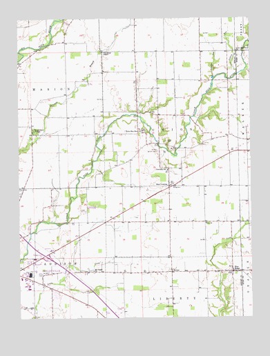
Rays Crossing, IN USGS Topographic Map
Click on map above to begin viewing in our Map Viewer.

This topographic map contains these locations and features:
Feature Name Type Latitude Longitude GNIS ID View Map
Bennett CemeteryCemeteryN39.5695°W85.6750°430811View Map
Blue RidgePopulated PlaceN39.5192°W85.6355°431235View Map
Blue River ChapelChurchN39.6109°W85.7041°431240View Map
Cotton RunStreamN39.6012°W85.6322°433022View Map
Dewitt CemeteryCemeteryN39.5734°W85.6697°433524View Map
Foltz Farm AirportAirportN39.5905°W85.7366°2677000View Map
Knighthood VillagePopulated PlaceN39.5784°W85.7422°437391View Map
Little Blue River ChurchChurchN39.5775°W85.6836°437995View Map
Little Blue River ChurchChurchN39.6103°W85.6319°437996View Map
Manilla BranchStreamN39.5842°W85.6553°438519View Map
MeltzerPopulated PlaceN39.5189°W85.6683°438977View Map
Mount Pisgah ChurchChurchN39.5192°W85.7103°439637View Map
Nasby AirportAirportN39.5219°W85.6872°2676974View Map
Parkinson Airport (historical)AirportN39.5509°W85.6911°449343View Map
Rays CrossingPopulated PlaceN39.5545°W85.6691°441801View Map
Shelbyville Fire Department Station 2BuildingN39.5175°W85.7431°2625585View Map
Sulphur RunStreamN39.5989°W85.6447°444377View Map
Township of UnionCivilN39.5756°W85.6680°453934View Map
Zion ChurchChurchN39.5387°W85.6497°446458View Map

Note: Coordinates in the location and feature list above are referenced to NAD83 datum.


Copyright (C) 2008-2024 Ryan Niemi / Sunset Dynamics ... All Rights Reserved