TopoQuest Logo
Do you find TopoQuest useful?
Help keep TopoQuest running and adding new maps/features by donating!
Bitcoin:  19c7KJd3qBynnjoSw5npx9KScwjBe4ifkT
Litecoin:  LXs6TkuXGGXo1vDsWCkWVdjQX94eUKd6ui
Home View Maps Find Maps Find Places Resources & Links


Ridott, Illinois Topographic Map

USGS Map Title: Ridott, IL
USGS Map MRC: 42089C4
DRG (GeoTIFF) Download: o42089c4.tif


Neighboring USGS Topographic Map Quads:


  Dakota, IL  
42089D5
 

  Davis, IL  
42089D4
 

  Durand, IL  
42089D3
 

  Freeport East, IL  
42089C5
 

  Ridott, IL  
42089C4
 

  Pecatonica, IL  
42089C3
 

  Forreston North, IL  
42089B5
 

  German Valley, IL  
42089B4
 

  Seward, IL  
42089B3


Map MRC Location:

N43°
W90°
N43°
W89°
H8 H7 H6 H5 H4 H3 H2 H1
G8 G7 G6 G5 G4 G3 G2 G1
F8 F7 F6 F5 F4 F3 F2 F1
E8 E7 E6 E5 E4 E3 E2 E1
D8 D7 D6 D5 D4 D3 D2 D1
C8 C7 C6 C5 C4 C3 C2 C1
B8 B7 B6 B5 B4 B3 B2 B1
A8 A7 A6 A5 A4 A3 A2 A1
N42°
W90°
N42°
W89°

Ridott, IL USGS 1:24K Topographic Map Preview:
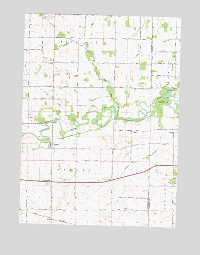
Ridott, IL USGS Topographic Map
Click on map above to begin viewing in our Map Viewer.

This topographic map contains these locations and features:
Feature Name Type Latitude Longitude GNIS ID View Map
Avy School (historical)SchoolN42.3467°W89.3982°423898View Map
Berlin School (historical)SchoolN42.3534°W89.4776°423899View Map
Blake School (historical)SchoolN42.3722°W89.3793°423920View Map
Bolen QuarryMineN42.3009°W89.4134°1967528View Map
Brown CreekStreamN42.3567°W89.4496°404948View Map
Cambier Airport (historical)AirportN42.2997°W89.4215°427731View Map
Centennial School (historical)SchoolN42.3747°W89.4271°423901View Map
College School (historical)SchoolN42.3461°W89.4271°423902View Map
EvartsPopulated PlaceN42.2531°W89.4746°422680View Map
Everts International Airport (historical)AirportN42.2542°W89.4682°427730View Map
Farwell BridgeBridgeN42.3142°W89.4248°423904View Map
German Valley Fire Protection District Station 2BuildingN42.2856°W89.4750°2640905View Map
Grove CreekStreamN42.2914°W89.3993°409540View Map
Hamilton School (historical)SchoolN42.2756°W89.3968°423942View Map
Hunt CornersPopulated PlaceN42.2750°W89.4559°423907View Map
Miller CreekStreamN42.3120°W89.4704°413584View Map
Morrison Spring BranchStreamN42.3270°W89.4298°413849View Map
North Ridott School (historical)SchoolN42.3236°W89.4948°423908View Map
Pecatonica CemeteryCemeteryN42.3064°W89.3768°415502View Map
Pink CreekStreamN42.3236°W89.4071°415716View Map
Poplar Grove School (historical)SchoolN42.2597°W89.4265°423910View Map
RidottPopulated PlaceN42.2964°W89.4754°416660View Map
Ridott BridgeBridgeN42.3106°W89.4757°423911View Map
Ridott Center CemeteryCemeteryN42.2764°W89.4659°416661View Map
Ridott Center School (historical)SchoolN42.2756°W89.4657°423912View Map
Ridott CornersPopulated PlaceN42.2753°W89.4757°423118View Map
Ridott Post OfficePost OfficeN42.2983°W89.4765°2788184View Map
Riverside School (historical)SchoolN42.3195°W89.4359°423913View Map
Rock RunStreamN42.3178°W89.4265°416829View Map
Rosehill CemeteryCemeteryN42.3396°W89.3792°416945View Map
Sumner CreekStreamN42.3231°W89.3829°419362View Map
Sumner IslandIslandN42.3245°W89.3893°419363View Map
Township of RidottCivilN42.2664°W89.4552°429641View Map
Village of RidottCivilN42.2973°W89.4773°2399075View Map
Wagner CemeteryCemeteryN42.2972°W89.4259°420370View Map
Wagner School (historical)SchoolN42.2961°W89.4223°423914View Map
Wickham CreekStreamN42.3022°W89.4673°421129View Map
Winneshiek CreekStreamN42.3028°W89.4976°421342View Map
Woodruff CornersPopulated PlaceN42.2775°W89.4268°423333View Map

Note: Coordinates in the location and feature list above are referenced to NAD83 datum.


Copyright (C) 2008-2025 Ryan Niemi / Sunset Dynamics ... All Rights Reserved