TopoQuest Logo
Do you find TopoQuest useful?
Help keep TopoQuest running and adding new maps/features by donating!
Bitcoin:  19c7KJd3qBynnjoSw5npx9KScwjBe4ifkT
Litecoin:  LXs6TkuXGGXo1vDsWCkWVdjQX94eUKd6ui
Home View Maps Find Maps Find Places Resources & Links


Rio Grande City South, Texas Topographic Map

USGS Map Title: Rio Grande City South, TX
USGS Map MRC: 26098C7
DRG (GeoTIFF) Download: o26098c7.tif


Neighboring USGS Topographic Map Quads:


  Roma-Los Saenz East, TX  
26098D8
 

  Rio Grande City North, TX  
26098D7
 

  Sagunada Ranch, TX  
26098D6
 

  Los Garzas, TX  
26098C8
 

  Rio Grande City South, TX  
26098C7
 

  La Grulla, TX  
26098C6


  Los Ebanos NW, TX  
26098B6


Map MRC Location:

N27°
W99°
N27°
W98°
H8 H7 H6 H5 H4 H3 H2 H1
G8 G7 G6 G5 G4 G3 G2 G1
F8 F7 F6 F5 F4 F3 F2 F1
E8 E7 E6 E5 E4 E3 E2 E1
D8 D7 D6 D5 D4 D3 D2 D1
C8 C7 C6 C5 C4 C3 C2 C1
B8 B7 B6 B5 B4 B3 B2 B1
A8 A7 A6 A5 A4 A3 A2 A1
N26°
W99°
N26°
W98°

Rio Grande City South, TX USGS 1:24K Topographic Map Preview:
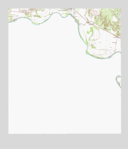
Rio Grande City South, TX USGS Topographic Map
Click on map above to begin viewing in our Map Viewer.

This topographic map contains these locations and features:
Feature Name Type Latitude Longitude GNIS ID View Map
B and E Census Designated PlaceCensusN26.3565°W98.7537°2584607View Map
B and E ColoniaPopulated PlaceN26.3565°W98.7542°2011263View Map
Casa Banco Number 90LeveeN26.3665°W98.8734°1332262View Map
El Chaparral Census Designated PlaceCensusN26.3488°W98.7673°2584629View Map
El Chaparral Number 1 ColoniaPopulated PlaceN26.3503°W98.7684°2011239View Map
El Chaparral Number 2 ColoniaPopulated PlaceN26.3473°W98.7684°2011240View Map
El RefugioPopulated PlaceN26.3403°W98.7559°1335260View Map
El Refugio Census Designated PlaceCensusN26.3406°W98.7589°2408060View Map
El Refugio ColoniaPopulated PlaceN26.3384°W98.7572°2011244View Map
Fort Ringgold Historic SiteParkN26.3737°W98.8086°2028314View Map
Garza-Salinas ColoniaPopulated PlaceN26.3734°W98.7964°2010839View Map
Garza-Salinas II Census Designated PlaceCensusN26.3518°W98.7595°2584645View Map
Garza-Salinas Number 2 ColoniaPopulated PlaceN26.3523°W98.7603°2010840View Map
Hinojosa Elementary SchoolSchoolN26.3612°W98.7753°1986000View Map
La Puerta Census Designated PlaceCensusN26.3468°W98.7505°2408514View Map
La Puerta Number 2 ColoniaPopulated PlaceN26.3503°W98.7553°2010873View Map
Las LomasPopulated PlaceN26.3648°W98.7753°1852726View Map
Las Lomas Census Designated PlaceCensusN26.3638°W98.7746°2408579View Map
Los Adjuntas Banco Number 91LeveeN26.3673°W98.8464°1340561View Map
Los Olmos CreekStreamN26.3567°W98.7972°1340622View Map
Los VelasPopulated PlaceN26.3381°W98.7811°1340635View Map
North Santa Cruz ColoniaPopulated PlaceN26.3665°W98.7714°2010808View Map
OlmosPopulated PlaceN26.3595°W98.7828°1343264View Map
Olmos CemeteryCemeteryN26.3662°W98.7828°1343267View Map
Ringgold Middle SchoolSchoolN26.3742°W98.8053°1986230View Map
Rodriguez Number 1 ColoniaPopulated PlaceN26.3584°W98.7772°2010783View Map
Rodriguez Number 2 ColoniaPopulated PlaceN26.3573°W98.7764°2010784View Map
Santa CruzPopulated PlaceN26.3545°W98.7684°1346628View Map
Santa Cruz Census Designated PlaceCensusN26.3537°W98.7676°2409278View Map
Santa Cruz Number 2 ColoniaPopulated PlaceN26.3634°W98.7714°2010737View Map
Santa Rosa Census Designated PlaceCensusN26.3487°W98.7699°2584737View Map
Santa Rosa ColoniaPopulated PlaceN26.3523°W98.7692°2010738View Map
Share 52 ColoniaPopulated PlaceN26.3653°W98.7772°2010740View Map
Tamez ColoniaPopulated PlaceN26.3353°W98.7584°2010743View Map
Tierra Linda ColoniaPopulated PlaceN26.3623°W98.7822°2010745View Map
VillarealesPopulated PlaceN26.3734°W98.8742°2035001View Map
Yzaguirre Banco Number 58LeveeN26.3731°W98.8384°1350713View Map

Note: Coordinates in the location and feature list above are referenced to NAD83 datum.


Copyright (C) 2008-2025 Ryan Niemi / Sunset Dynamics ... All Rights Reserved