TopoQuest Logo
Do you find TopoQuest useful?
Help keep TopoQuest running and adding new maps/features by donating!
Bitcoin:  19c7KJd3qBynnjoSw5npx9KScwjBe4ifkT
Litecoin:  LXs6TkuXGGXo1vDsWCkWVdjQX94eUKd6ui
Home View Maps Find Maps Find Places Resources & Links


Rocky Canyon, Nevada Topographic Map

USGS Map Title: Rocky Canyon, NV
USGS Map MRC: 40118E6
DRG (GeoTIFF) Download: o40118e6.tif


Neighboring USGS Topographic Map Quads:


  Dead Horse Canyon NE, NV  
40118F7
 

  Placerites, NV  
40118F6
 

  Scossa, NV  
40118F5
 

  Juniper Canyon, NV  
40118E7
 

  Rocky Canyon, NV  
40118E6
 

  Poker Brown Gap, NV  
40118E5
 

  Seven Troughs, NV  
40118D7
 

  Trinity Pass NW, NV  
40118D6
 

  Natchez Spring, NV  
40118D5


Map MRC Location:

N41°
W119°
N41°
W118°
H8 H7 H6 H5 H4 H3 H2 H1
G8 G7 G6 G5 G4 G3 G2 G1
F8 F7 F6 F5 F4 F3 F2 F1
E8 E7 E6 E5 E4 E3 E2 E1
D8 D7 D6 D5 D4 D3 D2 D1
C8 C7 C6 C5 C4 C3 C2 C1
B8 B7 B6 B5 B4 B3 B2 B1
A8 A7 A6 A5 A4 A3 A2 A1
N40°
W119°
N40°
W118°

Rocky Canyon, NV USGS 1:24K Topographic Map Preview:
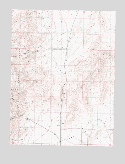
Rocky Canyon, NV USGS Topographic Map
Click on map above to begin viewing in our Map Viewer.

This topographic map contains these locations and features:
Feature Name Type Latitude Longitude GNIS ID View Map
Circle L Cow CampLocaleN40.5249°W118.7432°846111View Map
Eagles Nest RockSummitN40.5877°W118.7296°850103View Map
Egbert CanyonValleyN40.5955°W118.7074°850105View Map
Egbert MeadowFlatN40.5852°W118.7315°850104View Map
Farrell (historical)Populated PlaceN40.5243°W118.7290°850109View Map
Farrell Post OfficePost OfficeN40.5243°W118.7290°864385View Map
Hero MineMineN40.5382°W118.7313°853888View Map
KBSK MountainSummitN40.5813°W118.7471°850106View Map
Marker HouseLocaleN40.5249°W118.7432°852704View Map
Monarch MineMineN40.5491°W118.7449°853887View Map
Olson Meadow SpringSpringN40.6140°W118.7380°850102View Map
Phonolite PeakSummitN40.5557°W118.7474°846132View Map
Rocky CanyonValleyN40.5263°W118.6918°843318View Map
Shingle SpringSpringN40.5644°W118.7472°850107View Map
Stonehouse CanyonValleyN40.5180°W118.7043°854641View Map
Warmoth Mill (historical)LocaleN40.5463°W118.7482°852705View Map
Wildcat CanyonValleyN40.5260°W118.7402°854751View Map
Wildcat MineMineN40.5510°W118.7468°850108View Map

Note: Coordinates in the location and feature list above are referenced to NAD83 datum.


Copyright (C) 2008-2025 Ryan Niemi / Sunset Dynamics ... All Rights Reserved