TopoQuest Logo
Do you find TopoQuest useful?
Help keep TopoQuest running and adding new maps/features by donating!
Bitcoin:  19c7KJd3qBynnjoSw5npx9KScwjBe4ifkT
Litecoin:  LXs6TkuXGGXo1vDsWCkWVdjQX94eUKd6ui
Home View Maps Find Maps Find Places Resources & Links


Cape Fear, North Carolina Topographic Map

USGS Map Title: Cape Fear, NC
USGS Map MRC: 33077G8
DRG (GeoTIFF) Download: o33077g8.tif


Neighboring USGS Topographic Map Quads:


  Cape Fear, NC  
33077G8


Map MRC Location:

N34°
W78°
N34°
W77°
H8 H7 H6 H5 H4 H3 H2 H1
G8 G7 G6 G5 G4 G3 G2 G1
F8 F7 F6 F5 F4 F3 F2 F1
E8 E7 E6 E5 E4 E3 E2 E1
D8 D7 D6 D5 D4 D3 D2 D1
C8 C7 C6 C5 C4 C3 C2 C1
B8 B7 B6 B5 B4 B3 B2 B1
A8 A7 A6 A5 A4 A3 A2 A1
N33°
W78°
N33°
W77°

Cape Fear, NC USGS 1:24K Topographic Map Preview:
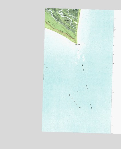
Cape Fear, NC USGS Topographic Map
Click on map above to begin viewing in our Map Viewer.

This topographic map contains these locations and features:
Feature Name Type Latitude Longitude GNIS ID View Map
Bald HeadCapeN33.8660°W78.0089°980465View Map
Bald Head Channel RangeChannelN33.8616°W78.0211°1008322View Map
Bald Head IslandPopulated PlaceN33.8618°W77.9944°1027622View Map
Bald Head IslandIslandN33.8599°W77.9894°980466View Map
Bald Head Island Department of Public Safety Fire and RescueBuildingN33.8585°W77.9861°2638183View Map
Bald Head Island Public Safety Department - PoliceBuildingN33.8584°W77.9860°2130886View Map
Bald Head LighthouseLocaleN33.8735°W78.0005°980467View Map
Bald Head ShoalBarN33.8541°W77.9853°1008313View Map
Bluff IslandIslandN33.8624°W77.9622°981645View Map
Cape FearCapeN33.8405°W77.9603°982615View Map
Cape Fear SlueGutN33.8299°W77.9583°1008319View Map
CPU Bald Head IslandPost OfficeN33.8732°W78.0005°2780614View Map
Deep CreekGutN33.8746°W77.9642°984053View Map
East BeachBeachN33.8649°W77.9592°984487View Map
Fishing CreekStreamN33.8732°W77.9950°985116View Map
Four Mile SlueGutN33.7796°W77.9300°1008318View Map
Frying Pan ShoalsBarN33.8010°W77.9469°985480View Map
Middle IslandIslandN33.8602°W77.9742°989783View Map
Village of Bald Head IslandCivilN33.8639°W77.9869°2407414View Map

Note: Coordinates in the location and feature list above are referenced to NAD83 datum.


Copyright (C) 2008-2025 Ryan Niemi / Sunset Dynamics ... All Rights Reserved