TopoQuest Logo
Do you find TopoQuest useful?
Help keep TopoQuest running and adding new maps/features by donating!
Bitcoin:  19c7KJd3qBynnjoSw5npx9KScwjBe4ifkT
Litecoin:  LXs6TkuXGGXo1vDsWCkWVdjQX94eUKd6ui
Home View Maps Find Maps Find Places Resources & Links


Cape Hatteras, North Carolina Topographic Map

USGS Map Title: Cape Hatteras, NC
USGS Map MRC: 35075B5
DRG (GeoTIFF) Download: o35075b5.tif


Neighboring USGS Topographic Map Quads:


  Buxton, NC  
35075C5


  Cape Hatteras, NC  
35075B5


Map MRC Location:

N36°
W76°
N36°
W75°
H8 H7 H6 H5 H4 H3 H2 H1
G8 G7 G6 G5 G4 G3 G2 G1
F8 F7 F6 F5 F4 F3 F2 F1
E8 E7 E6 E5 E4 E3 E2 E1
D8 D7 D6 D5 D4 D3 D2 D1
C8 C7 C6 C5 C4 C3 C2 C1
B8 B7 B6 B5 B4 B3 B2 B1
A8 A7 A6 A5 A4 A3 A2 A1
N35°
W76°
N35°
W75°

Cape Hatteras, NC USGS 1:24K Topographic Map Preview:
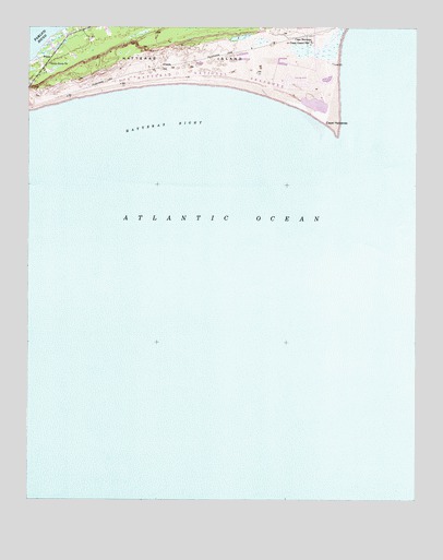
Cape Hatteras, NC USGS Topographic Map
Click on map above to begin viewing in our Map Viewer.

This topographic map contains these locations and features:
Feature Name Type Latitude Longitude GNIS ID View Map
Atlantic OceanSeaN35.2255°W75.5621°1008807View Map
Billy Mitchell AirportAirportN35.2318°W75.6213°997900View Map
Cape HatterasCapeN35.2246°W75.5302°982627View Map
Cape Hatteras National SeashoreParkN35.2424°W75.5312°982628View Map
Cape Hatteras State Park (historical)ParkN35.2363°W75.5310°982629View Map
Cape PointCapeN35.2227°W75.5257°1008346View Map
Creeds HillSummitN35.2396°W75.5821°1019854View Map
Diamond ShoalsBarN35.2064°W75.5186°1008608View Map
Frisco Fire Department Station 42BuildingN35.2470°W75.6132°2639013View Map
Hatteras BightBayN35.2238°W75.5785°986494View Map
Hatteras ShoalsBarN35.2085°W75.5163°1004648View Map
Hatteras SloughGutN35.1974°W75.5051°1867990View Map
Little Grove ChurchChurchN35.2405°W75.6177°988656View Map
Township of HatterasCivilN35.2200°W75.6112°1026612View Map

Note: Coordinates in the location and feature list above are referenced to NAD83 datum.


Copyright (C) 2008-2025 Ryan Niemi / Sunset Dynamics ... All Rights Reserved