TopoQuest Logo
Do you find TopoQuest useful?
Help keep TopoQuest running and adding new maps/features by donating!
Bitcoin:  19c7KJd3qBynnjoSw5npx9KScwjBe4ifkT
Litecoin:  LXs6TkuXGGXo1vDsWCkWVdjQX94eUKd6ui
Home View Maps Find Maps Find Places Resources & Links


Steamboat, Nevada Topographic Map

USGS Map Title: Steamboat, NV
USGS Map MRC: 39119D6
DRG (GeoTIFF) Download: o39119d6.tif


Neighboring USGS Topographic Map Quads:


  Reno, NV  
39119E7
 

  Vista, NV  
39119E6
 

  Patrick, NV  
39119E5
 

  Mount Rose NE, NV  
39119D7
 

  Steamboat, NV  
39119D6
 

  Chalk Hills, NV  
39119D5
 

  Washoe City, NV  
39119C7
 

  Virginia City, NV  
39119C6
 

  Flowery Peak, NV  
39119C5


Map MRC Location:

N40°
W120°
N40°
W119°
H8 H7 H6 H5 H4 H3 H2 H1
G8 G7 G6 G5 G4 G3 G2 G1
F8 F7 F6 F5 F4 F3 F2 F1
E8 E7 E6 E5 E4 E3 E2 E1
D8 D7 D6 D5 D4 D3 D2 D1
C8 C7 C6 C5 C4 C3 C2 C1
B8 B7 B6 B5 B4 B3 B2 B1
A8 A7 A6 A5 A4 A3 A2 A1
N39°
W120°
N39°
W119°

Steamboat, NV USGS 1:24K Topographic Map Preview:
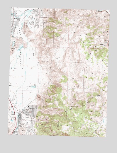
Steamboat, NV USGS Topographic Map
Click on map above to begin viewing in our Map Viewer.

This topographic map contains these locations and features:
Feature Name Type Latitude Longitude GNIS ID View Map
Alexander LakeReservoirN39.4606°W119.7376°847839View Map
Alum SpringSpringN39.3826°W119.7402°847841View Map
Bella Vista RanchLocaleN39.4716°W119.7416°847825View Map
Bianco RanchLocaleN39.3999°W119.7371°847821View Map
Boynton SloughStreamN39.4960°W119.7271°858999View Map
Brown Elementary SchoolSchoolN39.4077°W119.7482°863911View Map
Caldwell RavineValleyN39.4144°W119.6360°848306View Map
Carver WellWellN39.3791°W119.7413°857104View Map
Castle PeakSummitN39.4060°W119.6446°839339View Map
Castle Peak MineMineN39.4094°W119.6502°839341View Map
Castle Peak Mining DistrictCivilN39.4077°W119.6452°848370View Map
Chandler DitchCanalN39.3955°W119.7363°839415View Map
Crane DitchCanalN39.4091°W119.7338°839847View Map
Damonte Ranch High SchoolSchoolN39.4242°W119.7130°2080096View Map
Damonte Ranch Middle SchoolSchoolN39.4244°W119.7136°2080103View Map
Davidson WellWellN39.4277°W119.7119°857086View Map
Dimonte SpringSpringN39.4196°W119.7399°857087View Map
Donner Springs Elementary SchoolSchoolN39.4762°W119.7442°2080111View Map
Double Diamond Elementary SchoolSchoolN39.4411°W119.7478°2080112View Map
Double Diamond SpringSpringN39.4419°W119.7452°857067View Map
Double Diamond WellWellN39.4419°W119.7452°857068View Map
East Reno WellWellN39.3971°W119.7446°857092View Map
Frazier WellWellN39.3769°W119.7260°857100View Map
Geiger Lookout Wayside ParkParkN39.3838°W119.7046°848353View Map
Harold Herz WellsWellN39.4032°W119.7494°857138View Map
Hidden ValleyValleyN39.4924°W119.7263°840976View Map
Hidden ValleyPopulated PlaceN39.4919°W119.7180°847840View Map
Hidden Valley County ParkParkN39.4838°W119.7082°848560View Map
Hidden Valley Volunteer Fire DepartmentBuildingN39.4943°W119.7253°2581303View Map
Huffaker SpringsSpringN39.4574°W119.7227°857090View Map
Isbell WellWellN39.3919°W119.7307°857102View Map
Johnson WellWellN39.3841°W119.7216°857099View Map
KHIT-AM (Sun Valley)TowerN39.4157°W119.7152°865151View Map
Kids R Kids KindergartenSchoolN39.4455°W119.7481°2089691View Map
KJOR-AM (Reno)TowerN39.4157°W119.7152°865147View Map
Knox WellWellN39.3816°W119.7374°857123View Map
LeCroix WellWellN39.4305°W119.7116°857085View Map
Lighthouse Baptist AcademySchoolN39.4957°W119.7410°2089696View Map
Lookout PointCapeN39.3841°W119.7041°856306View Map
Lousetown (historical)LocaleN39.4152°W119.6346°865139View Map
Magnolia HouseLocaleN39.3905°W119.7185°847843View Map
McComas WellWellN39.4102°W119.7455°857089View Map
McKnight WellWellN39.3952°W119.7260°857101View Map
Miraloma Park Shopping CenterLocaleN39.4852°W119.7474°848094View Map
Mount Rose 1 WellWellN39.4013°W119.7466°857095View Map
Ponderosa RanchLocaleN39.3907°W119.7405°847823View Map
Rancho Mira LomaLocaleN39.4282°W119.7135°847820View Map
Red Rock CanyonValleyN39.4677°W119.6757°848305View Map
Reno Fire Department Station 12BuildingN39.4438°W119.7465°2581314View Map
Reno Hot SpringsSpringN39.3805°W119.7410°857098View Map
Reno Southeast DivisionCivilN39.4583°W119.7300°1937466View Map
Reno WellWellN39.3971°W119.7446°857093View Map
Rodeo WellWellN39.3882°W119.7441°857096View Map
Sage Hill Gun ClubLocaleN39.4152°W119.7430°847838View Map
Senges WellWellN39.3982°W119.7496°857139View Map
South Steamboat WellWellN39.3780°W119.7427°857097View Map
Southeast Truckee Meadows Division (historical)CensusN39.4652°W119.7355°1937473View Map
Star Grange HallBuildingN39.3977°W119.7371°847822View Map
SteamboatPopulated PlaceN39.3771°W119.7438°863833View Map
Steamboat 4 WellWellN39.3791°W119.7413°857103View Map
Steamboat SpringsSpringN39.3885°W119.7435°856394View Map
Storey County Fire Department Station 2 Virginia HighlandsBuildingN39.3887°W119.6320°2581263View Map
Sutherland WellWellN39.4102°W119.7455°857088View Map
Treps FarmLocaleN39.4299°W119.7121°847824View Map
Virginia City HighlandsPopulated PlaceN39.3807°W119.6438°854859View Map
Warren WellWellN39.4021°W119.7407°857094View Map
WashingtonLocaleN39.4655°W119.6324°854666View Map
Washington Hill ProspectMineN39.4607°W119.6405°854667View Map
Washington Mining DistrictCivilN39.4655°W119.6324°848369View Map
West Reno WellWellN39.3969°W119.7466°857091View Map
Whites CreekStreamN39.4402°W119.7477°861991View Map

Note: Coordinates in the location and feature list above are referenced to NAD83 datum.


Copyright (C) 2008-2024 Ryan Niemi / Sunset Dynamics ... All Rights Reserved