TopoQuest Logo
Do you find TopoQuest useful?
Help keep TopoQuest running and adding new maps/features by donating!
Bitcoin:  19c7KJd3qBynnjoSw5npx9KScwjBe4ifkT
Litecoin:  LXs6TkuXGGXo1vDsWCkWVdjQX94eUKd6ui
Home View Maps Find Maps Find Places Resources & Links


Tarnov, Nebraska Topographic Map

USGS Map Title: Tarnov, NE
USGS Map MRC: 41097E5
DRG (GeoTIFF) Download: o41097e5.tif


Neighboring USGS Topographic Map Quads:


  Lindsay, NE  
41097F6
 

  Cornlea, NE  
41097F5
 

  Humphrey, NE  
41097F4
 

  Lindsay SW, NE  
41097E6
 

  Tarnov, NE  
41097E5
 

  Platte Center, NE  
41097E4
 

  Genoa, NE  
41097D6
 

  Monroe, NE  
41097D5
 

  Duncan, NE  
41097D4


Map MRC Location:

N42°
W98°
N42°
W97°
H8 H7 H6 H5 H4 H3 H2 H1
G8 G7 G6 G5 G4 G3 G2 G1
F8 F7 F6 F5 F4 F3 F2 F1
E8 E7 E6 E5 E4 E3 E2 E1
D8 D7 D6 D5 D4 D3 D2 D1
C8 C7 C6 C5 C4 C3 C2 C1
B8 B7 B6 B5 B4 B3 B2 B1
A8 A7 A6 A5 A4 A3 A2 A1
N41°
W98°
N41°
W97°

Tarnov, NE USGS 1:24K Topographic Map Preview:
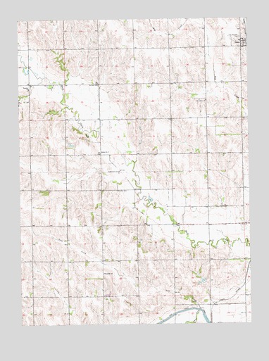
Tarnov, NE USGS Topographic Map
Click on map above to begin viewing in our Map Viewer.

This topographic map contains these locations and features:
Feature Name Type Latitude Longitude GNIS ID View Map
Burrows CemeteryCemeteryN41.5983°W97.5817°827800View Map
Greenwood CemeteryCemeteryN41.5708°W97.5806°829685View Map
Lost CreekStreamN41.5061°W97.5284°830907View Map
Platte CountyCivilN41.5713°W97.5212°835892View Map
Postville ChurchChurchN41.5967°W97.6198°832325View Map
Saint Anthony Post Office (historical)Post OfficeN41.5917°W97.5237°1880837View Map
Saint Anthonys ChurchChurchN41.5917°W97.5234°832840View Map
Saint Michaels Catholic Church (historical)ChurchN41.6158°W97.5023°1881027View Map
Saint Michaels CemeteryCemeteryN41.6178°W97.5045°833024View Map
School Number 11SchoolN41.5083°W97.5114°836166View Map
School Number 60SchoolN41.5922°W97.5231°836933View Map
TarnovPopulated PlaceN41.6158°W97.5023°834038View Map
TarnovLocaleN41.6158°W97.5009°1881026View Map
Tarnov Post Office (historical)Post OfficeN41.6158°W97.5023°1881028View Map
Township of BurrowsCivilN41.6130°W97.5424°837898View Map
Township of Lost CreekCivilN41.5260°W97.5420°838112View Map
Village of TarnovCivilN41.6148°W97.5025°2399955View Map
Wattsville SchoolSchoolN41.5208°W97.5803°834506View Map
Zion CemeteryCemeteryN41.5547°W97.5706°834939View Map

Note: Coordinates in the location and feature list above are referenced to NAD83 datum.


Copyright (C) 2008-2024 Ryan Niemi / Sunset Dynamics ... All Rights Reserved