TopoQuest Logo
Do you find TopoQuest useful?
Help keep TopoQuest running and adding new maps/features by donating!
Bitcoin:  19c7KJd3qBynnjoSw5npx9KScwjBe4ifkT
Litecoin:  LXs6TkuXGGXo1vDsWCkWVdjQX94eUKd6ui
Home View Maps Find Maps Find Places Resources & Links


Winter Flats, Colorado Topographic Map

USGS Map Title: Winter Flats, CO
USGS Map MRC: 39108C4
DRG (GeoTIFF) Download: o39108c4.tif


Neighboring USGS Topographic Map Quads:


  Middle Dry Fork, CO  
39108D5
 

  The Saddle, CO  
39108D4
 

  Long Point, CO  
39108D3
 

  Corcoran Peak, CO  
39108C5
 

  Winter Flats, CO  
39108C4
 

  Wagon Track Ridge, CO  
39108C3
 

  Corcoran Point, CO  
39108B5
 

  Round Mountain, CO  
39108B4
 

  Cameo, CO  
39108B3


Map MRC Location:

N40°
W109°
N40°
W108°
H8 H7 H6 H5 H4 H3 H2 H1
G8 G7 G6 G5 G4 G3 G2 G1
F8 F7 F6 F5 F4 F3 F2 F1
E8 E7 E6 E5 E4 E3 E2 E1
D8 D7 D6 D5 D4 D3 D2 D1
C8 C7 C6 C5 C4 C3 C2 C1
B8 B7 B6 B5 B4 B3 B2 B1
A8 A7 A6 A5 A4 A3 A2 A1
N39°
W109°
N39°
W108°

Winter Flats, CO USGS 1:24K Topographic Map Preview:
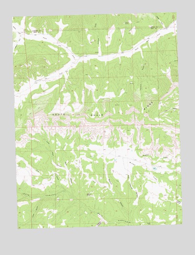
Winter Flats, CO USGS Topographic Map
Click on map above to begin viewing in our Map Viewer.

This topographic map contains these locations and features:
Feature Name Type Latitude Longitude GNIS ID View Map
Alkali CanyonValleyN39.2676°W108.4576°174316View Map
Corcoran WashStreamN39.3491°W108.4484°174296View Map
Cosgrove CanyonValleyN39.2541°W108.4355°174313View Map
Deer Retention DamDamN39.2816°W108.3940°200444View Map
East Redrock CanyonValleyN39.2556°W108.4158°174311View Map
Gothard GulchValleyN39.3480°W108.4344°174198View Map
Hancock GulchValleyN39.3555°W108.4057°174320View Map
Lane GulchValleyN39.2675°W108.4818°174314View Map
Lefthand DrawValleyN39.3643°W108.4933°174297View Map
Little Alkali CanyonValleyN39.2848°W108.4623°174315View Map
McKay ForkStreamN39.3619°W108.4837°174182View Map
Pedigo GulchValleyN39.3633°W108.3853°174204View Map
Pine GulchValleyN39.2712°W108.4633°174295View Map
Redrock CanyonValleyN39.2515°W108.4169°174312View Map
Redrock PointSummitN39.2691°W108.4476°174319View Map
Soap Retention DamDamN39.2883°W108.4256°200445View Map
South Shale RidgeRidgeN39.3211°W108.4118°202227View Map
Willow SpringSpringN39.3693°W108.4150°174317View Map
Winter FlatsFlatN39.2825°W108.4040°174308View Map

Note: Coordinates in the location and feature list above are referenced to NAD83 datum.


Copyright (C) 2008-2025 Ryan Niemi / Sunset Dynamics ... All Rights Reserved