TopoQuest Logo
Do you find TopoQuest useful?
Help keep TopoQuest running and adding new maps/features by donating!
Bitcoin:  19c7KJd3qBynnjoSw5npx9KScwjBe4ifkT
Litecoin:  LXs6TkuXGGXo1vDsWCkWVdjQX94eUKd6ui
Home View Maps Find Maps Find Places Resources & Links


Zoar, Wisconsin Topographic Map

USGS Map Title: Zoar, WI
USGS Map MRC: 45088A8
DRG (GeoTIFF) Download: o45088a8.tif


Neighboring USGS Topographic Map Quads:


  Bryant, WI  
45089B1
 

  Polar, WI  
45088B8
 

  White Lake, WI  
45088B7
 

  Mattoon, WI  
45089A1
 

  Zoar, WI  
45088A8
 

  Perote Lake, WI  
45088A7
 

  Regina, WI  
44089H1
 

  Burney Lake, WI  
44088H8
 

  Neopit, WI  
44088H7


Map MRC Location:

N46°
W89°
N46°
W88°
H8 H7 H6 H5 H4 H3 H2 H1
G8 G7 G6 G5 G4 G3 G2 G1
F8 F7 F6 F5 F4 F3 F2 F1
E8 E7 E6 E5 E4 E3 E2 E1
D8 D7 D6 D5 D4 D3 D2 D1
C8 C7 C6 C5 C4 C3 C2 C1
B8 B7 B6 B5 B4 B3 B2 B1
A8 A7 A6 A5 A4 A3 A2 A1
N45°
W89°
N45°
W88°

Zoar, WI USGS 1:24K Topographic Map Preview:
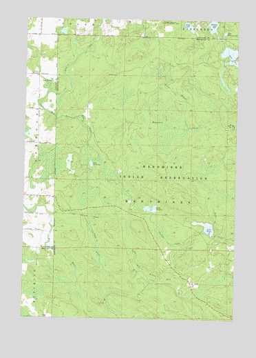
Zoar, WI USGS Topographic Map
Click on map above to begin viewing in our Map Viewer.

This topographic map contains these locations and features:
Feature Name Type Latitude Longitude GNIS ID View Map
Bass LakesLakeN45.1101°W88.8787°1561290View Map
Camp Black HawkLocaleN45.1241°W88.8987°1562580View Map
Camp CreekStreamN45.0161°W88.9676°1562592View Map
Chisel SpringsSpringN45.1019°W88.9929°1563044View Map
Deer CreekStreamN45.1241°W88.9565°1563825View Map
East Florence LakeLakeN45.1196°W88.8827°1564318View Map
Florence LakeLakeN45.1222°W88.8897°1565080View Map
Lake DamDamN45.1083°W88.8818°1792316View Map
Lake ElmaLakeN45.0377°W88.8904°1564573View Map
Lake NeconishLakeN45.0644°W88.9607°1570133View Map
Lake NoseumLakeN45.0460°W88.9246°1570569View Map
Menominee CreekStreamN45.0827°W88.8809°1569342View Map
Niobe LakeLakeN45.1221°W88.9041°1570310View Map
North Branch Menominee CreekStreamN45.0797°W88.9040°1570380View Map
Noseum CreekStreamN45.0164°W88.9148°1570568View Map
Rabe CreekStreamN45.1241°W88.9571°1572010View Map
Red River CampLocaleN45.0980°W88.9390°1572153View Map
Red SpringsSpringN45.0433°W88.9468°1572160View Map
Sipes CreekStreamN45.0841°W88.9821°1577228View Map
Sipes SpringSpringN45.0989°W88.9851°1574203View Map
Upper ReservoirReservoirN45.1083°W88.8818°1792317View Map
ZoarPopulated PlaceN45.0150°W88.8990°1577183View Map
Zoar Census Designated PlaceCensusN45.0178°W88.8945°2393870View Map

Note: Coordinates in the location and feature list above are referenced to NAD83 datum.


Copyright (C) 2008-2025 Ryan Niemi / Sunset Dynamics ... All Rights Reserved