TopoQuest Logo
Do you find TopoQuest useful?
Help keep TopoQuest running and adding new maps/features by donating!
Bitcoin:  19c7KJd3qBynnjoSw5npx9KScwjBe4ifkT
Litecoin:  LXs6TkuXGGXo1vDsWCkWVdjQX94eUKd6ui
Home View Maps Find Maps Find Places Resources & Links


Black Crater, Oregon Topographic Map

USGS Map Title: Black Crater, OR
USGS Map MRC: 44121C6
DRG (GeoTIFF) Download: o44121c6.tif


Neighboring USGS Topographic Map Quads:


  Three Fingered Jack, OR  
44121D7
 

  Black Butte, OR  
44121D6
 

  Little Squaw Back, OR  
44121D5
 

  Mount Washington, OR  
44121C7
 

  Black Crater, OR  
44121C6
 

  Sisters, OR  
44121C5
 

  North Sister, OR  
44121B7
 

  Trout Creek Butte, OR  
44121B6
 

  Three Creek Butte, OR  
44121B5


Map MRC Location:

N45°
W122°
N45°
W121°
H8 H7 H6 H5 H4 H3 H2 H1
G8 G7 G6 G5 G4 G3 G2 G1
F8 F7 F6 F5 F4 F3 F2 F1
E8 E7 E6 E5 E4 E3 E2 E1
D8 D7 D6 D5 D4 D3 D2 D1
C8 C7 C6 C5 C4 C3 C2 C1
B8 B7 B6 B5 B4 B3 B2 B1
A8 A7 A6 A5 A4 A3 A2 A1
N44°
W122°
N44°
W121°

Black Crater, OR USGS 1:24K Topographic Map Preview:
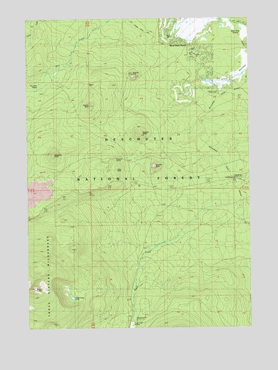
Black Crater, OR USGS Topographic Map
Click on map above to begin viewing in our Map Viewer.

This topographic map contains these locations and features:
Feature Name Type Latitude Longitude GNIS ID View Map
Big Meadow Golf CourseLocaleN44.3741°W121.6684°2562983View Map
Black Butte Ranch Census Designated PlaceCensusN44.3578°W121.6588°2584407View Map
Black Butte Ranch Rural Fire Protection DistrictBuildingN44.3602°W121.6603°2576893View Map
Black Butte SwampSwampN44.3684°W121.6275°1158127View Map
Black Crater LakeLakeN44.2621°W121.7262°1116716View Map
Bluegrass ButteSummitN44.3200°W121.7367°1138339View Map
Cold SpringSpringN44.3103°W121.6348°1139936View Map
Cold Spring Recreation SiteLocaleN44.3096°W121.6345°1156878View Map
Dry CreekSwampN44.3482°W121.7426°1161349View Map
Fivemile ButteSummitN44.3514°W121.6906°1142200View Map
Fourmile ButteSummitN44.3152°W121.6790°1142364View Map
Fourmile SpringSpringN44.3184°W121.7010°1142373View Map
Glaze MeadowFlatN44.3501°W121.6325°1142769View Map
Glaze Meadow Golf CourseLocaleN44.3471°W121.6572°2562982View Map
Graham ButteSummitN44.3286°W121.6865°1142895View Map
Graham Corral Horse CampLocaleN44.3448°W121.6425°1142896View Map
Latta CraterCraterN44.2724°W121.7468°1851716View Map
Little ButteSummitN44.3134°W121.7006°1145115View Map
Nootnagle DamDamN44.2532°W121.6927°1153927View Map
Nootnagle ReservoirReservoirN44.2532°W121.6928°1153926View Map
Paulina SpringSpringN44.3670°W121.6686°1116715View Map
Pole Creek SpringSpringN44.2579°W121.6945°1147850View Map
Sisters Horse Camp (historical)LocaleN44.2918°W121.6525°1149549View Map
Sixmile ButteSummitN44.3392°W121.7158°1149568View Map
Trout CreekStreamN44.2998°W121.6281°1151442View Map
Whispering Pine Horse CampLocaleN44.2534°W121.6906°1152216View Map

Note: Coordinates in the location and feature list above are referenced to NAD83 datum.


Copyright (C) 2008-2025 Ryan Niemi / Sunset Dynamics ... All Rights Reserved