TopoQuest Logo
Do you find TopoQuest useful?
Help keep TopoQuest running and adding new maps/features by donating!
Bitcoin:  19c7KJd3qBynnjoSw5npx9KScwjBe4ifkT
Litecoin:  LXs6TkuXGGXo1vDsWCkWVdjQX94eUKd6ui
Home View Maps Find Maps Find Places Resources & Links


Buckeye Ridge, California Topographic Map

USGS Map Title: Buckeye Ridge, CA
USGS Map MRC: 38119B4
DRG (GeoTIFF) Download: o38119b4.tif


Neighboring USGS Topographic Map Quads:


  Pickel Meadow, CA  
38119C5
 

  Fales Hot Springs, CA  
38119C4
 

  Mount Jackson, CA  
38119C3
 

  Tower Peak, CA  
38119B5
 

  Buckeye Ridge, CA  
38119B4
 

  Twin Lakes, CA  
38119B3
 

  Piute Mountain, CA  
38119A5
 

  Matterhorn Peak, CA  
38119A4
 

  Dunderberg Peak, CA  
38119A3


Map MRC Location:

N39°
W120°
N39°
W119°
H8 H7 H6 H5 H4 H3 H2 H1
G8 G7 G6 G5 G4 G3 G2 G1
F8 F7 F6 F5 F4 F3 F2 F1
E8 E7 E6 E5 E4 E3 E2 E1
D8 D7 D6 D5 D4 D3 D2 D1
C8 C7 C6 C5 C4 C3 C2 C1
B8 B7 B6 B5 B4 B3 B2 B1
A8 A7 A6 A5 A4 A3 A2 A1
N38°
W120°
N38°
W119°

Buckeye Ridge, CA USGS 1:24K Topographic Map Preview:
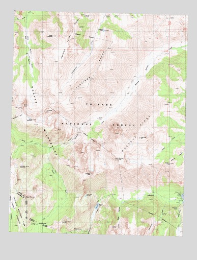
Buckeye Ridge, CA USGS Topographic Map
Click on map above to begin viewing in our Map Viewer.

This topographic map contains these locations and features:
Feature Name Type Latitude Longitude GNIS ID View Map
Barney LakeLakeN38.1406°W119.4380°218688View Map
Big MeadowFlatN38.2069°W119.4179°219214View Map
Blacksmith CreekStreamN38.1449°W119.3829°219426View Map
Buckeye PassGapN38.1299°W119.4793°254668View Map
Buckeye RidgeRidgeN38.1798°W119.4086°220041View Map
Center MountainSummitN38.1444°W119.4893°254731View Map
Cirque MountainSummitN38.1315°W119.4589°221121View Map
Eagle PeakSummitN38.1798°W119.4086°222821View Map
Flatiron ButteSummitN38.1970°W119.4926°260195View Map
Flatiron RidgeRidgeN38.2125°W119.4449°223591View Map
Grouse MountainSummitN38.1620°W119.4899°224666View Map
Hanging Valley RidgeRidgeN38.2349°W119.4598°224874View Map
Hanna MountainSummitN38.1884°W119.4859°253499View Map
Hoover WildernessReserveN38.1420°W119.4127°276153View Map
Horse CreekStreamN38.1446°W119.3779°261479View Map
Horsetail FallsFallsN38.1394°W119.3799°252446View Map
Hunewill PeakSummitN38.1589°W119.4435°253514View Map
Ink RocksPillarN38.1927°W119.4771°225937View Map
Little LakeLakeN38.1462°W119.4462°252447View Map
Little Slide CanyonValleyN38.1429°W119.4204°253525View Map
McMillan CabinLocaleN38.2477°W119.4352°228429View Map
McMillan LakeLakeN38.2400°W119.4365°228430View Map
Mono Village (historical)Populated PlaceN38.1496°W119.3771°1659157View Map
Mono Village ResortLocaleN38.1488°W119.3779°274805View Map
North Fork Buckeye CreekStreamN38.1724°W119.4710°264141View Map
Piute CanyonValleyN38.2462°W119.4917°264827View Map
Robinson PeakSummitN38.1659°W119.3865°231694View Map
Sawmill RidgeRidgeN38.1659°W119.3866°253578View Map
Snow CabinLocaleN38.1727°W119.4752°1662382View Map
South Fork Buckeye CreekStreamN38.1724°W119.4716°253601View Map
The RoughsRapidsN38.1755°W119.4604°268209View Map
Victoria PeakSummitN38.1680°W119.4235°237073View Map
Walker MountainSummitN38.2360°W119.4726°237181View Map

Note: Coordinates in the location and feature list above are referenced to NAD83 datum.


Copyright (C) 2008-2025 Ryan Niemi / Sunset Dynamics ... All Rights Reserved