TopoQuest Logo
Do you find TopoQuest useful?
Help keep TopoQuest running and adding new maps/features by donating!
Bitcoin:  19c7KJd3qBynnjoSw5npx9KScwjBe4ifkT
Litecoin:  LXs6TkuXGGXo1vDsWCkWVdjQX94eUKd6ui
Home View Maps Find Maps Find Places Resources & Links


Dixie, Louisiana Topographic Map

USGS Map Title: Dixie, LA
USGS Map MRC: 32093F7
DRG (GeoTIFF) Download: o32093f7.tif


Neighboring USGS Topographic Map Quads:


  Vivian South, LA  
32093G8
 

  Gilliam, LA  
32093G7
 

  Hughes, LA  
32093G6
 

  Mooringsport, LA  
32093F8
 

  Dixie, LA  
32093F7
 

  Benton, LA  
32093F6
 

  Blanchard, LA  
32093E8
 

  North Highlands, LA  
32093E7
 

  Bossier City, LA  
32093E6


Map MRC Location:

N33°
W94°
N33°
W93°
H8 H7 H6 H5 H4 H3 H2 H1
G8 G7 G6 G5 G4 G3 G2 G1
F8 F7 F6 F5 F4 F3 F2 F1
E8 E7 E6 E5 E4 E3 E2 E1
D8 D7 D6 D5 D4 D3 D2 D1
C8 C7 C6 C5 C4 C3 C2 C1
B8 B7 B6 B5 B4 B3 B2 B1
A8 A7 A6 A5 A4 A3 A2 A1
N32°
W94°
N32°
W93°

Dixie, LA USGS 1:24K Topographic Map Preview:
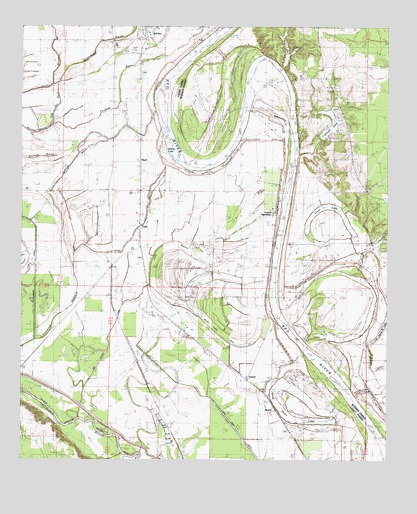
Dixie, LA USGS Topographic Map
Click on map above to begin viewing in our Map Viewer.

This topographic map contains these locations and features:
Feature Name Type Latitude Longitude GNIS ID View Map
Bee LakeLakeN32.7432°W93.7849°553568View Map
Bee Lake DamDamN32.6635°W93.7585°557020View Map
BelcherPopulated PlaceN32.7488°W93.8330°553580View Map
Belcher AirpatchAirportN32.7482°W93.8713°2676743View Map
Bethel ChurchChurchN32.7190°W93.8352°532981View Map
Brier Field Ferry (historical)CrossingN32.7424°W93.8135°550790View Map
Caddo PrairieAreaN32.6835°W93.8460°552240View Map
Cash Point CanalCanalN32.6301°W93.7985°533801View Map
Cat Island LakeLakeN32.6660°W93.7504°553922View Map
Clear LakeLakeN32.6982°W93.7695°554018View Map
Cottonwood CanalCanalN32.6793°W93.8707°534163View Map
Cottonwood Lake (historical)LakeN32.6849°W93.8488°552253View Map
Cowhide BayouStreamN32.7210°W93.8666°534216View Map
Cypress LakeReservoirN32.7206°W93.7699°554176View Map
Dickson CemeteryCemeteryN32.7351°W93.7682°534526View Map
DixiePopulated PlaceN32.6926°W93.8349°554245View Map
Dixie Airstrip (historical)AirportN32.7001°W93.8252°1632691View Map
Dixie Oil FieldOilfieldN32.6354°W93.8116°534540View Map
Doe Slough CanalCanalN32.6610°W93.8452°534548View Map
Dooley BayouGutN32.7382°W93.8641°554258View Map
Gold Point LakeLakeN32.6365°W93.7770°554543View Map
HaytiPopulated PlaceN32.7121°W93.8355°543283View Map
Horseshoe BayouStreamN32.7343°W93.8627°554760View Map
Hurrican BluffsCliffN32.7215°W93.7813°550844View Map
Irish BayouStreamN32.6713°W93.8405°554838View Map
Jefferson Shreveport Waterway ProjectCanalN32.6363°W93.8538°536016View Map
KEEL-AM (Shreveport)TowerN32.6765°W93.8599°1633238View Map
Lenwood ChurchChurchN32.7421°W93.7738°536403View Map
Little Kingdom ChurchChurchN32.7457°W93.8635°536569View Map
Moon Lake (historical)LakeN32.6690°W93.8166°552358View Map
Moon Lake BedFlatN32.6660°W93.8124°537189View Map
PickettPopulated PlaceN32.6399°W93.7888°538116View Map
Providence SchoolSchoolN32.6479°W93.7571°538427View Map
Rock Point Oil FieldOilfieldN32.7404°W93.8674°552397View Map
Rose of Sharon ChurchChurchN32.6599°W93.8155°538705View Map
Rosenwald SchoolSchoolN32.7101°W93.8607°538724View Map
Saint James SchoolSchoolN32.6524°W93.8046°538866View Map
SentellPopulated PlaceN32.6482°W93.7977°541187View Map
Sentell Ferry (historical)CrossingN32.6990°W93.7846°550882View Map
Sentell PlantationLocaleN32.6960°W93.7891°539257View Map
Slay's Ultralight FlightparkAirportN32.7472°W93.8710°2717352View Map
Stumpy Lake (historical)LakeN32.6324°W93.8250°552447View Map
Sullivan SloughStreamN32.6274°W93.8343°552448View Map
The Trail RaceGutN32.7276°W93.8635°539858View Map
Thompson BayouStreamN32.7146°W93.8568°552480View Map
Trinity BayouGutN32.7118°W93.8591°556267View Map
Uni (historical)Populated PlaceN32.7349°W93.8346°552457View Map
Williams Lake (historical)LakeN32.6868°W93.8243°552475View Map
Willow ChuteStreamN32.6588°W93.7566°540456View Map
Willow LakeLakeN32.7143°W93.8266°556438View Map

Note: Coordinates in the location and feature list above are referenced to NAD83 datum.


Copyright (C) 2008-2024 Ryan Niemi / Sunset Dynamics ... All Rights Reserved