TopoQuest Logo
Do you find TopoQuest useful?
Help keep TopoQuest running and adding new maps/features by donating!
Bitcoin:  19c7KJd3qBynnjoSw5npx9KScwjBe4ifkT
Litecoin:  LXs6TkuXGGXo1vDsWCkWVdjQX94eUKd6ui
Home View Maps Find Maps Find Places Resources & Links


Ellis, Idaho Topographic Map

USGS Map Title: Ellis, ID
USGS Map MRC: 44114F1
DRG (GeoTIFF) Download: o44114f1.tif


Neighboring USGS Topographic Map Quads:


  Wards Butte, ID  
44114G2
 

  Hat Creek, ID  
44114G1
 

  Allison Creek, ID  
44113G8
 

  Gooseberry Creek, ID  
44114F2
 

  Ellis, ID  
44114F1
 

  Ennis Gulch, ID  
44113F8
 

  Challis, ID  
44114E2
 

  Grouse Peak, ID  
44114E1
 

  May, ID  
44113E8


Map MRC Location:

N45°
W115°
N45°
W114°
H8 H7 H6 H5 H4 H3 H2 H1
G8 G7 G6 G5 G4 G3 G2 G1
F8 F7 F6 F5 F4 F3 F2 F1
E8 E7 E6 E5 E4 E3 E2 E1
D8 D7 D6 D5 D4 D3 D2 D1
C8 C7 C6 C5 C4 C3 C2 C1
B8 B7 B6 B5 B4 B3 B2 B1
A8 A7 A6 A5 A4 A3 A2 A1
N44°
W115°
N44°
W114°

Ellis, ID USGS 1:24K Topographic Map Preview:
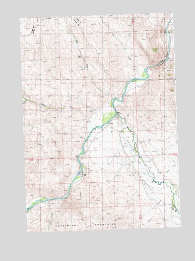
Ellis, ID USGS Topographic Map
Click on map above to begin viewing in our Map Viewer.

This topographic map contains these locations and features:
Feature Name Type Latitude Longitude GNIS ID View Map
Anderson SpringStreamN44.6458°W114.0073°376629View Map
Cherry CreekStreamN44.7030°W114.1217°379229View Map
Cow CreekStreamN44.7363°W114.0028°379960View Map
Cronks CanyonValleyN44.7271°W114.0045°380074View Map
Deer GulchValleyN44.7013°W114.0509°380457View Map
Deer Gulch Access AreaLocaleN44.7019°W114.0456°401289View Map
Dry GulchValleyN44.7130°W114.0301°380864View Map
Eagle RockCliffN44.6577°W114.0778°380997View Map
EllisPopulated PlaceN44.6919°W114.0484°381426View Map
Ellis Access AreaLocaleN44.6871°W114.0553°401322View Map
Ellis CreekStreamN44.6838°W114.0690°381429View Map
Ellis Post OfficePost OfficeN44.6914°W114.0485°2766892View Map
Ennis GulchValleyN44.6549°W114.0098°381481View Map
Hot Spring (historical)SpringN44.7196°W114.0170°398415View Map
Magpie SpringSpringN44.7262°W114.0752°398416View Map
Pahsimeroi Rearing PondsLocaleN44.6844°W114.0392°401103View Map
Pahsimeroi RiverStreamN44.6919°W114.0487°388123View Map
Pahsimeroi ValleyValleyN44.6852°W114.0509°388124View Map
Shep CreekStreamN44.6433°W114.1076°390295View Map
Shotgun CreekStreamN44.6508°W114.0884°390386View Map

Note: Coordinates in the location and feature list above are referenced to NAD83 datum.


Copyright (C) 2008-2025 Ryan Niemi / Sunset Dynamics ... All Rights Reserved