TopoQuest Logo
Do you find TopoQuest useful?
Help keep TopoQuest running and adding new maps/features by donating!
Bitcoin:  19c7KJd3qBynnjoSw5npx9KScwjBe4ifkT
Litecoin:  LXs6TkuXGGXo1vDsWCkWVdjQX94eUKd6ui
Home View Maps Find Maps Find Places Resources & Links


Esmeralda Hill, Montana Topographic Map

USGS Map Title: Esmeralda Hill, MT
USGS Map MRC: 46112F4
DRG (GeoTIFF) Download: o46112f4.tif


Neighboring USGS Topographic Map Quads:


  Nevada Mountain, MT  
46112G5
 

  Granite Butte, MT  
46112G4
 

  Canyon Creek, MT  
46112G3
 

  Ophir Creek, MT  
46112F5
 

  Esmeralda Hill, MT  
46112F4
 

  Greenhorn Mountain, MT  
46112F3
 

  Avon, MT  
46112E5
 

  Elliston, MT  
46112E4
 

  MacDonald Pass, MT  
46112E3


Map MRC Location:

N47°
W113°
N47°
W112°
H8 H7 H6 H5 H4 H3 H2 H1
G8 G7 G6 G5 G4 G3 G2 G1
F8 F7 F6 F5 F4 F3 F2 F1
E8 E7 E6 E5 E4 E3 E2 E1
D8 D7 D6 D5 D4 D3 D2 D1
C8 C7 C6 C5 C4 C3 C2 C1
B8 B7 B6 B5 B4 B3 B2 B1
A8 A7 A6 A5 A4 A3 A2 A1
N46°
W113°
N46°
W112°

Esmeralda Hill, MT USGS 1:24K Topographic Map Preview:
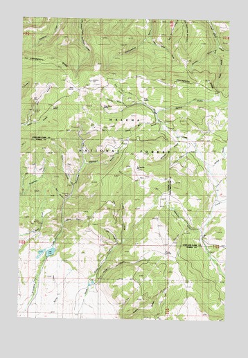
Esmeralda Hill, MT USGS Topographic Map
Click on map above to begin viewing in our Map Viewer.

This topographic map contains these locations and features:
Feature Name Type Latitude Longitude GNIS ID View Map
Betor RanchLocaleN46.7038°W112.3914°800442View Map
Cave GulchValleyN46.7072°W112.4961°800572View Map
Cayuse SpringSpringN46.7127°W112.4820°800574View Map
Charity GulchValleyN46.7141°W112.4381°800579View Map
Christopher Columbus DamDamN46.6516°W112.4892°798445View Map
Clarks CanyonValleyN46.6394°W112.4539°781328View Map
Crazy Horse SpringSpringN46.7130°W112.4521°800646View Map
Dana SpringSpringN46.7205°W112.4681°800671View Map
Deadwood GulchValleyN46.6899°W112.4620°782162View Map
Dry ForkStreamN46.6569°W112.4389°782597View Map
Earthquake MineMineN46.7380°W112.3775°803743View Map
Empire CreekStreamN46.7499°W112.3884°800764View Map
Esmeralda HillSummitN46.6874°W112.4306°783225View Map
Faith GulchValleyN46.7163°W112.4397°800773View Map
Ferris (historical)Populated PlaceN46.6910°W112.3889°1789185View Map
Hope CreekStreamN46.6752°W112.3820°800958View Map
Iron GulchValleyN46.6952°W112.3967°800981View Map
Jerusha GulchValleyN46.7372°W112.3864°800992View Map
Jerusha MillsiteMineN46.7402°W112.3814°803854View Map
Left Hand Fork Cottonwood GulchValleyN46.7433°W112.4236°801048View Map
Lois LakeReservoirN46.6525°W112.4818°793800View Map
McGuire GulchValleyN46.7005°W112.4061°801136View Map
Meyers HillSummitN46.7241°W112.4586°801157View Map
Nelson GulchValleyN46.6897°W112.3842°801215View Map
NW SE Section 19 MineMineN46.6558°W112.4453°805049View Map
Pats GulchValleyN46.6749°W112.4747°788692View Map
Pauly SpringsSpringN46.6535°W112.4125°788711View Map
Polly SpringSpringN46.7169°W112.4272°801308View Map
Right Hand Fork Lost Horse CreekStreamN46.7397°W112.3822°801366View Map
Sawmill GulchValleyN46.6622°W112.3925°801410View Map
Shamrock MineMineN46.6772°W112.4734°805043View Map
Snowshoe DamDamN46.6499°W112.4809°796350View Map
Spring GulchValleyN46.6658°W112.4742°791290View Map
Spring GulchValleyN46.7119°W112.4181°801522View Map
Uncle Ben GulchValleyN46.7074°W112.4189°801635View Map
Ward GulchValleyN46.6808°W112.4700°792815View Map
Wet ForkStreamN46.6563°W112.4417°793146View Map

Note: Coordinates in the location and feature list above are referenced to NAD83 datum.


Copyright (C) 2008-2024 Ryan Niemi / Sunset Dynamics ... All Rights Reserved