TopoQuest Logo
Do you find TopoQuest useful?
Help keep TopoQuest running and adding new maps/features by donating!
Bitcoin:  19c7KJd3qBynnjoSw5npx9KScwjBe4ifkT
Litecoin:  LXs6TkuXGGXo1vDsWCkWVdjQX94eUKd6ui
Home View Maps Find Maps Find Places Resources & Links


Alta Vista Ranch SW, Texas Topographic Map

USGS Map Title: Alta Vista Ranch SW, TX
USGS Map MRC: 27098A6
DRG (GeoTIFF) Download: o27098a6.tif


Neighboring USGS Topographic Map Quads:


  Armstrong Ranch, TX  
27098B7
 

  McCampbell Ranch, TX  
27098B6
 

  Baluarte Ranch, TX  
27098B5
 

  San Pablo Ranch, TX  
27098A7
 

  Alta Vista Ranch SW, TX  
27098A6
 

  Alta Vista Ranch, TX  
27098A5
 

  San Antonio Viejo, TX  
26098H7
 

  Agua Nueva NW, TX  
26098H6
 

  Agua Nueva, TX  
26098H5


Map MRC Location:

N28°
W99°
N28°
W98°
H8 H7 H6 H5 H4 H3 H2 H1
G8 G7 G6 G5 G4 G3 G2 G1
F8 F7 F6 F5 F4 F3 F2 F1
E8 E7 E6 E5 E4 E3 E2 E1
D8 D7 D6 D5 D4 D3 D2 D1
C8 C7 C6 C5 C4 C3 C2 C1
B8 B7 B6 B5 B4 B3 B2 B1
A8 A7 A6 A5 A4 A3 A2 A1
N27°
W99°
N27°
W98°

Alta Vista Ranch SW, TX USGS 1:24K Topographic Map Preview:
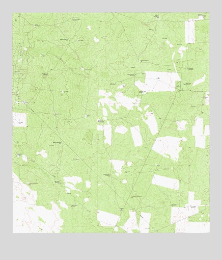
Alta Vista Ranch SW, TX USGS Topographic Map
Click on map above to begin viewing in our Map Viewer.

This topographic map contains these locations and features:
Feature Name Type Latitude Longitude GNIS ID View Map
Barrelosa WindmillLocaleN27.0637°W98.6917°1330079View Map
Berrendo WindmillLocaleN27.0906°W98.7300°1330447View Map
Blanco WindmillLocaleN27.1100°W98.7139°1330837View Map
Cabeza de Toro WindmillLocaleN27.0898°W98.6720°1331808View Map
Coloraditas WindmillLocaleN27.0439°W98.7470°1333139View Map
Colorado WindmillLocaleN27.0973°W98.6681°1333152View Map
El Camino WindmillLocaleN27.0206°W98.6736°1335169View Map
El Nuevo WindmillLocaleN27.0848°W98.6845°1335234View Map
El Toro WindmillLocaleN27.1228°W98.6564°1335285View Map
Frijole WindmillLocaleN27.0934°W98.7045°1336255View Map
Guadalupe WindmillLocaleN27.0281°W98.7400°1337072View Map
Jim Hogg CountyCivilN27.0434°W98.6973°1383909View Map
La Retama WindmillLocaleN27.0159°W98.6492°1339399View Map
Marrina WindmillLocaleN27.0514°W98.7189°1340976View Map
Melargo WindmillLocaleN27.0934°W98.6381°1341348View Map
Palo Blanco WindmillLocaleN27.1214°W98.7075°1343487View Map
Patato WindmillLocaleN27.0675°W98.7228°1343652View Map
Pita WindmillLocaleN27.1178°W98.7353°1344143View Map
San Pedro WindmillLocaleN27.0153°W98.6372°1346461View Map
San Rafael WindmillLocaleN27.0287°W98.7195°1346469View Map
Santa Lucia WindmillLocaleN27.0845°W98.6403°1346653View Map
Santa Rita WindmillLocaleN27.1237°W98.6292°1346668View Map
Tegulero WindmillLocaleN27.0162°W98.7097°1348329View Map
Toedgar WindmillLocaleN27.0664°W98.7028°1348612View Map
Trampa Verde WindmillLocaleN27.0328°W98.6881°1348696View Map
Verrando WindmillLocaleN27.0803°W98.6661°1349250View Map

Note: Coordinates in the location and feature list above are referenced to NAD83 datum.


Copyright (C) 2008-2025 Ryan Niemi / Sunset Dynamics ... All Rights Reserved