TopoQuest Logo
Do you find TopoQuest useful?
Help keep TopoQuest running and adding new maps/features by donating!
Bitcoin:  19c7KJd3qBynnjoSw5npx9KScwjBe4ifkT
Litecoin:  LXs6TkuXGGXo1vDsWCkWVdjQX94eUKd6ui
Home View Maps Find Maps Find Places Resources & Links


Carpenter Mesa SW, New Mexico Topographic Map

USGS Map Title: Carpenter Mesa SW, NM
USGS Map MRC: 35103C8
DRG (GeoTIFF) Download: o35103c8.tif


Neighboring USGS Topographic Map Quads:


  La Cinta Mesa, NM  
35104D1
 

  Carpenter Mesa NW, NM  
35103D8
 

  Medina Mesa, NM  
35103D7
 

  Monument Point, NM  
35104C1
 

  Carpenter Mesa SW, NM  
35103C8
 

  Trinchera Creek, NM  
35103C7
 

  Muniz Canyon, NM  
35104B1
 

  Cow Canyon, NM  
35103B8
 

  Liberty Mesa, NM  
35103B7


Map MRC Location:

N36°
W104°
N36°
W103°
H8 H7 H6 H5 H4 H3 H2 H1
G8 G7 G6 G5 G4 G3 G2 G1
F8 F7 F6 F5 F4 F3 F2 F1
E8 E7 E6 E5 E4 E3 E2 E1
D8 D7 D6 D5 D4 D3 D2 D1
C8 C7 C6 C5 C4 C3 C2 C1
B8 B7 B6 B5 B4 B3 B2 B1
A8 A7 A6 A5 A4 A3 A2 A1
N35°
W104°
N35°
W103°

Carpenter Mesa SW, NM USGS 1:24K Topographic Map Preview:
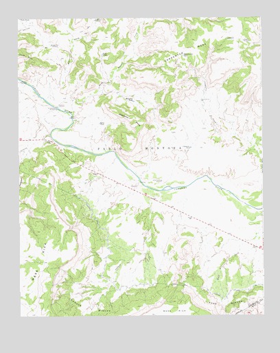
Carpenter Mesa SW, NM USGS Topographic Map
Click on map above to begin viewing in our Map Viewer.

This topographic map contains these locations and features:
Feature Name Type Latitude Longitude GNIS ID View Map
Alamosa CanyonValleyN35.3145°W104.0000°885642View Map
Alamosa CreekStreamN35.3289°W103.9802°885645View Map
Alamosa WindmillLocaleN35.3487°W103.9989°885651View Map
Badger WindmillLocaleN35.3653°W103.8841°885987View Map
Bollschweiler TankReservoirN35.3593°W103.9153°886575View Map
Boxcar WindmillLocaleN35.3334°W103.9736°886686View Map
Carpenter TankReservoirN35.3206°W103.9119°887211View Map
Carpenter WindmillLocaleN35.3067°W103.9300°887213View Map
Carpenter WindmillLocaleN35.3662°W103.8922°887214View Map
Conchas CanalCanalN35.2917°W103.9636°887768View Map
Hells Hole WindmillLocaleN35.3739°W103.9605°889889View Map
Johnson CreekStreamN35.3023°W103.9280°890500View Map
Johnson RinconAreaN35.2537°W103.9650°890517View Map
Little Pete WindmillLocaleN35.3637°W103.9830°891167View Map
Manhead MesaSummitN35.3242°W103.9422°891573View Map
McCavley TankReservoirN35.3402°W103.9411°891726View Map
New WindmillLocaleN35.3401°W103.9064°892522View Map
Quail TankReservoirN35.3309°W103.9585°893577View Map
Road RinconAreaN35.2542°W103.8950°893998View Map
Saint Patrick CreekStreamN35.3351°W103.9727°894287View Map
Sarsaparilla WindmillLocaleN35.3370°W103.9808°894601View Map
Toni TankReservoirN35.3600°W103.9566°895751View Map
Tunnel Number 3TunnelN35.3070°W103.9875°898192View Map
Tunnel Number 4TunnelN35.2626°W103.9177°898193View Map
Watrous CreekStreamN35.3409°W103.9861°896282View Map
Watrous WindmillLocaleN35.3387°W103.9794°896284View Map

Note: Coordinates in the location and feature list above are referenced to NAD83 datum.


Copyright (C) 2008-2025 Ryan Niemi / Sunset Dynamics ... All Rights Reserved