TopoQuest Logo
Do you find TopoQuest useful?
Help keep TopoQuest running and adding new maps/features by donating!
Bitcoin:  19c7KJd3qBynnjoSw5npx9KScwjBe4ifkT
Litecoin:  LXs6TkuXGGXo1vDsWCkWVdjQX94eUKd6ui
Home View Maps Find Maps Find Places Resources & Links


Carpenter Mountain, Oregon Topographic Map

USGS Map Title: Carpenter Mountain, OR
USGS Map MRC: 44122C2
DRG (GeoTIFF) Download: o44122c2.tif


Neighboring USGS Topographic Map Quads:


  Upper Soda, OR  
44122D3
 

  Harter Mountain, OR  
44122D2
 

  Echo Mountain, OR  
44122D1
 

  Tidbits Mountain, OR  
44122C3
 

  Carpenter Mountain, OR  
44122C2
 

  Tamolitch Falls, OR  
44122C1
 

  Blue River, OR  
44122B3
 

  McKenzie Bridge, OR  
44122B2
 

  Belknap Springs, OR  
44122B1


Map MRC Location:

N45°
W123°
N45°
W122°
H8 H7 H6 H5 H4 H3 H2 H1
G8 G7 G6 G5 G4 G3 G2 G1
F8 F7 F6 F5 F4 F3 F2 F1
E8 E7 E6 E5 E4 E3 E2 E1
D8 D7 D6 D5 D4 D3 D2 D1
C8 C7 C6 C5 C4 C3 C2 C1
B8 B7 B6 B5 B4 B3 B2 B1
A8 A7 A6 A5 A4 A3 A2 A1
N44°
W123°
N44°
W122°

Carpenter Mountain, OR USGS 1:24K Topographic Map Preview:
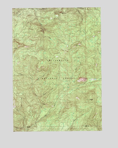
Carpenter Mountain, OR USGS Topographic Map
Click on map above to begin viewing in our Map Viewer.

This topographic map contains these locations and features:
Feature Name Type Latitude Longitude GNIS ID View Map
Burnside CreekStreamN44.3746°W122.1623°1138979View Map
Cadenza CreekStreamN44.3193°W122.1259°1118448View Map
Carpenter MountainSummitN44.2812°W122.1442°1118625View Map
Cook CreekStreamN44.2510°W122.2320°1119217View Map
Flunky CreekStreamN44.2546°W122.2362°1116451View Map
Jumpoff Joe MountainSummitN44.3690°W122.1834°1122559View Map
Latiwi CreekStreamN44.3732°W122.2187°1150234View Map
Latiwi MountainSummitN44.3357°W122.1634°1127500View Map
Mann CreekStreamN44.2948°W122.1715°1123725View Map
North Fork Cook CreekStreamN44.2693°W122.2442°1130769View Map
Quentin CreekStreamN44.2598°W122.2173°1125747View Map
Quentin KnobSummitN44.2776°W122.2040°1162209View Map
Sevenmile CreekStreamN44.3732°W122.2190°1149258View Map
Slipout CreekStreamN44.2846°W122.2178°1130770View Map
Three Creek TrailTrailN44.3543°W122.2398°1151162View Map
Trapper CreekStreamN44.2971°W122.2234°1130771View Map
Wolf CreekStreamN44.2948°W122.1715°1129269View Map
Wolf MeadowFlatN44.3021°W122.1379°1129284View Map
Wolf RockPillarN44.3028°W122.1518°1129286View Map

Note: Coordinates in the location and feature list above are referenced to NAD83 datum.


Copyright (C) 2008-2024 Ryan Niemi / Sunset Dynamics ... All Rights Reserved