TopoQuest Logo
Do you find TopoQuest useful?
Help keep TopoQuest running and adding new maps/features by donating!
Bitcoin:  19c7KJd3qBynnjoSw5npx9KScwjBe4ifkT
Litecoin:  LXs6TkuXGGXo1vDsWCkWVdjQX94eUKd6ui
Home View Maps Find Maps Find Places Resources & Links


Carvers, Nevada Topographic Map

USGS Map Title: Carvers, NV
USGS Map MRC: 38117G2
DRG (GeoTIFF) Download: o38117g2.tif


Neighboring USGS Topographic Map Quads:


  South Toiyabe Peak, NV  
38117H3
 

  Carvers NW, NV  
38117H2
 

  Carvers NE, NV  
38117H1
 

  Arc Dome, NV  
38117G3
 

  Carvers, NV  
38117G2
 

  Carvers SE, NV  
38117G1
 

  Toms Canyon, NV  
38117F3
 

  Pablo Canyon Ranch, NV  
38117F2
 

  Round Mountain, NV  
38117F1


Map MRC Location:

N39°
W118°
N39°
W117°
H8 H7 H6 H5 H4 H3 H2 H1
G8 G7 G6 G5 G4 G3 G2 G1
F8 F7 F6 F5 F4 F3 F2 F1
E8 E7 E6 E5 E4 E3 E2 E1
D8 D7 D6 D5 D4 D3 D2 D1
C8 C7 C6 C5 C4 C3 C2 C1
B8 B7 B6 B5 B4 B3 B2 B1
A8 A7 A6 A5 A4 A3 A2 A1
N38°
W118°
N38°
W117°

Carvers, NV USGS 1:24K Topographic Map Preview:
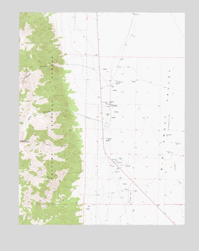
Carvers, NV USGS Topographic Map
Click on map above to begin viewing in our Map Viewer.

This topographic map contains these locations and features:
Feature Name Type Latitude Longitude GNIS ID View Map
Belcher CanyonValleyN38.8427°W117.2170°858856View Map
Bergs RanchLocaleN38.8341°W117.1762°858870View Map
Big Smoky Highway Maintenance StationLocaleN38.7869°W117.1795°846988View Map
Broad CreekStreamN38.7910°W117.1826°859016View Map
CarversPopulated PlaceN38.7866°W117.1793°859166View Map
Carvers Roadside Rest AreaLocaleN38.7830°W117.1754°864187View Map
Cove CanyonValleyN38.8177°W117.2120°859398View Map
Darroughs Hot SpringsPopulated PlaceN38.8202°W117.1806°859453View Map
Darroughs Stage Station (historical)LocaleN38.8266°W117.1829°846287View Map
Devils CanyonValleyN38.7966°W117.2062°859516View Map
Howard RanchLocaleN38.7619°W117.1665°846989View Map
Jefferson CreekStreamN38.7919°W117.1356°860195View Map
M and O Ranch Airport (historical)AirportN38.7680°W117.1629°864121View Map
Niagara CaņonValleyN38.7688°W117.2054°847043View Map
Round Mountain TownshipCivilN38.7974°W117.1490°857640View Map
Smokey Valley Ambulance ServiceBuildingN38.7859°W117.1780°2581358View Map
Smokey Valley Fire DepartmentBuildingN38.7860°W117.1778°2581357View Map
Smoky Valley Forest Service FacilityLocaleN38.7910°W117.1840°864192View Map
Toiyabe Dome Southeast SummitSummitN38.7960°W117.2470°861743View Map
Twin River RanchLocaleN38.8708°W117.1956°846991View Map
Wine Glass Ranch Airport (historical)AirportN38.7958°W117.1687°864122View Map
Wineglass RanchLocaleN38.8005°W117.1845°862082View Map

Note: Coordinates in the location and feature list above are referenced to NAD83 datum.


Copyright (C) 2008-2025 Ryan Niemi / Sunset Dynamics ... All Rights Reserved