TopoQuest Logo
Do you find TopoQuest useful?
Help keep TopoQuest running and adding new maps/features by donating!
Bitcoin:  19c7KJd3qBynnjoSw5npx9KScwjBe4ifkT
Litecoin:  LXs6TkuXGGXo1vDsWCkWVdjQX94eUKd6ui
Home View Maps Find Maps Find Places Resources & Links


Cashmere, Washington Topographic Map

USGS Map Title: Cashmere, WA
USGS Map MRC: 47120E4
DRG (GeoTIFF) Download: o47120e4.tif


Neighboring USGS Topographic Map Quads:


  Van Creek, WA  
47120F5
 

  Chumstick Mountain, WA  
47120F4
 

  Ardenvoir, WA  
47120F3
 

  Peshastin, WA  
47120E5
 

  Cashmere, WA  
47120E4
 

  Rocky Reach Dam, WA  
47120E3
 

  Tiptop, WA  
47120D5
 

  Monitor, WA  
47120D4
 

  Wenatchee, WA  
47120D3


Map MRC Location:

N48°
W121°
N48°
W120°
H8 H7 H6 H5 H4 H3 H2 H1
G8 G7 G6 G5 G4 G3 G2 G1
F8 F7 F6 F5 F4 F3 F2 F1
E8 E7 E6 E5 E4 E3 E2 E1
D8 D7 D6 D5 D4 D3 D2 D1
C8 C7 C6 C5 C4 C3 C2 C1
B8 B7 B6 B5 B4 B3 B2 B1
A8 A7 A6 A5 A4 A3 A2 A1
N47°
W121°
N47°
W120°

Cashmere, WA USGS 1:24K Topographic Map Preview:
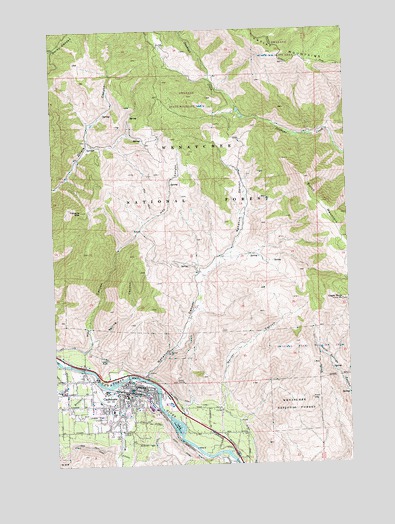
Cashmere, WA USGS Topographic Map
Click on map above to begin viewing in our Map Viewer.

This topographic map contains these locations and features:
Feature Name Type Latitude Longitude GNIS ID View Map
Ardetta ParkParkN47.5221°W120.4701°1530276View Map
Brender CreekStreamN47.5232°W120.4737°1516932View Map
Burch MountainSummitN47.5823°W120.3937°1517106View Map
Cascade HeliportAirportN47.5248°W120.4706°1533701View Map
CashmerePopulated PlaceN47.5223°W120.4698°1517455View Map
Cashmere Avenue ParkParkN47.5207°W120.4609°1530286View Map
Cashmere CemeteryCemeteryN47.5186°W120.4869°1530285View Map
Cashmere Church of ChristChurchN47.5252°W120.4885°2609351View Map
Cashmere Convalescent CenterBuildingN47.5180°W120.4826°2607683View Map
Cashmere High SchoolSchoolN47.5130°W120.4791°1529396View Map
Cashmere LandfillLocaleN47.5246°W120.4681°2605572View Map
Cashmere Middle SchoolSchoolN47.5163°W120.4775°1529397View Map
Cashmere Post OfficePost OfficeN47.5226°W120.4681°2769270View Map
Cashmere Presbyterian ChurchChurchN47.5226°W120.4656°2609352View Map
Cashmere Seventh Day Adventist ChurchChurchN47.5173°W120.4773°2608448View Map
Cashmere Sewage Treatment PlantLocaleN47.5108°W120.4504°2610654View Map
Cashmere United Methodist ChurchChurchN47.5198°W120.4695°2609353View Map
Cashmere-Dryden AirportAirportN47.5148°W120.4841°1533700View Map
Chelan County Exposition CenterLocaleN47.5222°W120.4984°2608340View Map
City of CashmereCivilN47.5175°W120.4667°2409405View Map
Eagle RockSummitN47.5468°W120.3787°1519061View Map
Evergreen Baptist ChurchChurchN47.5238°W120.4858°2608455View Map
Faith Church of GodChurchN47.5167°W120.4863°2609354View Map
Goodwin Road BridgeBridgeN47.5275°W120.4894°2607977View Map
Grace Lutheran ChurchChurchN47.5221°W120.4627°2609355View Map
Hay CanyonValleyN47.5332°W120.4870°1520617View Map
Hay Canyon Mobile Home ParkPopulated PlaceN47.5289°W120.4872°2607151View Map
Icicle CanalCanalN47.5054°W120.4884°1521123View Map
John Simpson Memorial ParkParkN47.5168°W120.4762°1530148View Map
Life Trac Family MinistriesChurchN47.5211°W120.4674°2608969View Map
Middle SchoolSchoolN47.5198°W120.4709°1523105View Map
Mission CreekStreamN47.5215°W120.4759°1523271View Map
Nahahum CanyonValleyN47.5248°W120.4637°1523559View Map
Natatoruim ParkParkN47.5212°W120.4734°1530201View Map
Saint Francis Xavier Catholic ChurchChurchN47.5190°W120.4703°2609356View Map
Selfs Trailer ParkPopulated PlaceN47.5084°W120.4294°2607153View Map
Spring CanyonValleyN47.5354°W120.4851°1526402View Map
Tibbetts MountainSummitN47.5729°W120.4887°1527197View Map
Town's Mobile Home ParkPopulated PlaceN47.5205°W120.4742°2607154View Map
United Methodist Foundation of the NorthwestChurchN47.5211°W120.4675°2609165View Map
Vale Elementary SchoolSchoolN47.5180°W120.4714°1533489View Map
Warner CanyonValleyN47.5171°W120.4304°1527812View Map
West Monitor BridgeBridgeN47.5010°W120.4255°2608010View Map
Willis Carey Historical MuseumBuildingN47.5204°W120.4567°1530447View Map

Note: Coordinates in the location and feature list above are referenced to NAD83 datum.


Copyright (C) 2008-2025 Ryan Niemi / Sunset Dynamics ... All Rights Reserved