TopoQuest Logo
Do you find TopoQuest useful?
Help keep TopoQuest running and adding new maps/features by donating!
Bitcoin:  19c7KJd3qBynnjoSw5npx9KScwjBe4ifkT
Litecoin:  LXs6TkuXGGXo1vDsWCkWVdjQX94eUKd6ui
Home View Maps Find Maps Find Places Resources & Links


Hilgard, Oregon Topographic Map

USGS Map Title: Hilgard, OR
USGS Map MRC: 45118C2
DRG (GeoTIFF) Download: o45118c2.tif


Neighboring USGS Topographic Map Quads:


  Huron, OR  
45118D3
 

  Drumhill Ridge, OR  
45118D2
 

  Summerville, OR  
45118D1
 

  Kamela SE, OR  
45118C3
 

  Hilgard, OR  
45118C2
 

  La Grande, OR  
45118C1
 

  Little Beaver Creek, OR  
45118B3
 

  La Grande Reservoir, OR  
45118B2
 

  Glass Hill, OR  
45118B1


Map MRC Location:

N46°
W119°
N46°
W118°
H8 H7 H6 H5 H4 H3 H2 H1
G8 G7 G6 G5 G4 G3 G2 G1
F8 F7 F6 F5 F4 F3 F2 F1
E8 E7 E6 E5 E4 E3 E2 E1
D8 D7 D6 D5 D4 D3 D2 D1
C8 C7 C6 C5 C4 C3 C2 C1
B8 B7 B6 B5 B4 B3 B2 B1
A8 A7 A6 A5 A4 A3 A2 A1
N45°
W119°
N45°
W118°

Hilgard, OR USGS 1:24K Topographic Map Preview:
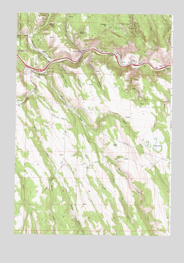
Hilgard, OR USGS Topographic Map
Click on map above to begin viewing in our Map Viewer.

This topographic map contains these locations and features:
Feature Name Type Latitude Longitude GNIS ID View Map
Bear CanyonValleyN45.3471°W118.1444°1137641View Map
Beartrap SpringSpringN45.3644°W118.1997°1117404View Map
Blacksmith CanyonValleyN45.3687°W118.2263°1117792View Map
Cottonwood SpringSpringN45.3533°W118.1982°1119355View Map
Coyote CanyonValleyN45.3471°W118.2186°1119451View Map
Five Points CreekStreamN45.3465°W118.2219°1142196View Map
Graves CreekStreamN45.3201°W118.2049°1121340View Map
Hamilton CanyonValleyN45.3524°W118.1952°1143242View Map
HilgardPopulated PlaceN45.3521°W118.2280°1136378View Map
Hilgard CemeteryCemeteryN45.3591°W118.2345°1121829View Map
Hilgard Junction State ParkParkN45.3401°W118.2399°1162323View Map
Hilgard Post Office (historical)Post OfficeN45.3521°W118.2280°1165395View Map
Hunter LakeLakeN45.3008°W118.1721°1122152View Map
Little Coyote CanyonValleyN45.3457°W118.2163°1123164View Map
Little Graves CreekStreamN45.3004°W118.1966°1123200View Map
Little Rock CreekStreamN45.2940°W118.1791°1123267View Map
Little Whiskey CreekStreamN45.2871°W118.2172°1123310View Map
Mahogany MountainSummitN45.3685°W118.1769°1123683View Map
Morgan LakeLakeN45.3009°W118.1359°1124355View Map
Morgan Lake Campground Boat RampLocaleN45.3018°W118.1386°2700350View Map
Morgan Lake DamDamN45.3050°W118.1366°1133615View Map
Morgan Lake ParkParkN45.2972°W118.1342°2091213View Map
Mouse SpringSpringN45.3730°W118.2084°1167280View Map
Oregon Youth Authority - RiverBend FacilityBuildingN45.3375°W118.2418°2722739View Map
Oregon Youth Authority Riverbend Sewer Treatment PlantLocaleN45.3386°W118.2394°2697186View Map
Peach CanyonValleyN45.3537°W118.1902°1125253View Map
Pelican CreekStreamN45.3607°W118.2399°1147570View Map
PerryPopulated PlaceN45.3485°W118.1666°1136624View Map
Perry Post Office (historical)Post OfficeN45.3485°W118.1666°1165779View Map
Perry School (historical)SchoolN45.3483°W118.1547°1125310View Map
Robbs CreekStreamN45.3471°W118.1538°1152829View Map
Rock CreekStreamN45.3418°W118.2261°1126163View Map
Sheep CreekStreamN45.3112°W118.1947°1164134View Map
Strober RanchLocaleN45.3674°W118.1272°1167281View Map
Twin LakeLakeN45.3015°W118.1435°1128345View Map
Whiskey CreekStreamN45.3235°W118.2463°1128941View Map
Wilson CanyonValleyN45.3446°W118.1527°1129184View Map

Note: Coordinates in the location and feature list above are referenced to NAD83 datum.


Copyright (C) 2008-2024 Ryan Niemi / Sunset Dynamics ... All Rights Reserved