TopoQuest Logo
Do you find TopoQuest useful?
Help keep TopoQuest running and adding new maps/features by donating!
Bitcoin:  19c7KJd3qBynnjoSw5npx9KScwjBe4ifkT
Litecoin:  LXs6TkuXGGXo1vDsWCkWVdjQX94eUKd6ui
Home View Maps Find Maps Find Places Resources & Links


Katahdin Lake, Maine Topographic Map

USGS Map Title: Katahdin Lake, ME
USGS Map MRC: 45068H7
DRG (GeoTIFF) Download: o45068h7.tif


Neighboring USGS Topographic Map Quads:


  Wassataquoik Lake, ME  
46068A8
 

  The Traveler, ME  
46068A7
 

  Bowlin Brook, ME  
46068A6
 

  Mount Katahdin, ME  
45068H8
 

  Katahdin Lake, ME  
45068H7
 

  Deasey Mountain, ME  
45068H6
 

  Abol Pond, ME  
45068G8
 

  Trout Mountain, ME  
45068G7
 

  Whetstone Mountain, ME  
45068G6


Map MRC Location:

N46°
W69°
N46°
W68°
H8 H7 H6 H5 H4 H3 H2 H1
G8 G7 G6 G5 G4 G3 G2 G1
F8 F7 F6 F5 F4 F3 F2 F1
E8 E7 E6 E5 E4 E3 E2 E1
D8 D7 D6 D5 D4 D3 D2 D1
C8 C7 C6 C5 C4 C3 C2 C1
B8 B7 B6 B5 B4 B3 B2 B1
A8 A7 A6 A5 A4 A3 A2 A1
N45°
W69°
N45°
W68°

Katahdin Lake, ME USGS 1:24K Topographic Map Preview:
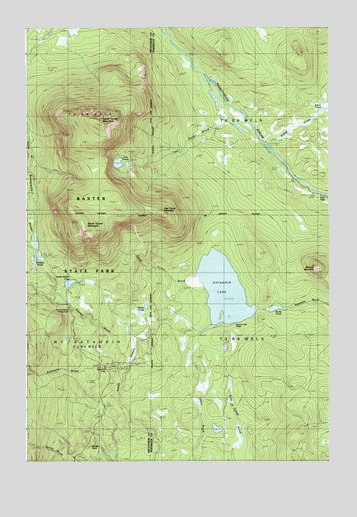
Katahdin Lake, ME USGS Topographic Map
Click on map above to begin viewing in our Map Viewer.

This topographic map contains these locations and features:
Feature Name Type Latitude Longitude GNIS ID View Map
Avalanche BrookStreamN45.8989°W68.8359°561366View Map
Barnard MountainSummitN45.9312°W68.7548°561619View Map
East Turner MountainSummitN45.9463°W68.8182°565695View Map
Katahdin LakeLakeN45.9244°W68.7933°569046View Map
Katahdin Lake CampsLocaleN45.9145°W68.7903°569047View Map
Martin PondsLakeN45.9175°W68.8275°570855View Map
North Turner MountainSummitN45.9726°W68.8438°572416View Map
Roaring BrookStreamN45.9045°W68.8339°574277View Map
Roaring Brook CampgroundLocaleN45.9195°W68.8584°574278View Map
Robar BrookStreamN45.9675°W68.7770°574283View Map
Rober PondLakeN45.9766°W68.7519°574295View Map
Rocky PondLakeN45.9190°W68.7719°574410View Map
Sand Bank TrailTrailN45.9084°W68.7614°574819View Map
Sandy Stream PondLakeN45.9263°W68.8571°574899View Map
South Turner BrookStreamN45.9284°W68.8050°575914View Map
South Turner MountainSummitN45.9412°W68.8505°575915View Map
T3 R8 WELSCivilN45.9065°W68.7583°1987311View Map
T4 R8 WELSCivilN45.9959°W68.7580°1987314View Map
Twin Pond BrookStreamN45.9664°W68.7775°577486View Map
Twin PondsLakeN45.9610°W68.8369°577488View Map
Whidden PondsLakeN45.9335°W68.8691°578324View Map
Windey PitchCliffN45.8789°W68.8495°578563View Map

Note: Coordinates in the location and feature list above are referenced to NAD83 datum.


Copyright (C) 2008-2025 Ryan Niemi / Sunset Dynamics ... All Rights Reserved