TopoQuest Logo
Do you find TopoQuest useful?
Help keep TopoQuest running and adding new maps/features by donating!
Bitcoin:  19c7KJd3qBynnjoSw5npx9KScwjBe4ifkT
Litecoin:  LXs6TkuXGGXo1vDsWCkWVdjQX94eUKd6ui
Home View Maps Find Maps Find Places Resources & Links


Rodanthe, North Carolina Topographic Map

USGS Map Title: Rodanthe, NC
USGS Map MRC: 35075E4
DRG (GeoTIFF) Download: o35075e4.tif


Neighboring USGS Topographic Map Quads:


  Rodanthe, NC  
35075E4


Map MRC Location:

N36°
W76°
N36°
W75°
H8 H7 H6 H5 H4 H3 H2 H1
G8 G7 G6 G5 G4 G3 G2 G1
F8 F7 F6 F5 F4 F3 F2 F1
E8 E7 E6 E5 E4 E3 E2 E1
D8 D7 D6 D5 D4 D3 D2 D1
C8 C7 C6 C5 C4 C3 C2 C1
B8 B7 B6 B5 B4 B3 B2 B1
A8 A7 A6 A5 A4 A3 A2 A1
N35°
W76°
N35°
W75°

Rodanthe, NC USGS 1:24K Topographic Map Preview:
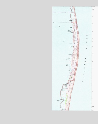
Rodanthe, NC USGS Topographic Map
Click on map above to begin viewing in our Map Viewer.

This topographic map contains these locations and features:
Feature Name Type Latitude Longitude GNIS ID View Map
Aunt Phoebes MarshSwampN35.5692°W75.4693°980369View Map
Blackmar GutGutN35.5952°W75.4713°981555View Map
Chicamacomico Banks Volunteer Fire Department Station 50BuildingN35.5840°W75.4662°2639629View Map
Chicamacomico Channel (historical)ChannelN35.5991°W75.4996°1008008View Map
Chickinacommock (historical)GutN35.6168°W75.4663°1018650View Map
Clarks BayBayN35.5310°W75.4779°983228View Map
Dare County Emergency Medical Services Station 6BuildingN35.5839°W75.4659°2720615View Map
Davids PointCapeN35.5616°W75.4738°983974View Map
Great IslandIslandN35.5618°W75.4763°986025View Map
Green PointCapeN35.5966°W75.4724°986078View Map
Greens PointCapeN35.6063°W75.4646°1002377View Map
Midgett CoveBayN35.5485°W75.4727°989811View Map
Midgett IslandIslandN35.5546°W75.4760°989812View Map
National Park Service HeadquartersParkN35.5893°W75.4527°1002379View Map
No AcheSwampN35.5241°W75.4821°991158View Map
No Ache BayBayN35.5124°W75.4840°991159View Map
No Ache IslandIslandN35.5116°W75.4874°991160View Map
North DrainStreamN35.5802°W75.4690°991216View Map
Outer BanksIslandN35.5668°W75.4685°1985747View Map
Pauls DitchStreamN35.6077°W75.4715°991950View Map
RodanthePopulated PlaceN35.5935°W75.4679°1022381View Map
Rodanthe Census Designated PlaceCensusN35.5903°W75.4655°2628652View Map
Rodanthe Post OfficePost OfficeN35.5623°W75.4684°2774277View Map
Round Hammock BayBayN35.6213°W75.4718°993740View Map
SalvoPopulated PlaceN35.5402°W75.4729°1022471View Map
Salvo Census Designated PlaceCensusN35.5488°W75.4690°2628655View Map
Salvo Fire Department Station 48BuildingN35.5455°W75.4700°2638145View Map
South RodanthePopulated PlaceN35.5871°W75.4685°1002378View Map
SteeplePopulated PlaceN35.5738°W75.4538°1005159View Map
Township of KinnakeetCivilN35.5400°W75.4920°1026613View Map
Uncle Jimmys LandingPopulated PlaceN35.5996°W75.4699°1023033View Map
WavesPopulated PlaceN35.5668°W75.4685°1023135View Map
Waves Census Designated PlaceCensusN35.5677°W75.4666°2630784View Map
Waves LandingPopulated PlaceN35.5668°W75.4707°1023136View Map
Wimble ShoalsBarN35.5460°W75.4788°1018652View Map

Note: Coordinates in the location and feature list above are referenced to NAD83 datum.


Copyright (C) 2008-2025 Ryan Niemi / Sunset Dynamics ... All Rights Reserved