TopoQuest Logo
Do you find TopoQuest useful?
Help keep TopoQuest running and adding new maps/features by donating!
Bitcoin:  19c7KJd3qBynnjoSw5npx9KScwjBe4ifkT
Litecoin:  LXs6TkuXGGXo1vDsWCkWVdjQX94eUKd6ui
Home View Maps Find Maps Find Places Resources & Links


Slate Lake East, Minnesota Topographic Map

USGS Map Title: Slate Lake East, MN
USGS Map MRC: 47091F5
DRG (GeoTIFF) Download: o47091f5.tif


Neighboring USGS Topographic Map Quads:


  Bogberry Lake, MN  
47091G6
 

  Gabbro Lake, MN  
47091G5
 

  Quadga Lake, MN  
47091G4
 

  Slate Lake West, MN  
47091F6
 

  Slate Lake East, MN  
47091F5
 

  Mitawan Lake, MN  
47091F4
 

  Greenwood Lake West, MN  
47091E6
 

  Greenwood Lake East, MN  
47091E5
 

  Isabella Station, MN  
47091E4


Map MRC Location:

N48°
W92°
N48°
W91°
H8 H7 H6 H5 H4 H3 H2 H1
G8 G7 G6 G5 G4 G3 G2 G1
F8 F7 F6 F5 F4 F3 F2 F1
E8 E7 E6 E5 E4 E3 E2 E1
D8 D7 D6 D5 D4 D3 D2 D1
C8 C7 C6 C5 C4 C3 C2 C1
B8 B7 B6 B5 B4 B3 B2 B1
A8 A7 A6 A5 A4 A3 A2 A1
N47°
W92°
N47°
W91°

Slate Lake East, MN USGS 1:24K Topographic Map Preview:
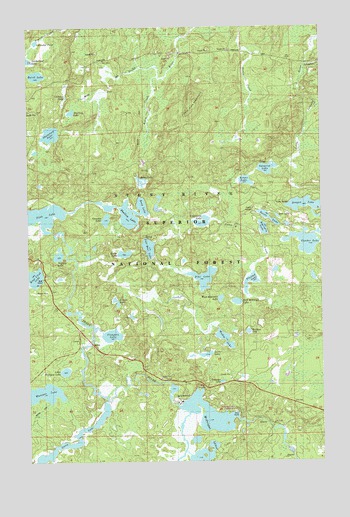
Slate Lake East, MN USGS Topographic Map
Click on map above to begin viewing in our Map Viewer.

This topographic map contains these locations and features:
Feature Name Type Latitude Longitude GNIS ID View Map
Alsike LakeLakeN47.6848°W91.5840°655113View Map
Baird LakeLakeN47.7362°W91.6208°655191View Map
Bandana LakeLakeN47.6622°W91.5315°655221View Map
Bearskin LakeLakeN47.6920°W91.5249°655290View Map
Beetle LakeLakeN47.6951°W91.5228°655320View Map
Camp BuckskinLocaleN47.6394°W91.5607°659149View Map
Camp East CreekStreamN47.6944°W91.5474°655609View Map
Campers LakeLakeN47.6612°W91.5897°655619View Map
Chipmunk LakeLakeN47.6939°W91.5509°655712View Map
Climber LakeLakeN47.7311°W91.6089°655759View Map
Deep LakeLakeN47.6983°W91.5763°659740View Map
Dragon LakeLakeN47.6983°W91.5066°656039View Map
East Chub LakeLakeN47.6782°W91.6221°656090View Map
East Moccasin LakeLakeN47.6708°W91.5364°657441View Map
Eikala LakeLakeN47.6703°W91.5870°659152View Map
Gander LakeLakeN47.6881°W91.5067°656354View Map
Grass LakeLakeN47.7056°W91.5320°659150View Map
Gunsten LakeLakeN47.6945°W91.5917°656488View Map
Hide LakeLakeN47.6955°W91.5186°659151View Map
Highlife LakeLakeN47.6841°W91.6121°656585View Map
Jack Pine MountainSummitN47.7307°W91.5551°656754View Map
Labrador PondLakeN47.7456°W91.6211°656926View Map
Leatherleaf LakeLakeN47.7405°W91.6243°656973View Map
Little Wampus LakeLakeN47.6510°W91.6097°657148View Map
Luster LakeLakeN47.6559°W91.5493°657264View Map
McDougal LakeReservoirN47.6399°W91.5618°1776037View Map
McDougal Lake DamDamN47.6399°W91.5618°1776036View Map
McDougal LakesLakeN47.6274°W91.5504°657358View Map
McDougal Lakes CampgroundLocaleN47.6391°W91.5351°659146View Map
Pike LakeLakeN47.6777°W91.5504°657827View Map
Planted LakeLakeN47.6766°W91.5304°657868View Map
Robin CreekStreamN47.7357°W91.5690°658067View Map
Robin LakeLakeN47.7057°W91.5763°658068View Map
Sand RiverStreamN47.6630°W91.5974°658157View Map
Shallow LakeLakeN47.6963°W91.5842°658559View Map
Shamrock LakeLakeN47.7194°W91.6151°658231View Map
Slate LakeLakeN47.6937°W91.6242°658300View Map
Sphagnum CreekStreamN47.7394°W91.5054°658386View Map
Starling LakeLakeN47.7256°W91.6061°658455View Map
Surprise LakeLakeN47.7092°W91.5230°659153View Map
Teamster LakeLakeN47.6478°W91.5430°658622View Map
Township of Stony RiverCivilN47.6888°W91.5076°665720View Map
Two Deer LakeLakeN47.6865°W91.5737°658798View Map
Wadop LakeLakeN47.6601°W91.5417°658872View Map
Wampus LakeLakeN47.6447°W91.6187°658890View Map
West Moccasin LakeLakeN47.6718°W91.5432°659148View Map

Note: Coordinates in the location and feature list above are referenced to NAD83 datum.


Copyright (C) 2008-2025 Ryan Niemi / Sunset Dynamics ... All Rights Reserved