TopoQuest Logo
Do you find TopoQuest useful?
Help keep TopoQuest running and adding new maps/features by donating!
Bitcoin:  19c7KJd3qBynnjoSw5npx9KScwjBe4ifkT
Litecoin:  LXs6TkuXGGXo1vDsWCkWVdjQX94eUKd6ui
Home View Maps Find Maps Find Places Resources & Links


Cedar, Minnesota Topographic Map

USGS Map Title: Cedar, MN
USGS Map MRC: 45093C3
DRG (GeoTIFF) Download: o45093c3.tif


Neighboring USGS Topographic Map Quads:


  Crown, MN  
45093D4
 

  Saint Francis, MN  
45093D3
 

  Isanti, MN  
45093D2
 

  Nowthen, MN  
45093C4
 

  Cedar, MN  
45093C3
 

  Coon Lake Beach, MN  
45093C2
 

  Anoka, MN  
45093B4
 

  Coon Rapids, MN  
45093B3
 

  Circle Pines, MN  
45093B2


Map MRC Location:

N46°
W94°
N46°
W93°
H8 H7 H6 H5 H4 H3 H2 H1
G8 G7 G6 G5 G4 G3 G2 G1
F8 F7 F6 F5 F4 F3 F2 F1
E8 E7 E6 E5 E4 E3 E2 E1
D8 D7 D6 D5 D4 D3 D2 D1
C8 C7 C6 C5 C4 C3 C2 C1
B8 B7 B6 B5 B4 B3 B2 B1
A8 A7 A6 A5 A4 A3 A2 A1
N45°
W94°
N45°
W93°

Cedar, MN USGS 1:24K Topographic Map Preview:
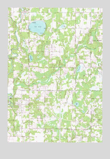
Cedar, MN USGS Topographic Map
Click on map above to begin viewing in our Map Viewer.

This topographic map contains these locations and features:
Feature Name Type Latitude Longitude GNIS ID View Map
Allina Health Emergency Medical ServiceBuildingN45.3208°W93.2865°2721222View Map
Andover Fire Department Station 2BuildingN45.2719°W93.3647°2666156View Map
Andover Fire Department Station 3BuildingN45.2592°W93.2848°2666205View Map
CedarPopulated PlaceN45.3197°W93.2861°640984View Map
Cedar CemeteryCemeteryN45.3027°W93.2863°640990View Map
Cedar CreekStreamN45.2919°W93.3688°655677View Map
City of AndoverCivilN45.2571°W93.3265°2393954View Map
City of Oak GroveCivilN45.3409°W93.3265°2395282View Map
Clark School (historical)SchoolN45.2981°W93.3264°2703233View Map
ConstancePopulated PlaceN45.2552°W93.2855°641447View Map
Constance Evangelical Free Church CemeteryCemeteryN45.2626°W93.2867°2094147View Map
Constance Post Office (historical)Post OfficeN45.2553°W93.2853°2094161View Map
County Ditch Number FortyeightCanalN45.3083°W93.3061°642133View Map
County Ditch Number FortyeightCanalN45.3127°W93.2836°642134View Map
County Ditch Number NineteenCanalN45.3408°W93.3536°641761View Map
County Ditch Number NineteenCanalN45.3505°W93.3194°641766View Map
County Ditch Number SeventyoneCanalN45.2966°W93.2822°642292View Map
County Ditch Number SixCanalN45.2691°W93.3377°642216View Map
County Ditch Number ThirtysevenCanalN45.2547°W93.3019°642013View Map
County Ditch Number TwentynineCanalN45.2644°W93.2680°641913View Map
Crooked BrookStreamN45.3364°W93.2616°655876View Map
Gillespie BridgeBridgeN45.3275°W93.3725°644144View Map
Grass LakeLakeN45.3577°W93.3036°644371View Map
Hickey LakeLakeN45.3283°W93.3449°644929View Map
Immaculate Heart of Mary AcademySchoolN45.3705°W93.2850°2479719View Map
Lake GeorgeLakeN45.3568°W93.3358°644081View Map
Lake George County ParkParkN45.3616°W93.3447°646356View Map
Lifelong Learning CenterSchoolN45.3146°W93.2872°2433278View Map
Mahoney BrookStreamN45.3105°W93.3194°647389View Map
Oak GrovePopulated PlaceN45.3408°W93.3269°1669536View Map
Oak Grove Fire Department Station 1BuildingN45.3315°W93.3178°2666452View Map
Oak Grove Town HallBuildingN45.3314°W93.3177°2478021View Map
Oak View Middle SchoolSchoolN45.2508°W93.3088°2433178View Map
Oakgrove Post Office (historical)Post OfficeN45.3408°W93.3267°2094169View Map
Pierce CemeteryCemeteryN45.3644°W93.3174°649390View Map
Rum River Elementary SchoolSchoolN45.2782°W93.3284°2479254View Map
Saint Patricks ChurchChurchN45.2980°W93.3566°650947View Map
School Number 10 (historical)SchoolN45.2978°W93.3467°2703232View Map
School Number 33 (historical)SchoolN45.2667°W93.3469°2703234View Map
Seelye BrookStreamN45.3597°W93.3644°651842View Map
Swan LakeLakeN45.3184°W93.2814°652890View Map
Township of Grow (historical)CivilN45.2511°W93.3264°2628224View Map
Township of Oak Grove (historical)CivilN45.3447°W93.3266°665187View Map
Ward LakeLakeN45.2855°W93.2839°653775View Map
West Oak Grove CemeteryCemeteryN45.3452°W93.3722°653994View Map

Note: Coordinates in the location and feature list above are referenced to NAD83 datum.


Copyright (C) 2008-2025 Ryan Niemi / Sunset Dynamics ... All Rights Reserved