TopoQuest Logo
Do you find TopoQuest useful?
Help keep TopoQuest running and adding new maps/features by donating!
Bitcoin:  19c7KJd3qBynnjoSw5npx9KScwjBe4ifkT
Litecoin:  LXs6TkuXGGXo1vDsWCkWVdjQX94eUKd6ui
Home View Maps Find Maps Find Places Resources & Links


Cedar Camp Canyon, Utah Topographic Map

USGS Map Title: Cedar Camp Canyon, UT
USGS Map MRC: 39109D4
DRG (GeoTIFF) Download: o39109d4.tif


Neighboring USGS Topographic Map Quads:


  Wolf Point, UT  
39109E5
 

  Pine Spring Canyon, UT  
39109E4
 

  Seep Canyon, UT  
39109E3
 

  Tenmile Canyon North, UT  
39109D5
 

  Cedar Camp Canyon, UT  
39109D4
 

  P R Spring, UT  
39109D3
 

  Tenmile Canyon South, UT  
39109C5
 

  Preacher Canyon, UT  
39109C4
 

  Dry Canyon, UT  
39109C3


Map MRC Location:

N40°
W110°
N40°
W109°
H8 H7 H6 H5 H4 H3 H2 H1
G8 G7 G6 G5 G4 G3 G2 G1
F8 F7 F6 F5 F4 F3 F2 F1
E8 E7 E6 E5 E4 E3 E2 E1
D8 D7 D6 D5 D4 D3 D2 D1
C8 C7 C6 C5 C4 C3 C2 C1
B8 B7 B6 B5 B4 B3 B2 B1
A8 A7 A6 A5 A4 A3 A2 A1
N39°
W110°
N39°
W109°

Cedar Camp Canyon, UT USGS 1:24K Topographic Map Preview:
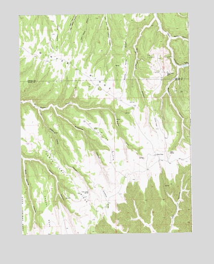
Cedar Camp Canyon, UT USGS Topographic Map
Click on map above to begin viewing in our Map Viewer.

This topographic map contains these locations and features:
Feature Name Type Latitude Longitude GNIS ID View Map
Cedar Camp CanyonValleyN39.4464°W109.4862°1426434View Map
Cedar Camp RidgeRidgeN39.4089°W109.4671°1426435View Map
Cedar Camp SpringSpringN39.3987°W109.4508°1426436View Map
Cherry CanyonValleyN39.4186°W109.4973°1426554View Map
Cherry MesaSummitN39.3902°W109.4815°1426564View Map
Fence Canyon Gas FieldOilfieldN39.4708°W109.3973°1427902View Map
Little Asphalt RidgeRidgeN39.4944°W109.4704°1429668View Map
Meadow CanyonValleyN39.4858°W109.3882°1430201View Map
Pretty Valley RidgeRidgeN39.4730°W109.4201°1431464View Map
Shale SpringSpringN39.4206°W109.3910°1432356View Map
Snowshoe CanyonValleyN39.4477°W109.4754°1432602View Map
Snowshoe RidgeRidgeN39.3947°W109.4371°1432603View Map
Three PinesPopulated PlaceN39.4194°W109.4004°1437703View Map
Whetrock CanyonValleyN39.4686°W109.3837°1434145View Map
Willow FlatsFlatN39.4250°W109.4332°1434327View Map
Wire Fence CanyonValleyN39.4972°W109.3998°1434417View Map
Wire Fence PointSummitN39.4650°W109.3926°1434418View Map

Note: Coordinates in the location and feature list above are referenced to NAD83 datum.


Copyright (C) 2008-2025 Ryan Niemi / Sunset Dynamics ... All Rights Reserved