TopoQuest Logo
Do you find TopoQuest useful?
Help keep TopoQuest running and adding new maps/features by donating!
Bitcoin:  19c7KJd3qBynnjoSw5npx9KScwjBe4ifkT
Litecoin:  LXs6TkuXGGXo1vDsWCkWVdjQX94eUKd6ui
Home View Maps Find Maps Find Places Resources & Links


Cedar Mountain, Oregon Topographic Map

USGS Map Title: Cedar Mountain, OR
USGS Map MRC: 43117C6
DRG (GeoTIFF) Download: o43117c6.tif


Neighboring USGS Topographic Map Quads:


  Skull Spring, OR  
43117D7
 

  Copeland Reservoirs, OR  
43117D6
 

  Wall Rock Springs, OR  
43117D5
 

  Burnt Flat, OR  
43117C7
 

  Cedar Mountain, OR  
43117C6
 

  Big Mud Flat, OR  
43117C5
 

  Sacramento Butte, OR  
43117B7
 

  Rinehart Canyon, OR  
43117B6
 

  The Hole in the Ground, OR  
43117B5


Map MRC Location:

N44°
W118°
N44°
W117°
H8 H7 H6 H5 H4 H3 H2 H1
G8 G7 G6 G5 G4 G3 G2 G1
F8 F7 F6 F5 F4 F3 F2 F1
E8 E7 E6 E5 E4 E3 E2 E1
D8 D7 D6 D5 D4 D3 D2 D1
C8 C7 C6 C5 C4 C3 C2 C1
B8 B7 B6 B5 B4 B3 B2 B1
A8 A7 A6 A5 A4 A3 A2 A1
N43°
W118°
N43°
W117°

Cedar Mountain, OR USGS 1:24K Topographic Map Preview:
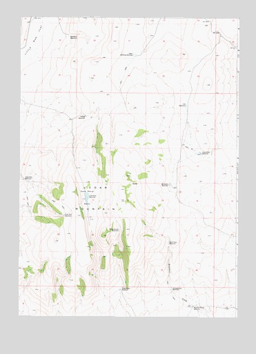
Cedar Mountain, OR USGS Topographic Map
Click on map above to begin viewing in our Map Viewer.

This topographic map contains these locations and features:
Feature Name Type Latitude Longitude GNIS ID View Map
Burnt Stump ReservoirReservoirN43.2862°W117.6930°1118364View Map
Campground ReservoirReservoirN43.2619°W117.6624°1119188View Map
Cedar Mount ReservoirReservoirN43.3073°W117.7477°1118760View Map
Cedar MountainSummitN43.2999°W117.7093°1159061View Map
Cook Stove BasinBasinN43.2960°W117.7102°1119223View Map
Cook Stove ReservoirReservoirN43.3000°W117.7115°1119224View Map
Hard Time ReservoirReservoirN43.2811°W117.6644°1121589View Map
Horsetail ReservoirReservoirN43.3052°W117.6644°1122048View Map
Little Mud FlatFlatN43.3663°W117.7393°1123234View Map
Lone Tree ReservoirReservoirN43.2925°W117.7241°1123395View Map
Long Walk ReservoirReservoirN43.3185°W117.6465°1123454View Map
Red Head ReservoirReservoirN43.3670°W117.7220°1125883View Map
Rinehart Creek ReservoirReservoirN43.2548°W117.6503°1126040View Map
S E ReservoirReservoirN43.3382°W117.6550°1126397View Map
Upper McNulty ReservoirReservoirN43.3593°W117.6849°1128461View Map
Wilsey ReservoirReservoirN43.3337°W117.7125°1129181View Map
Wood Road ReservoirReservoirN43.2615°W117.6915°1129300View Map

Note: Coordinates in the location and feature list above are referenced to NAD83 datum.


Copyright (C) 2008-2025 Ryan Niemi / Sunset Dynamics ... All Rights Reserved