TopoQuest Logo
Do you find TopoQuest useful?
Help keep TopoQuest running and adding new maps/features by donating!
Bitcoin:  19c7KJd3qBynnjoSw5npx9KScwjBe4ifkT
Litecoin:  LXs6TkuXGGXo1vDsWCkWVdjQX94eUKd6ui
Home View Maps Find Maps Find Places Resources & Links


Chadron East, Nebraska Topographic Map

USGS Map Title: Chadron East, NE
USGS Map MRC: 42102G8
DRG (GeoTIFF) Download: o42102g8.tif


Neighboring USGS Topographic Map Quads:


  Bohemian Creek, NE  
42103H1
 

  Isinglass Buttes, NE  
42102H8
 

  Chadron NE, NE  
42102H7
 

  Chadron West, NE  
42103G1
 

  Chadron East, NE  
42102G8
 

  Bordeaux, NE  
42102G7
 

  Coffee Mill Butte, NE  
42103F1
 

  Kings Canyon, NE  
42102F8
 

  Hay Springs Creek, NE  
42102F7


Map MRC Location:

N43°
W103°
N43°
W102°
H8 H7 H6 H5 H4 H3 H2 H1
G8 G7 G6 G5 G4 G3 G2 G1
F8 F7 F6 F5 F4 F3 F2 F1
E8 E7 E6 E5 E4 E3 E2 E1
D8 D7 D6 D5 D4 D3 D2 D1
C8 C7 C6 C5 C4 C3 C2 C1
B8 B7 B6 B5 B4 B3 B2 B1
A8 A7 A6 A5 A4 A3 A2 A1
N42°
W103°
N42°
W102°

Chadron East, NE USGS 1:24K Topographic Map Preview:
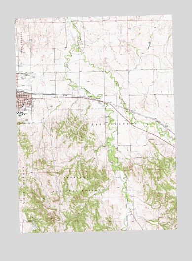
Chadron East, NE USGS Topographic Map
Click on map above to begin viewing in our Map Viewer.

This topographic map contains these locations and features:
Feature Name Type Latitude Longitude GNIS ID View Map
Alpha SchoolSchoolN42.8275°W102.9371°835487View Map
Andrews HallBuildingN42.8200°W102.9969°1828162View Map
Armstrong GymBuildingN42.8183°W102.9988°1828159View Map
Assumption AcademySchoolN42.8280°W102.9919°835492View Map
Berean Fundamental ChurchChurchN42.8275°W102.9974°1828244View Map
Bible Baptist ChurchChurchN42.8208°W102.9880°1828249View Map
Big Bordeaux CreekStreamN42.8589°W102.9505°835925View Map
Bordeaux Trading Post Historical MarkerParkN42.8264°W102.9393°1828220View Map
Brooks HallBuildingN42.8208°W102.9999°1828152View Map
Burkhiser Technology ComplexBuildingN42.8189°W102.9944°1828165View Map
ChadronPopulated PlaceN42.8294°W102.9999°835519View Map
Chadron Christian SchoolSchoolN42.8208°W102.9880°1828262View Map
Chadron Church of ChristChurchN42.8250°W102.9885°1828248View Map
Chadron East Ward Elementary SchoolSchoolN42.8236°W102.9955°1828269View Map
Chadron Medical ClinicHospitalN42.8286°W102.9963°1828267View Map
Chadron Middle SchoolSchoolN42.8250°W102.9949°1828270View Map
Chadron Senior High SchoolSchoolN42.8222°W102.9938°1828271View Map
Chadron-Chicago 1893 Cowboy Race Historical MarkerParkN42.8308°W102.9994°1828219View Map
Church of the NazareneChurchN42.8250°W102.9880°1828245View Map
Dawes County FairgroundLocaleN42.8414°W102.9957°835813View Map
Dawes County FairgroundsLocaleN42.8416°W102.9921°1828239View Map
Election Precinct 01CivilN42.8306°W102.9975°1929218View Map
Election Precinct 03CivilN42.8269°W102.9956°1929222View Map
Election Precinct 04CivilN42.8222°W102.9958°1929223View Map
Election Precinct 06CivilN42.8196°W102.9807°1929225View Map
Finnegan ParkParkN42.8264°W102.9921°835559View Map
Grace Episcopal ChurchChurchN42.8266°W102.9996°1828257View Map
High Rise Womens HallBuildingN42.8205°W102.9971°1828161View Map
Highland CemeteryCemeteryN42.8164°W102.9305°835589View Map
Immanuel Lutheran ChurchChurchN42.8233°W102.9966°1828256View Map
Jehovahs Witnesses Kingdom HallChurchN42.8408°W102.9991°1828261View Map
Kent HallBuildingN42.8203°W102.9974°1828160View Map
Kline CenterBuildingN42.8203°W102.9994°1828158View Map
KZNE-AM (Chadron)TowerN42.8144°W102.9107°837322View Map
Little Bordeaux CreekStreamN42.8589°W102.9505°835951View Map
Marshall DamDamN42.8750°W102.9655°1767933View Map
Marshall ReservoirReservoirN42.8742°W102.9664°1767934View Map
Math and Science BuildingBuildingN42.8191°W102.9960°1828163View Map
Memorial ParkParkN42.8214°W102.9974°1828144View Map
Museum of the Fur TradeBuildingN42.8233°W102.9293°835804View Map
National Guard ArmoryBuildingN42.8183°W102.9971°1828164View Map
O and N Airport (historical)AirportN42.8372°W102.9924°837520View Map
Our Saviours Lutheran ChurchChurchN42.8216°W102.9902°1828251View Map
Redwood Mobile CourtPopulated PlaceN42.8294°W102.9999°1828272View Map
Reta E King LibraryBuildingN42.8194°W102.9996°1828157View Map
Saint Patricks ChurchChurchN42.8278°W102.9916°1828246View Map
Seventh Day Adventist ChurchChurchN42.8253°W102.9996°1828255View Map
Spotted Tail CampgroundLocaleN42.7572°W102.9893°835671View Map
Spotted Tail TrailheadLocaleN42.7566°W102.9882°835811View Map
Student CenterBuildingN42.8194°W102.9988°1828166View Map
The Church of Jesus Christ of Latter Day SaintsChurchN42.8216°W102.9866°1828259View Map
United Methodist ChurchChurchN42.8225°W102.9980°1828247View Map

Note: Coordinates in the location and feature list above are referenced to NAD83 datum.


Copyright (C) 2008-2025 Ryan Niemi / Sunset Dynamics ... All Rights Reserved