TopoQuest Logo
Do you find TopoQuest useful?
Help keep TopoQuest running and adding new maps/features by donating!
Bitcoin:  19c7KJd3qBynnjoSw5npx9KScwjBe4ifkT
Litecoin:  LXs6TkuXGGXo1vDsWCkWVdjQX94eUKd6ui
Home View Maps Find Maps Find Places Resources & Links


Alzada, Montana Topographic Map

USGS Map Title: Alzada, MT
USGS Map MRC: 45104A4
DRG (GeoTIFF) Download: o45104a4.tif


Neighboring USGS Topographic Map Quads:


  Black Point NE, MT  
45104B5
 

  Alzada NW, MT  
45104B4
 

  Albion, MT  
45104B3
 

  Gomer Draw, MT  
45104A5
 

  Alzada, MT  
45104A4
 

  Sevenmile Creek, MT  
45104A3
 

  Gaff Creek, WY  
44104H5
 

  Antelope Gulch, WY  
44104H4
 

  Devils Run, WY  
44104H3


Map MRC Location:

N46°
W105°
N46°
W104°
H8 H7 H6 H5 H4 H3 H2 H1
G8 G7 G6 G5 G4 G3 G2 G1
F8 F7 F6 F5 F4 F3 F2 F1
E8 E7 E6 E5 E4 E3 E2 E1
D8 D7 D6 D5 D4 D3 D2 D1
C8 C7 C6 C5 C4 C3 C2 C1
B8 B7 B6 B5 B4 B3 B2 B1
A8 A7 A6 A5 A4 A3 A2 A1
N45°
W105°
N45°
W104°

Alzada, MT USGS 1:24K Topographic Map Preview:
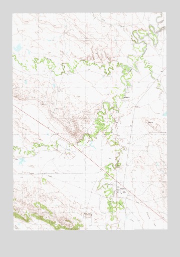
Alzada, MT USGS Topographic Map
Click on map above to begin viewing in our Map Viewer.

This topographic map contains these locations and features:
Feature Name Type Latitude Longitude GNIS ID View Map
09S59E15ADCC01 WellWellN45.0489°W104.4619°807538View Map
AlzadaPopulated PlaceN45.0230°W104.4125°801990View Map
Alzada Baptist ChurchChurchN45.0278°W104.4166°1688740View Map
Alzada CemeteryCemeteryN45.0342°W104.4188°1688739View Map
Alzada Census Designated PlaceCensusN45.0205°W104.4128°2583785View Map
Alzada Congregational ChurchChurchN45.0242°W104.4163°1688694View Map
Alzada MissionChurchN45.0242°W104.4163°1688741View Map
Alzada Post OfficePost OfficeN45.0212°W104.4068°1688734View Map
Alzada SchoolSchoolN45.0209°W104.4130°1688773View Map
Alzada Volunteer Fire ControlBuildingN45.0214°W104.4134°2546696View Map
Arkansas CreekStreamN45.0167°W104.4208°768334View Map
B59-26-1 MineMineN45.0133°W104.4502°802687View Map
B59-26-2 MineMineN45.0139°W104.4447°802689View Map
B59-26-3 MineMineN45.0125°W104.4422°802694View Map
Fivemile CreekStreamN45.1016°W104.3940°771416View Map
Fivemile Post Office (historical)Post OfficeN45.0903°W104.3880°1688723View Map
K and L McDowell Number 5 DamDamN45.1117°W104.4938°798119View Map
K and L McDowell Number 7 DamDamN45.0850°W104.4622°798118View Map
Sevenmile CreekStreamN45.1180°W104.3844°776361View Map
Short CreekStreamN45.1075°W104.3997°799670View Map
Willow CreekStreamN45.0925°W104.4116°778535View Map

Note: Coordinates in the location and feature list above are referenced to NAD83 datum.


Copyright (C) 2008-2024 Ryan Niemi / Sunset Dynamics ... All Rights Reserved