TopoQuest Logo
Do you find TopoQuest useful?
Help keep TopoQuest running and adding new maps/features by donating!
Bitcoin:  19c7KJd3qBynnjoSw5npx9KScwjBe4ifkT
Litecoin:  LXs6TkuXGGXo1vDsWCkWVdjQX94eUKd6ui
Home View Maps Find Maps Find Places Resources & Links


Chasm Falls, New York Topographic Map

USGS Map Title: Chasm Falls, NY
USGS Map MRC: 44074G2
DRG (GeoTIFF) Download: o44074g2.tif


Neighboring USGS Topographic Map Quads:


  Constable, NY  
44074H3
 

  Burke, NY  
44074H2
 

  Chateaugay, NY  
44074H1
 

  Malone, NY  
44074G3
 

  Chasm Falls, NY  
44074G2
 

  Brainardsville, NY  
44074G1
 

  Lake Titus, NY  
44074F3
 

  Owls Head, NY  
44074F2
 

  Ragged Lake, NY  
44074F1


Map MRC Location:

N45°
W75°
N45°
W74°
H8 H7 H6 H5 H4 H3 H2 H1
G8 G7 G6 G5 G4 G3 G2 G1
F8 F7 F6 F5 F4 F3 F2 F1
E8 E7 E6 E5 E4 E3 E2 E1
D8 D7 D6 D5 D4 D3 D2 D1
C8 C7 C6 C5 C4 C3 C2 C1
B8 B7 B6 B5 B4 B3 B2 B1
A8 A7 A6 A5 A4 A3 A2 A1
N44°
W75°
N44°
W74°

Chasm Falls, NY USGS 1:24K Topographic Map Preview:
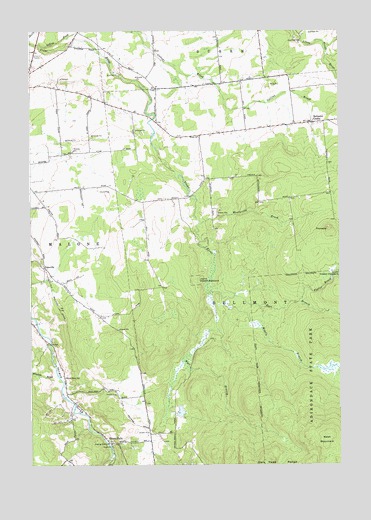
Chasm Falls, NY USGS Topographic Map
Click on map above to begin viewing in our Map Viewer.

This topographic map contains these locations and features:
Feature Name Type Latitude Longitude GNIS ID View Map
Adirondack QuarryMineN44.8711°W74.1403°2709829View Map
Bellmont CenterPopulated PlaceN44.8481°W74.1357°972217View Map
Bellmont Center CemeteryCemeteryN44.8481°W74.1348°2559769View Map
Boyce Mill (historical)LocaleN44.7889°W74.1583°2475063View Map
Chasm FallsPopulated PlaceN44.7573°W74.2188°972311View Map
Chasm Falls Station (historical)LocaleN44.7606°W74.2033°2475062View Map
Collins BrookStreamN44.8712°W74.2468°970025View Map
Coughlin School (historical)SchoolN44.8086°W74.2039°2475059View Map
East Branch Trout RiverStreamN44.7992°W74.1768°949020View Map
Fishpole OutletStreamN44.7559°W74.2182°970125View Map
Foot School (historical)SchoolN44.8244°W74.2450°2475057View Map
Foster BrookStreamN44.7970°W74.1410°950514View Map
Franklin Drive-In (historical)LocaleN44.8681°W74.2492°2558363View Map
Kingdom Hall of Jehovahs WitnessesChurchN44.8693°W74.2337°2616572View Map
Middle Branch Trout RiverStreamN44.7981°W74.1721°957087View Map
Moody School (historical)SchoolN44.8272°W74.1911°2475058View Map
PinnacleSummitN44.8178°W74.1293°960601View Map
River Street SchoolSchoolN44.7753°W74.2357°962558View Map
School Number 11 (historical)SchoolN44.8578°W74.1447°2475066View Map
School Number 12 (historical)SchoolN44.8394°W74.2383°2475056View Map
School Number 13 (historical)SchoolN44.7528°W74.1850°2475061View Map
School Number 21 (historical)SchoolN44.7564°W74.2028°2475060View Map
School Number 6 (historical)SchoolN44.8267°W74.1486°2475064View Map
School Number 7 (historical)SchoolN44.8539°W74.2189°2475055View Map
TebovillePopulated PlaceN44.8067°W74.2443°973146View Map
Wentworth BrookStreamN44.8192°W74.1816°969064View Map
West Branch Trout RiverStreamN44.7989°W74.1768°969140View Map
West MountainSummitN44.7581°W74.1307°970813View Map
White ChurchChurchN44.8448°W74.1813°971085View Map
Winslow BrookStreamN44.7762°W74.2391°971505View Map

Note: Coordinates in the location and feature list above are referenced to NAD83 datum.


Copyright (C) 2008-2024 Ryan Niemi / Sunset Dynamics ... All Rights Reserved