TopoQuest Logo
Do you find TopoQuest useful?
Help keep TopoQuest running and adding new maps/features by donating!
Bitcoin:  19c7KJd3qBynnjoSw5npx9KScwjBe4ifkT
Litecoin:  LXs6TkuXGGXo1vDsWCkWVdjQX94eUKd6ui
Home View Maps Find Maps Find Places Resources & Links


Cherry Creek, Utah Topographic Map

USGS Map Title: Cherry Creek, UT
USGS Map MRC: 39112G4
DRG (GeoTIFF) Download: o39112g4.tif


Neighboring USGS Topographic Map Quads:


  Erickson Knoll, UT  
39112H5
 

  Dutch Peak, UT  
39112H4
 

  Sabie Mountain, UT  
39112H3
 

  Desert Mountain Pass, UT  
39112G5
 

  Cherry Creek, UT  
39112G4
 

  Maple Peak, UT  
39112G3
 

  Desert Mountain Reservoir, UT  
39112F5
 

  Lynndyl NW, UT  
39112F4
 

  Tanner Creek Narrows, UT  
39112F3


Map MRC Location:

N40°
W113°
N40°
W112°
H8 H7 H6 H5 H4 H3 H2 H1
G8 G7 G6 G5 G4 G3 G2 G1
F8 F7 F6 F5 F4 F3 F2 F1
E8 E7 E6 E5 E4 E3 E2 E1
D8 D7 D6 D5 D4 D3 D2 D1
C8 C7 C6 C5 C4 C3 C2 C1
B8 B7 B6 B5 B4 B3 B2 B1
A8 A7 A6 A5 A4 A3 A2 A1
N39°
W113°
N39°
W112°

Cherry Creek, UT USGS 1:24K Topographic Map Preview:
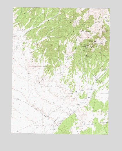
Cherry Creek, UT USGS Topographic Map
Click on map above to begin viewing in our Map Viewer.

This topographic map contains these locations and features:
Feature Name Type Latitude Longitude GNIS ID View Map
Allah MineMineN39.8408°W112.3852°1425080View Map
Bates GulchValleyN39.8105°W112.4088°1425319View Map
Bates ShaftMineN39.8363°W112.4066°1425322View Map
Bonanza MineMineN39.8408°W112.3972°1425866View Map
Browns RidgeRidgeN39.8391°W112.3969°1426021View Map
Buck HollowValleyN39.8452°W112.4572°1439227View Map
Chicken RockSummitN39.8524°W112.3838°1426575View Map
Clyde RanchLocaleN39.8524°W112.4791°1426735View Map
Cow HollowValleyN39.8516°W112.4836°1440090View Map
Eighty-eight ShaftMineN39.8269°W112.4000°1427769View Map
Great Eastern HollowValleyN39.8108°W112.4375°1428381View Map
Great Western King MineMineN39.8516°W112.4072°1428384View Map
Indian HollowValleyN39.8361°W112.4713°1442010View Map
Indian SpringsSpringN39.7816°W112.4104°1429024View Map
Iron King MineMineN39.8386°W112.4086°1429041View Map
Jones MineMineN39.8274°W112.4033°1429241View Map
Lead King MineMineN39.8369°W112.3969°1429506View Map
Murphy MineMineN39.8333°W112.4077°1430608View Map
Orient MineMineN39.8433°W112.4013°1431026View Map
Oro Plata MineMineN39.8458°W112.4113°1431031View Map
Otts CanyonValleyN39.8611°W112.4991°1444128View Map
Pole CanyonValleyN39.8616°W112.4980°1444530View Map
Pyramid MineMineN39.8277°W112.3805°1431507View Map
Resurrection MineMineN39.8419°W112.3977°1431758View Map
Rockwell RanchLocaleN39.7547°W112.4466°1431949View Map
Scotia GulchValleyN39.8252°W112.4000°1432282View Map
Scotia MineMineN39.8422°W112.3902°1432283View Map
Sullivan ShaftMineN39.8363°W112.4066°1433035View Map
Tintic Western MineMineN39.8369°W112.4066°1433553View Map
Walker ShaftMineN39.8413°W112.3927°1433932View Map
War Eagle MineMineN39.8380°W112.4041°1433944View Map

Note: Coordinates in the location and feature list above are referenced to NAD83 datum.


Copyright (C) 2008-2024 Ryan Niemi / Sunset Dynamics ... All Rights Reserved