TopoQuest Logo
Do you find TopoQuest useful?
Help keep TopoQuest running and adding new maps/features by donating!
Bitcoin:  19c7KJd3qBynnjoSw5npx9KScwjBe4ifkT
Litecoin:  LXs6TkuXGGXo1vDsWCkWVdjQX94eUKd6ui
Home View Maps Find Maps Find Places Resources & Links


Exchequer Spring, Nevada Topographic Map

USGS Map Title: Exchequer Spring, NV
USGS Map MRC: 39114H8
DRG (GeoTIFF) Download: o39114h8.tif


Neighboring USGS Topographic Map Quads:


  High Bald Peaks SE, NV  
40115A1
 

  Paris Creek, NV  
40114A8
 

  Goshute Creek, NV  
40114A7
 

  Ninemile Well, NV  
39115H1
 

  Exchequer Spring, NV  
39114H8
 

  Cherry Creek Station, NV  
39114H7
 

  Franks Well, NV  
39115G1
 

  Egan Canyon, NV  
39114G8
 

  Borchert Spring, NV  
39114G7


Map MRC Location:

N40°
W115°
N40°
W114°
H8 H7 H6 H5 H4 H3 H2 H1
G8 G7 G6 G5 G4 G3 G2 G1
F8 F7 F6 F5 F4 F3 F2 F1
E8 E7 E6 E5 E4 E3 E2 E1
D8 D7 D6 D5 D4 D3 D2 D1
C8 C7 C6 C5 C4 C3 C2 C1
B8 B7 B6 B5 B4 B3 B2 B1
A8 A7 A6 A5 A4 A3 A2 A1
N39°
W115°
N39°
W114°

Exchequer Spring, NV USGS 1:24K Topographic Map Preview:
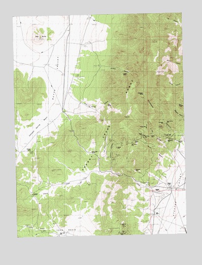
Exchequer Spring, NV USGS Topographic Map
Click on map above to begin viewing in our Map Viewer.

This topographic map contains these locations and features:
Feature Name Type Latitude Longitude GNIS ID View Map
Bluebell MineMineN39.9244°W114.9261°848858View Map
Bull HillSummitN39.8799°W114.9236°848842View Map
Bull Hill MineMineN39.8813°W114.9239°848843View Map
Calcite MineMineN39.9180°W114.9292°853240View Map
Carlson CanyonValleyN39.9699°W114.9345°848869View Map
Carlson SpringSpringN39.9660°W114.9203°848868View Map
Chance MineMineN39.9358°W114.9039°848854View Map
Cherry CreekPopulated PlaceN39.9005°W114.8859°857939View Map
Cherry Creek CanyonValleyN39.8999°W114.9017°849859View Map
Cherry Creek Mining DistrictCivilN39.9666°W114.8897°856587View Map
Cherry Creek Post Office (historical)Post OfficeN39.9005°W114.8859°864688View Map
Cherry Creek SummitSummitN39.9219°W114.9445°848861View Map
Cherry SpringSpringN39.9089°W114.9206°851864View Map
Clonch CanyonValleyN39.8794°W114.9767°848963View Map
Egan Basin WellWellN39.8760°W114.9695°848839View Map
El Rey CanyonValleyN39.9210°W114.8859°848864View Map
Exchequer MineMineN39.9374°W114.8911°848853View Map
Exchequer SpringSpringN39.9546°W114.9054°848867View Map
Fera FortysixWellN39.8763°W114.8914°850871View Map
Fillmore MineMineN39.9283°W114.9128°848856View Map
Flint SpringSpringN39.9488°W114.9323°848865View Map
Flint Spring CanyonValleyN39.9527°W114.9567°848866View Map
Geneva MineMineN39.9310°W114.9006°848850View Map
Gray Eagle MineMineN39.9310°W114.8900°848849View Map
Happy MineMineN39.9363°W114.9320°849880View Map
John Salvis Hot SpringSpringN39.8880°W114.8995°857077View Map
Johnson SpringSpringN39.9234°W114.9892°848862View Map
Johnson Spring BasinBasinN39.9360°W114.9859°848863View Map
Last Chance MineMineN39.9269°W114.9148°848857View Map
Lead Mine CanyonValleyN39.9174°W114.9395°848860View Map
Madellina RanchLocaleN39.8991°W114.8961°848845View Map
Maryanne MineMineN39.9116°W114.9128°848846View Map
Maude CanyonValleyN39.9155°W114.8867°848855View Map
New Century MineMineN39.9380°W114.8889°848852View Map
Niptown (historical)LocaleN39.9274°W114.8809°848847View Map
Old Timer MineMineN39.9308°W114.9053°848851View Map
Overland SummitSummitN39.8991°W114.9886°848840View Map
Pinenut CanyonValleyN39.9113°W114.9311°848859View Map
Red ButteSummitN39.9874°W114.9820°848870View Map
Salvi RanchLocaleN39.8872°W114.8989°848844View Map
Star MineMineN39.9291°W114.8878°848838View Map
Steptoe Valley Volunteer Fire DepartmentBuildingN39.9001°W114.8852°2581326View Map
Teacup MineMineN39.9313°W114.9070°854705View Map
Uppertown (historical)LocaleN39.9280°W114.8886°848848View Map
Wide West PeakSummitN39.8772°W114.9236°848841View Map

Note: Coordinates in the location and feature list above are referenced to NAD83 datum.


Copyright (C) 2008-2025 Ryan Niemi / Sunset Dynamics ... All Rights Reserved