TopoQuest Logo
Do you find TopoQuest useful?
Help keep TopoQuest running and adding new maps/features by donating!
Bitcoin:  19c7KJd3qBynnjoSw5npx9KScwjBe4ifkT
Litecoin:  LXs6TkuXGGXo1vDsWCkWVdjQX94eUKd6ui
Home View Maps Find Maps Find Places Resources & Links


Cherry Creek Canyon, Montana Topographic Map

USGS Map Title: Cherry Creek Canyon, MT
USGS Map MRC: 45111E4
DRG (GeoTIFF) Download: o45111e4.tif


Neighboring USGS Topographic Map Quads:


  Norris NE, MT  
45111F5
 

  Madison Plateau, MT  
45111F4
 

  Anceney, MT  
45111F3
 

  Bear Trap Creek, MT  
45111E5
 

  Cherry Creek Canyon, MT  
45111E4
 

  Ruby Mountain, MT  
45111E3
 

  Cherry Lake, MT  
45111D5
 

  Willow Swamp, MT  
45111D4
 

  Beacon Point, MT  
45111D3


Map MRC Location:

N46°
W112°
N46°
W111°
H8 H7 H6 H5 H4 H3 H2 H1
G8 G7 G6 G5 G4 G3 G2 G1
F8 F7 F6 F5 F4 F3 F2 F1
E8 E7 E6 E5 E4 E3 E2 E1
D8 D7 D6 D5 D4 D3 D2 D1
C8 C7 C6 C5 C4 C3 C2 C1
B8 B7 B6 B5 B4 B3 B2 B1
A8 A7 A6 A5 A4 A3 A2 A1
N45°
W112°
N45°
W111°

Cherry Creek Canyon, MT USGS 1:24K Topographic Map Preview:
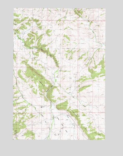
Cherry Creek Canyon, MT USGS Topographic Map
Click on map above to begin viewing in our Map Viewer.

This topographic map contains these locations and features:
Feature Name Type Latitude Longitude GNIS ID View Map
Butler DitchCanalN45.5699°W111.4566°780687View Map
Butler RanchLocaleN45.5585°W111.4441°780688View Map
Carpenter CreekStreamN45.5063°W111.4511°780962View Map
Carpenter Creek DitchCanalN45.5149°W111.4550°780963View Map
Cherry Creek BasinBasinN45.5147°W111.4364°781192View Map
Cherry Creek CanyonValleyN45.5869°W111.4697°781193View Map
Cooper MineMineN45.6222°W111.4897°804545View Map
Cow CampLocaleN45.5219°W111.4455°781768View Map
Cowboy CanyonValleyN45.5530°W111.4444°781798View Map
East Fork Cherry CreekStreamN45.5330°W111.4469°782823View Map
East Fork Pole CreekStreamN45.5369°W111.4839°782890View Map
Elk MountainSummitN45.5574°W111.4705°783098View Map
Finnegan RidgeRidgeN45.5177°W111.4100°783398View Map
Havana (historical)LocaleN45.5860°W111.4719°1797520View Map
Havana Post Office (historical)Post OfficeN45.5860°W111.4719°1797519View Map
Home RanchLocaleN45.5910°W111.3780°784966View Map
Lower DitchCanalN45.5913°W111.4964°786669View Map
McCormack PassGapN45.5319°W111.4639°787012View Map
Middle Fork Pole CreekStreamN45.5369°W111.4841°787296View Map
Mill CreekStreamN45.5552°W111.4425°787360View Map
Nome RanchLocaleN45.5902°W111.3788°794533View Map
Savannah RidgeRidgeN45.6105°W111.4861°790035View Map
Turner Ranch MineMineN45.6127°W111.4730°804546View Map
Upper Cherry Creek DitchCanalN45.5052°W111.4414°792621View Map
Upper DitchCanalN45.5822°W111.4975°792627View Map
West Fork Pole CreekStreamN45.5413°W111.4889°793061View Map
Wiley RidgeRidgeN45.5977°W111.4730°793309View Map

Note: Coordinates in the location and feature list above are referenced to NAD83 datum.


Copyright (C) 2008-2024 Ryan Niemi / Sunset Dynamics ... All Rights Reserved