TopoQuest Logo
Do you find TopoQuest useful?
Help keep TopoQuest running and adding new maps/features by donating!
Bitcoin:  19c7KJd3qBynnjoSw5npx9KScwjBe4ifkT
Litecoin:  LXs6TkuXGGXo1vDsWCkWVdjQX94eUKd6ui
Home View Maps Find Maps Find Places Resources & Links


Chewey, Oklahoma Topographic Map

USGS Map Title: Chewey, OK
USGS Map MRC: 36094A7
DRG (GeoTIFF) Download: o36094a7.tif


Neighboring USGS Topographic Map Quads:


  Leach, OK  
36094B8
 

  Kansas, OK  
36094B7
 

  Siloam Springs NW, OK  
36094B6
 

  Moodys, OK  
36094A8
 

  Chewey, OK  
36094A7
 

  Chance, OK  
36094A6
 

  Tahlequah, OK  
35094H8
 

  Proctor, OK  
35094H7
 

  Christie, OK  
35094H6


Map MRC Location:

N37°
W95°
N37°
W94°
H8 H7 H6 H5 H4 H3 H2 H1
G8 G7 G6 G5 G4 G3 G2 G1
F8 F7 F6 F5 F4 F3 F2 F1
E8 E7 E6 E5 E4 E3 E2 E1
D8 D7 D6 D5 D4 D3 D2 D1
C8 C7 C6 C5 C4 C3 C2 C1
B8 B7 B6 B5 B4 B3 B2 B1
A8 A7 A6 A5 A4 A3 A2 A1
N36°
W95°
N36°
W94°

Chewey, OK USGS 1:24K Topographic Map Preview:
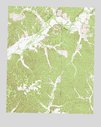
Chewey, OK USGS Topographic Map
Click on map above to begin viewing in our Map Viewer.

This topographic map contains these locations and features:
Feature Name Type Latitude Longitude GNIS ID View Map
Black Fox HollowValleyN36.1214°W94.8058°1090203View Map
CheweyPopulated PlaceN36.1037°W94.7674°1100289View Map
Chewey CemeteryCemeteryN36.1086°W94.7697°2712391View Map
Dog HollowValleyN36.0692°W94.8549°1092131View Map
Fall BranchStreamN36.0987°W94.7858°1092751View Map
Falls BranchStreamN36.0990°W94.8244°1092754View Map
Hampton BridgeBridgeN36.1045°W94.7830°1093500View Map
Hogshooter BluffCliffN36.0993°W94.7922°1093831View Map
Illinois River Association Fire StationBuildingN36.0976°W94.8337°2657524View Map
Kirk SpringsSpringN36.0679°W94.7980°1094410View Map
Kirk Springs HollowValleyN36.0862°W94.8358°1094411View Map
Luna BranchStreamN36.1084°W94.7772°1095057View Map
Pine BluffCliffN36.1120°W94.8147°1096644View Map
ProctorCivilN36.0022°W94.7576°2631156View Map
Pumpkin FlatsFlatN36.0256°W94.8438°1096959View Map
Round Hollow Public Access AreaParkN36.0923°W94.8308°1097486View Map
Sawmill HollowValleyN36.0771°W94.8218°1097852View Map
ScraperCivilN36.0287°W94.8603°2631168View Map
ScraperPopulated PlaceN36.0895°W94.8505°1100820View Map
Skelly Public SchoolSchoolN36.1042°W94.7689°1790697View Map
Thompson CemeteryCemeteryN36.0912°W94.8222°1098859View Map
Winset HollowValleyN36.1167°W94.8091°1099918View Map

Note: Coordinates in the location and feature list above are referenced to NAD83 datum.


Copyright (C) 2008-2025 Ryan Niemi / Sunset Dynamics ... All Rights Reserved