TopoQuest Logo
Do you find TopoQuest useful?
Help keep TopoQuest running and adding new maps/features by donating!
Bitcoin:  19c7KJd3qBynnjoSw5npx9KScwjBe4ifkT
Litecoin:  LXs6TkuXGGXo1vDsWCkWVdjQX94eUKd6ui
Home View Maps Find Maps Find Places Resources & Links


Cheyenne South, Wyoming Topographic Map

USGS Map Title: Cheyenne South, WY
USGS Map MRC: 41104A7
DRG (GeoTIFF) Download: o41104a7.tif


Neighboring USGS Topographic Map Quads:


  Round Top Lake, WY  
41104B8
 

  Cheyenne North, WY  
41104B7
 

  Archer, WY  
41104B6
 

  Borie, WY  
41104A8
 

  Cheyenne South, WY  
41104A7
 

  Altvan, WY  
41104A6
 

  Carr West, CO  
40104H8
 

  Carr East, CO  
40104H7
 

  Chalk Bluffs West, CO  
40104H6


Map MRC Location:

N42°
W105°
N42°
W104°
H8 H7 H6 H5 H4 H3 H2 H1
G8 G7 G6 G5 G4 G3 G2 G1
F8 F7 F6 F5 F4 F3 F2 F1
E8 E7 E6 E5 E4 E3 E2 E1
D8 D7 D6 D5 D4 D3 D2 D1
C8 C7 C6 C5 C4 C3 C2 C1
B8 B7 B6 B5 B4 B3 B2 B1
A8 A7 A6 A5 A4 A3 A2 A1
N41°
W105°
N41°
W104°

Cheyenne South, WY USGS 1:24K Topographic Map Preview:
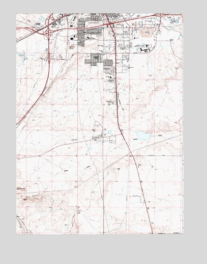
Cheyenne South, WY USGS Topographic Map
Click on map above to begin viewing in our Map Viewer.

This topographic map contains these locations and features:
Feature Name Type Latitude Longitude GNIS ID View Map
Afflerbach Elementary SchoolSchoolN41.0887°W104.8044°1608648View Map
Arp Elementary SchoolSchoolN41.1110°W104.7862°1608481View Map
AtholPopulated PlaceN41.0128°W104.8283°1608482View Map
Athol CampLocaleN41.0053°W104.8369°1608483View Map
Chambers CampLocaleN41.0100°W104.7705°1608516View Map
Cheyenne Fire and Rescue Station 2BuildingN41.1172°W104.8104°2673485View Map
Civitan ParkParkN41.1153°W104.8233°1608521View Map
Clear Creek ParkParkN41.1186°W104.8411°1608645View Map
Cole Elementary SchoolSchoolN41.1246°W104.8160°1608523View Map
Fox Farm-College Census Designated PlaceCensusN41.1117°W104.7856°2408252View Map
Full Gospel ChurchChurchN41.1236°W104.8027°1608541View Map
GleasonPopulated PlaceN41.0083°W104.8741°1608543View Map
Goins Elementary SchoolSchoolN41.1148°W104.8231°1608544View Map
Hodge Spring CorralLocaleN41.0578°W104.8547°1608552View Map
Intermountain SpeedwayLocaleN41.0741°W104.8033°1608555View Map
Johnson Junior High SchoolSchoolN41.1113°W104.8212°1608557View Map
KFBC-AM (Cheyenne)TowerN41.1214°W104.8025°1608797View Map
KRAE-AM (Cheyenne)TowerN41.1239°W104.8200°1609447View Map
KSHY-AM (Cheyenne)TowerN41.1214°W104.8400°1608796View Map
KSHY-AM (Fox Farm)TowerN41.0525°W104.8319°1608801View Map
KUUY-AM (Cheyenne)TowerN41.0525°W104.8319°1608795View Map
KUUY-AM (Orchard Valley)TowerN41.0525°W104.8319°1608810View Map
KVWO Radio Tower (Cheyenne)TowerN41.1214°W104.8475°1608646View Map
Laramie County Community CollegeSchoolN41.1033°W104.7780°1608647View Map
Laramie County Fire District 1 Cheyenne Station 1BuildingN41.1093°W104.7988°2673507View Map
Laramie County Fire District 1 Cheyenne Station 2BuildingN41.0553°W104.8093°2673508View Map
McCard Pit Number OneMineN41.1208°W104.7622°1726236View Map
Orchard ValleyPopulated PlaceN41.0966°W104.8194°1608583View Map
Prosser CorralLocaleN41.0322°W104.8125°1608587View Map
Rossman Elementary SchoolSchoolN41.1035°W104.8111°1608589View Map
South GreeleyPopulated PlaceN41.0969°W104.8064°1867671View Map
South Greeley Census Designated PlaceCensusN41.0935°W104.8066°2408765View Map
State Line CampLocaleN41.0044°W104.7972°1608606View Map
Swan CampLocaleN41.0989°W104.8686°1608608View Map
Swan DamDamN41.1016°W104.8689°1605642View Map
Swan ReservoirReservoirN41.1011°W104.8712°1595230View Map
Terry AnticlineSummitN41.0200°W104.8694°1595377View Map
Terry PeakSummitN41.0258°W104.8730°1595380View Map
Terry Peak CampLocaleN41.0222°W104.8536°1608609View Map

Note: Coordinates in the location and feature list above are referenced to NAD83 datum.


Copyright (C) 2008-2024 Ryan Niemi / Sunset Dynamics ... All Rights Reserved