TopoQuest Logo
Do you find TopoQuest useful?
Help keep TopoQuest running and adding new maps/features by donating!
Bitcoin:  19c7KJd3qBynnjoSw5npx9KScwjBe4ifkT
Litecoin:  LXs6TkuXGGXo1vDsWCkWVdjQX94eUKd6ui
Home View Maps Find Maps Find Places Resources & Links


Chin Creek Reservoir, Nevada Topographic Map

USGS Map Title: Chin Creek Reservoir, NV
USGS Map MRC: 40114A3
DRG (GeoTIFF) Download: o40114a3.tif


Neighboring USGS Topographic Map Quads:


  Boone Canyon, NV  
40114B4
 

  Kinsley Mountains, NV  
40114B3
 

  Ferber Peak NW, NV  
40114B2
 

  Chin Creek Spring, NV  
40114A4
 

  Chin Creek Reservoir, NV  
40114A3
 

  Ayarbe Spring, NV  
40114A2
 

  Baldy Peak, NV  
39114H4
 

  Sunset Reservoir, NV  
39114H3
 

  Spring Creek Flat NW, NV  
39114H2


Map MRC Location:

N41°
W115°
N41°
W114°
H8 H7 H6 H5 H4 H3 H2 H1
G8 G7 G6 G5 G4 G3 G2 G1
F8 F7 F6 F5 F4 F3 F2 F1
E8 E7 E6 E5 E4 E3 E2 E1
D8 D7 D6 D5 D4 D3 D2 D1
C8 C7 C6 C5 C4 C3 C2 C1
B8 B7 B6 B5 B4 B3 B2 B1
A8 A7 A6 A5 A4 A3 A2 A1
N40°
W115°
N40°
W114°

Chin Creek Reservoir, NV USGS 1:24K Topographic Map Preview:
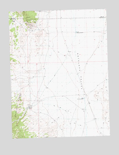
Chin Creek Reservoir, NV USGS Topographic Map
Click on map above to begin viewing in our Map Viewer.

This topographic map contains these locations and features:
Feature Name Type Latitude Longitude GNIS ID View Map
Antelope ValleyBasinN40.0999°W114.2842°863785View Map
Chin Creek DitchCanalN40.0222°W114.3017°848744View Map
Chin Creek RanchLocaleN40.0319°W114.3520°850469View Map
Chin Creek ReservoirReservoirN40.0298°W114.3545°848741View Map
Doty TunnelMineN40.1085°W114.3475°853251View Map
Evan SpringSpringN40.0033°W114.3406°850470View Map
Felt Robison MineMineN40.1110°W114.3464°848739View Map
Kinsley (historical)LocaleN40.1158°W114.3678°849899View Map
Kinsley MineMineN40.1174°W114.3578°855635View Map
Kinsley Mining DistrictCivilN40.1158°W114.3678°863797View Map
Kinsley SpringSpringN40.1152°W114.3685°848740View Map
Middle Chin Creek ReservoirReservoirN40.0373°W114.2824°848742View Map
Morning Star MineMineN40.1149°W114.3572°853513View Map
North Chin Creek ReservoirReservoirN40.1026°W114.2898°848743View Map
West Chin Creek ReservoirReservoirN40.0949°W114.3179°850468View Map
Western Marble Mining CampLocaleN40.1144°W114.3536°849903View Map

Note: Coordinates in the location and feature list above are referenced to NAD83 datum.


Copyright (C) 2008-2025 Ryan Niemi / Sunset Dynamics ... All Rights Reserved