TopoQuest Logo
Do you find TopoQuest useful?
Help keep TopoQuest running and adding new maps/features by donating!
Bitcoin:  19c7KJd3qBynnjoSw5npx9KScwjBe4ifkT
Litecoin:  LXs6TkuXGGXo1vDsWCkWVdjQX94eUKd6ui
Home View Maps Find Maps Find Places Resources & Links


Chinati Peak, Texas Topographic Map

USGS Map Title: Chinati Peak, TX
USGS Map MRC: 29104H4
DRG (GeoTIFF) Download: o29104h4.tif


Neighboring USGS Topographic Map Quads:


  Ruidosa Hot Springs, TX  
30104A5
 

  Cuesta Del Burro West, TX  
30104A4
 

  Cuesta Del Burro East, TX  
30104A3
 

  Sierra Parda, TX  
29104H5
 

  Chinati Peak, TX  
29104H4
 

  Cieneguita, TX  
29104H3
 

  Adobes, TX  
29104G5
 

  Cerro Orona, TX  
29104G4
 

  Shafter, TX  
29104G3


Map MRC Location:

N30°
W105°
N30°
W104°
H8 H7 H6 H5 H4 H3 H2 H1
G8 G7 G6 G5 G4 G3 G2 G1
F8 F7 F6 F5 F4 F3 F2 F1
E8 E7 E6 E5 E4 E3 E2 E1
D8 D7 D6 D5 D4 D3 D2 D1
C8 C7 C6 C5 C4 C3 C2 C1
B8 B7 B6 B5 B4 B3 B2 B1
A8 A7 A6 A5 A4 A3 A2 A1
N29°
W105°
N29°
W104°

Chinati Peak, TX USGS 1:24K Topographic Map Preview:
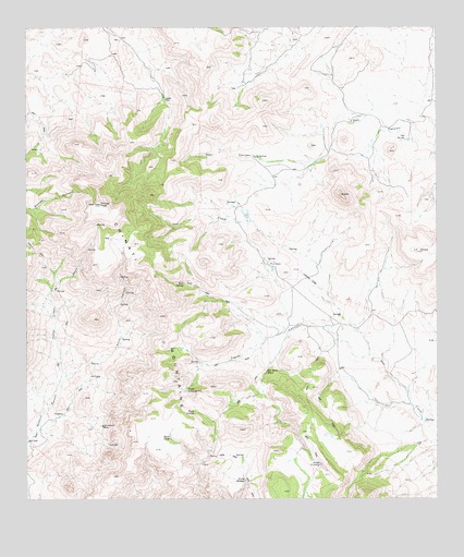
Chinati Peak, TX USGS Topographic Map
Click on map above to begin viewing in our Map Viewer.

This topographic map contains these locations and features:
Feature Name Type Latitude Longitude GNIS ID View Map
AgujaSummitN29.9560°W104.4044°1329276View Map
Bull SpringSpringN29.9325°W104.4525°1331608View Map
Caņon Cinco de MayoValleyN29.9054°W104.4896°1332108View Map
Chaffin PlacePopulated PlaceN29.9810°W104.4577°1378110View Map
Chinati MountainsRangeN29.9049°W104.4638°1373089View Map
Chinati PeakSummitN29.9532°W104.4777°1332776View Map
Deck SpringSpringN29.8982°W104.4496°1334174View Map
Doll CanyonValleyN29.9686°W104.3761°1334464View Map
La MesaSummitN29.9407°W104.3813°1339353View Map
Mesa TankReservoirN29.8913°W104.4566°1341395View Map
Ojo Agua ZarcaSpringN29.9089°W104.4272°1343100View Map
Ojo BonitoSpringN29.9703°W104.3847°1343102View Map
Ojo Bonito SpringSpringN29.9918°W104.3921°1998397View Map
Pinto CanyonValleyN29.9054°W104.4896°1344106View Map
Presa LloronaReservoirN29.9041°W104.4510°1344538View Map
Presa RinconReservoirN29.8799°W104.4338°1344539View Map
Presa ViruelasReservoirN29.8845°W104.4112°1344542View Map
San Antonio MineMineN29.8946°W104.4771°1346307View Map
Tigner CanyonValleyN29.9131°W104.3960°1348560View Map
Wood RanchLocaleN29.9377°W104.4263°1350516View Map

Note: Coordinates in the location and feature list above are referenced to NAD83 datum.


Copyright (C) 2008-2025 Ryan Niemi / Sunset Dynamics ... All Rights Reserved